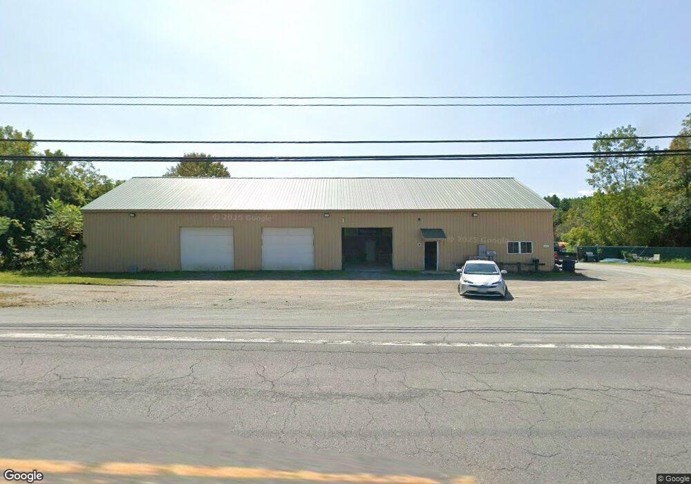
1615 Route 20 New Lebanon, NY 12125
Estimated Value: $213,105
--
Bed
--
Bath
6,750
Sq Ft
$32/Sq Ft
Est. Value
About This Home
This home is located at 1615 Route 20, New Lebanon, NY 12125 and is currently estimated at $213,105, approximately $31 per square foot. 1615 Route 20 is a home located in Columbia County with nearby schools including Walter B. Howard Elementary School and New Lebanon Junior/Senior High School.
Ownership History
Date
Name
Owned For
Owner Type
Purchase Details
Closed on
Dec 27, 2019
Sold by
Lebanon Valley Landscapng
Bought by
Bpg Park Llc
Current Estimated Value
Purchase Details
Closed on
Jul 27, 2017
Sold by
Campagna Robert
Bought by
Lebanon Valley Landscapng
Purchase Details
Closed on
Feb 9, 2007
Sold by
Koepp Ruth A
Bought by
Campagna Robert
Create a Home Valuation Report for This Property
The Home Valuation Report is an in-depth analysis detailing your home's value as well as a comparison with similar homes in the area
Home Values in the Area
Average Home Value in this Area
Purchase History
| Date | Buyer | Sale Price | Title Company |
|---|---|---|---|
| Bpg Park Llc | -- | None Available | |
| Bpg Park Llc | -- | None Available | |
| Lebanon Valley Landscapng | $125,000 | -- | |
| Lebanon Valley Landscapng | $125,000 | -- | |
| Campagna Robert | $100,000 | Brian Baker | |
| Campagna Robert | $100,000 | Brian Baker |
Source: Public Records
Tax History Compared to Growth
Tax History
| Year | Tax Paid | Tax Assessment Tax Assessment Total Assessment is a certain percentage of the fair market value that is determined by local assessors to be the total taxable value of land and additions on the property. | Land | Improvement |
|---|---|---|---|---|
| 2024 | $4,107 | $265,000 | $146,500 | $118,500 |
| 2023 | $4,236 | $238,500 | $76,500 | $162,000 |
| 2022 | $4,564 | $225,000 | $76,500 | $148,500 |
| 2021 | $4,753 | $225,000 | $76,500 | $148,500 |
| 2020 | $4,749 | $225,000 | $76,500 | $148,500 |
| 2019 | $5,635 | $225,000 | $76,500 | $148,500 |
| 2018 | $5,635 | $250,000 | $76,500 | $173,500 |
| 2017 | $9,407 | $250,000 | $76,500 | $173,500 |
| 2016 | $9,577 | $250,000 | $76,500 | $173,500 |
| 2015 | -- | $250,000 | $76,500 | $173,500 |
| 2014 | -- | $115,000 | $38,600 | $76,400 |
Source: Public Records
Map
Nearby Homes
- 4283 County Route 9
- L34.111 County Route 9
- 61 Schoolhouse Rd
- L30.4 Gale Hill Rd
- 3859 County Route 9
- Tbd Avery Hand Ln
- 0 County Route 13
- 0 Old Gale Hill Rd Unit 20252762
- 18 McGrath Hill Rd
- 336 Ashley Hill Rd
- 189 Covenant Cir
- 189 Covenant Cir
- 4702 S Stephentown Rd
- 70 Woodard Rd
- 4702 S So Stephentown Rd
- 978 U S 20 Unit 18
- 547 County Route 34
- 78 Tsatsawassa Lake Rd
- 439 Kelly Rd
- 563 County Route 34
- 1601 Route 20
- 1615 U S 20
- 1615 W Us Route 20 Rd
- 1615 State Route 20
- 1620 State Route 20
- 1602 U S 20
- 1602 Highway 20
- 1643 U S 20
- 1643 Us Route 20
- 1645 U S 20
- 4297 County Route 9
- 4272 County Route 9s Rd
- 4272 Cty Rte 9s
- 1573 U S 20
- 1575 U S 20
- 1576 Route 20
- 4283 Cty Rt 9
- 1568 Route 20
- 1568 U S 20
- 4272 County Route 9