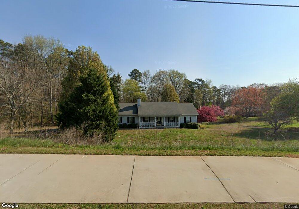
1615 Sharon Rd Cumming, GA 30041
Big Creek NeighborhoodEstimated Value: $420,000 - $514,886
3
Beds
2
Baths
1,346
Sq Ft
$344/Sq Ft
Est. Value
About This Home
This home is located at 1615 Sharon Rd, Cumming, GA 30041 and is currently estimated at $463,472, approximately $344 per square foot. 1615 Sharon Rd is a home located in Forsyth County with nearby schools including Shiloh Point Elementary School, Piney Grove Middle School, and South Forsyth High School.
Ownership History
Date
Name
Owned For
Owner Type
Purchase Details
Closed on
Feb 13, 2023
Sold by
Bentley Darryl T
Bought by
Jorwell Properties Llc
Current Estimated Value
Home Financials for this Owner
Home Financials are based on the most recent Mortgage that was taken out on this home.
Original Mortgage
$1,500,000
Interest Rate
5.25%
Purchase Details
Closed on
May 9, 2002
Sold by
Bentley Stacey L
Bought by
Bentley Darryl T
Create a Home Valuation Report for This Property
The Home Valuation Report is an in-depth analysis detailing your home's value as well as a comparison with similar homes in the area
Home Values in the Area
Average Home Value in this Area
Purchase History
| Date | Buyer | Sale Price | Title Company |
|---|---|---|---|
| Jorwell Properties Llc | -- | -- | |
| Jorwell Properties Llc | $450,000 | -- | |
| Bentley Darryl T | -- | -- |
Source: Public Records
Mortgage History
| Date | Status | Borrower | Loan Amount |
|---|---|---|---|
| Closed | Jorwell Properties Llc | $1,500,000 |
Source: Public Records
Tax History Compared to Growth
Tax History
| Year | Tax Paid | Tax Assessment Tax Assessment Total Assessment is a certain percentage of the fair market value that is determined by local assessors to be the total taxable value of land and additions on the property. | Land | Improvement |
|---|---|---|---|---|
| 2025 | $4,448 | $155,828 | $54,600 | $101,228 |
| 2024 | $4,448 | $181,404 | $84,000 | $97,404 |
| 2023 | $3,177 | $190,540 | $105,000 | $85,540 |
| 2022 | $2,402 | $84,396 | $22,800 | $61,596 |
| 2021 | $1,954 | $84,396 | $22,800 | $61,596 |
| 2020 | $1,899 | $81,728 | $22,800 | $58,928 |
| 2019 | $1,846 | $79,020 | $20,520 | $58,500 |
| 2018 | $1,582 | $65,752 | $19,000 | $46,752 |
| 2017 | $1,510 | $62,020 | $19,000 | $43,020 |
| 2016 | $1,429 | $58,220 | $15,200 | $43,020 |
| 2015 | $1,432 | $58,220 | $15,200 | $43,020 |
| 2014 | $1,282 | $54,632 | $15,200 | $39,432 |
Source: Public Records
Map
Nearby Homes
- 2260 Thames Ct
- The Oxford Plan at Windsor Bluffs
- The Cambridge Plan at Windsor Bluffs
- The Berkshire Plan at Windsor Bluffs
- 2250 Thames Ct
- 2255 Windsor Bluffs Dr
- 1740 Cobble Creek Way
- 1255 Bookhout Dr
- 1065 Bookhout Dr
- 1430 Diplomat Dr
- 1555 Diplomat Dr
- 1760 Commonwealth Trail
- 1475 Badingham Dr
- 1330 Badingham Dr
- 1460 Badingham Dr
- 1315 Seneca Ave
- 2615 Hillandale Cir
- 1355 Seneca Ave Unit 1A
- 1655 Sharon Rd
- 1637 Sharon Rd
- 3240 Sharon Cir
- 1720 Laleiah Dr
- 1710 Laleiah Dr Unit 34
- 1710 Laleiah Dr Unit I
- 3230 Sharon Cir
- 3250 Sharon Cir
- 1690 Laleiah Dr
- 2080 Westford Cove
- 3260 Sharon Cir
- 1683 Sharon Rd
- 1705 Laleiah Dr
- 3270 Sharon Cir
- 3220 Sharon Cir
- 2090 Westford Cove
- 2075 Westford Cove
- 2110 Westford Cove
- 2120 Westford Cove
- 1670 Laleiah Dr