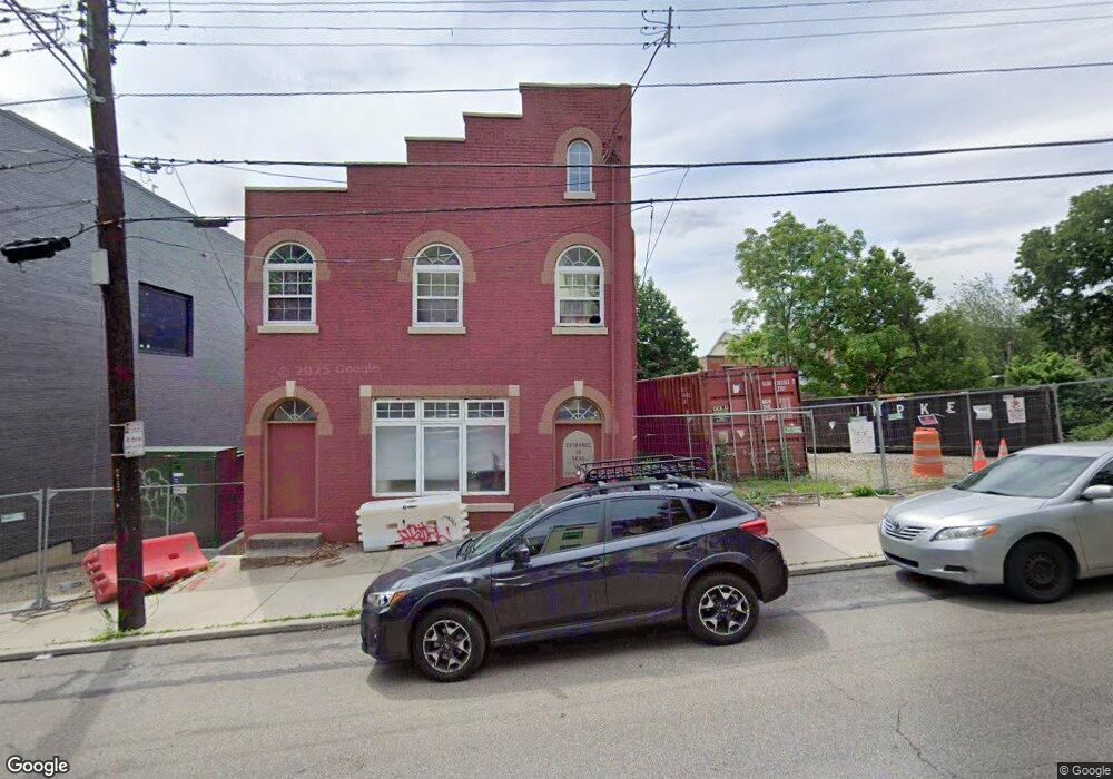
1615 Sycamore St Cincinnati, OH 45202
Mount Auburn NeighborhoodEstimated Value: $200,000
Studio
--
Bath
--
Sq Ft
4,443
Sq Ft
About This Home
This home is located at 1615 Sycamore St, Cincinnati, OH 45202 and is currently priced at $200,000. 1615 Sycamore St is a home located in Hamilton County with nearby schools including Rothenberg Preparatory Academy, Robert A. Taft Information Technology High School, and Gilbert A. Dater High School.
Ownership History
Date
Name
Owned For
Owner Type
Purchase Details
Closed on
Nov 11, 2022
Sold by
Wdc Llc
Bought by
Sam1 Llc
Current Estimated Value
Purchase Details
Closed on
Oct 30, 2014
Sold by
Rolling River Capital Llc
Bought by
Wdc Llc
Purchase Details
Closed on
Jan 3, 2011
Sold by
Hillside Limited Liability Company
Bought by
Rolling River Capital Llc
Purchase Details
Closed on
Feb 24, 2010
Sold by
Hillside Limited Partnership I
Bought by
Hillside Limited Liability Company
Create a Home Valuation Report for This Property
The Home Valuation Report is an in-depth analysis detailing your home's value as well as a comparison with similar homes in the area
Home Values in the Area
Average Home Value in this Area
Purchase History
| Date | Buyer | Sale Price | Title Company |
|---|---|---|---|
| Sam1 Llc | -- | -- | |
| Wdc Llc | -- | Attorney | |
| Rolling River Capital Llc | -- | Attorney | |
| Hillside Limited Liability Company | -- | Attorney |
Source: Public Records
Mortgage History
| Date | Status | Borrower | Loan Amount |
|---|---|---|---|
| Closed | Hillside Limited Liability Company | $0 |
Source: Public Records
Tax History
| Year | Tax Paid | Tax Assessment Tax Assessment Total Assessment is a certain percentage of the fair market value that is determined by local assessors to be the total taxable value of land and additions on the property. | Land | Improvement |
|---|---|---|---|---|
| 2025 | $227 | $2,503 | $2,503 | -- |
| 2023 | $225 | $2,503 | $2,503 | $0 |
| 2022 | $239 | $2,415 | $2,415 | $0 |
| 2021 | $229 | $2,415 | $2,415 | $0 |
| 2020 | $232 | $2,415 | $2,415 | $0 |
| 2019 | $223 | $2,177 | $2,177 | $0 |
| 2018 | $224 | $2,177 | $2,177 | $0 |
| 2017 | $216 | $2,177 | $2,177 | $0 |
| 2016 | $228 | $2,261 | $2,261 | $0 |
| 2015 | $210 | $2,261 | $2,261 | $0 |
| 2014 | $211 | $2,261 | $2,261 | $0 |
| 2013 | $215 | $2,307 | $2,307 | $0 |
Source: Public Records
Map
Nearby Homes
- 163 E McMicken Ave
- 323 Milton St
- 325 Milton St
- 118 E Liberty St
- 107 Corwine St
- 330 Boal St
- 320 Mulberry St
- 305 Seitz St
- 1341 Main St
- 412 Liberty Hill
- 1825 Walker St
- 318 Seitz St
- 203 Seitz St
- 142 E Clifton Ave
- 432 Liberty Hill
- 436 Boal St
- 1302 Main St
- 1330 Spring St
- 27 Mercer St
- 0 Goethe St Unit 1848287
- 1613 Sycamore St
- 1609 Sycamore St
- 1610 Hughes St
- 1608 Hughes St
- 1614 Sycamore St
- 222 E Liberty St
- 1612 Hughes St
- 1625 Sycamore St
- 1601 Sycamore St
- 1614 Hughes St
- 220 E Liberty St
- 1616 Sycamore St Unit 6
- 1616 Sycamore St Unit 4
- 1616 Sycamore St Unit 7
- 1616 Sycamore St
- 1618 Hughes St
- 218 E Liberty St
- 1616 Hughes St
- 1610 Sycamore St
- 1610 Sycamore St Unit 4
Your Personal Tour Guide
Ask me questions while you tour the home.