N
Seller's Agent in 2025
Non Member
Non-member Office
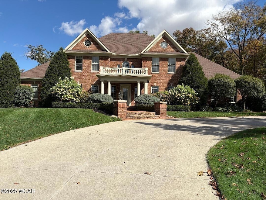
Custom built Georgian style former parade home. Located at the end of cul-de-sac on 1.5 ac, 5 bed, 4.5 bath home features 3 car garage, 2 story foyer w/split staircase, vaulted family room & gourmet kitchen w/Sub-Zero/Wolf appliances, Italian inspired island. Wood-paneled study w/coffered ceiling, extensive trim & Vorst built-ins throughout. Finished basement w/9' ceilings, bar, game room, bedroom, full bath, egress windows & storage. Backyard oasis w/fenced yard, pool w/auto cover & waterfalls, outdoor kit/fp & paver patio. Surround sound, security, irrigation. Inc parcels 0001017432, 2800010174
Last Agent to Sell the Property
Non Member
Non-member Office Listed on: 10/10/2025
| Date | Type | Sale Price | Title Company |
|---|---|---|---|
| Warranty Deed | $1,300,000 | Whitman Title | |
| Survivorship Deed | $695,000 | Heartland Title |
| Date | Status | Loan Amount | Loan Type |
|---|---|---|---|
| Open | $1,105,000 | New Conventional | |
| Previous Owner | $562,400 | Unknown |
| Date | Event | Price | List to Sale | Price per Sq Ft |
|---|---|---|---|---|
| 10/10/2025 10/10/25 | Sold | $1,300,000 | +0.1% | $351 / Sq Ft |
| 10/10/2025 10/10/25 | Pending | -- | -- | -- |
| 10/10/2025 10/10/25 | For Sale | $1,299,000 | -- | $351 / Sq Ft |
| Year | Tax Paid | Tax Assessment Tax Assessment Total Assessment is a certain percentage of the fair market value that is determined by local assessors to be the total taxable value of land and additions on the property. | Land | Improvement |
|---|---|---|---|---|
| 2024 | $10,937 | $287,850 | $27,810 | $260,040 |
| 2023 | $10,685 | $287,850 | $27,810 | $260,040 |
| 2022 | $10,584 | $287,850 | $27,810 | $260,040 |
| 2021 | $10,331 | $248,400 | $27,830 | $220,570 |
| 2020 | $10,417 | $248,400 | $27,830 | $220,570 |
| 2019 | $10,004 | $248,400 | $27,830 | $220,570 |
| 2018 | $8,606 | $234,930 | $18,550 | $216,380 |
| 2017 | $4,328 | $234,930 | $18,550 | $216,380 |
| 2016 | $8,364 | $234,930 | $18,550 | $216,380 |
| 2015 | $8,012 | $218,620 | $16,760 | $201,860 |
| 2014 | $8,085 | $218,620 | $16,760 | $201,860 |
| 2012 | $8,039 | $208,380 | $16,760 | $191,620 |
N
Seller's Agent in 2025
Non Member
Non-member Office

Buyer's Agent in 2025
Lisa Wenger
CCR Realtors
(419) 231-1823
99 Total Sales
Source: West Central Association of REALTORS® (OH)
MLS Number: 308507
APN: 28-0001017432
Ask me questions while you tour the home.