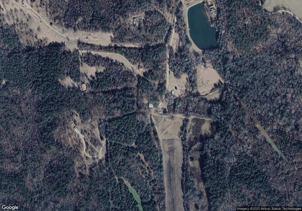
16167 Jake Sanford Rd Northport, AL 35475
Estimated Value: $130,000 - $321,000
--
Bed
--
Bath
--
Sq Ft
39
Acres
About This Home
This home is located at 16167 Jake Sanford Rd, Northport, AL 35475 and is currently estimated at $199,259. 16167 Jake Sanford Rd is a home with nearby schools including Walker Elementary School, Northside Middle School, and Northside High School.
Ownership History
Date
Name
Owned For
Owner Type
Purchase Details
Closed on
Feb 19, 2014
Sold by
Falls Tracy L
Bought by
Falls Richard A
Current Estimated Value
Home Financials for this Owner
Home Financials are based on the most recent Mortgage that was taken out on this home.
Original Mortgage
$130,000
Outstanding Balance
$98,583
Interest Rate
4.43%
Mortgage Type
New Conventional
Estimated Equity
$100,676
Purchase Details
Closed on
Apr 16, 2008
Sold by
Falls Johnny B
Bought by
Falls Richard A
Home Financials for this Owner
Home Financials are based on the most recent Mortgage that was taken out on this home.
Original Mortgage
$92,000
Interest Rate
6.08%
Create a Home Valuation Report for This Property
The Home Valuation Report is an in-depth analysis detailing your home's value as well as a comparison with similar homes in the area
Home Values in the Area
Average Home Value in this Area
Purchase History
| Date | Buyer | Sale Price | Title Company |
|---|---|---|---|
| Falls Richard A | $269,500 | -- | |
| Falls Richard A | $90,500 | -- |
Source: Public Records
Mortgage History
| Date | Status | Borrower | Loan Amount |
|---|---|---|---|
| Open | Falls Richard A | $130,000 | |
| Previous Owner | Falls Richard A | $92,000 |
Source: Public Records
Tax History Compared to Growth
Tax History
| Year | Tax Paid | Tax Assessment Tax Assessment Total Assessment is a certain percentage of the fair market value that is determined by local assessors to be the total taxable value of land and additions on the property. | Land | Improvement |
|---|---|---|---|---|
| 2024 | $314 | $21,760 | $19,440 | $2,320 |
| 2023 | $314 | $21,760 | $19,440 | $2,320 |
| 2022 | $314 | $21,760 | $19,440 | $2,320 |
| 2021 | $311 | $21,760 | $19,440 | $2,320 |
| 2020 | $305 | $21,180 | $19,440 | $1,740 |
| 2019 | $313 | $21,180 | $19,440 | $1,740 |
| 2018 | $173 | $12,320 | $10,580 | $1,740 |
| 2017 | $173 | $0 | $0 | $0 |
| 2016 | $162 | $0 | $0 | $0 |
| 2015 | $162 | $0 | $0 | $0 |
| 2014 | $162 | $11,480 | $10,580 | $900 |
Source: Public Records
Map
Nearby Homes
- 0 Morman 11 Rd
- 0 Morman 12 Rd
- 0 Morman 10 Rd
- 0 Morman 9 Rd
- 0 Morman 8 Rd
- 0 Morman 7 Rd
- 0 Morman 6 Rd
- 0 Morman 5 Rd
- 0 Morman 2 Rd
- 03 Mormon Rd
- 15498 Northside Rd
- 18263 Mormon Rd
- 0 County Road 35
- Morman Rd
- 17505 Mormon Rd
- 0 Brown Rd
- 13988 Northside Rd
- 0 Pleasant Ridge Church Rd
- 16662 Old Fayette Rd
- 16614 Old Fayette Rd
- 16132 Jake Sanford Rd
- 16127 Jake Sanford Rd
- 16031 Jake Sanford Rd
- 11 Jake Sanford Rd
- 12 Jake Sanford Rd
- 10 Jake Sanford Rd
- 9 Jake Sanford Rd
- 8 Jake Sanford Rd
- 7 Jake Sanford Rd
- 16043 Jake Sanford Rd
- 15849 Jake Sanford Rd
- 19246 Mormon Rd
- 19243 Mormon Rd
- 19018 Phillips Rd
- 19325 Mormon Rd
- 18884 Mormon Rd
- 19087 Mormon Rd
- 18020 Watson Rd
- 15845 Tootsie Loop
- 19022 Northside Rd
