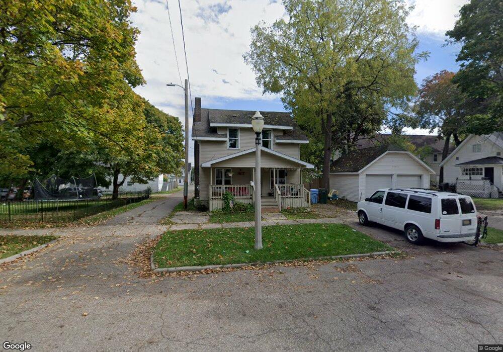
1617 Coleman Ave Lansing, MI 48910
Moores Park NeighborhoodEstimated Value: $114,052 - $138,000
--
Bed
1
Bath
1,361
Sq Ft
$94/Sq Ft
Est. Value
About This Home
This home is located at 1617 Coleman Ave, Lansing, MI 48910 and is currently estimated at $128,013, approximately $94 per square foot. 1617 Coleman Ave is a home located in Ingham County with nearby schools including Averill Elementary School, Pattengill Academy, and J.W. Sexton High School.
Ownership History
Date
Name
Owned For
Owner Type
Purchase Details
Closed on
Nov 3, 2014
Sold by
Powell Gerald David
Bought by
Carson Paul David and Carson Jinny Lynn
Current Estimated Value
Purchase Details
Closed on
Aug 20, 2012
Sold by
Powell Gerald David
Bought by
Carson Paul David and Carson Jinny Lynn
Home Financials for this Owner
Home Financials are based on the most recent Mortgage that was taken out on this home.
Original Mortgage
$12,000
Interest Rate
3.38%
Mortgage Type
Seller Take Back
Purchase Details
Closed on
May 15, 2008
Sold by
Powell Andrew Steven
Bought by
Powell Gerald David
Purchase Details
Closed on
Nov 3, 1989
Bought by
Powell Gerald D
Create a Home Valuation Report for This Property
The Home Valuation Report is an in-depth analysis detailing your home's value as well as a comparison with similar homes in the area
Home Values in the Area
Average Home Value in this Area
Purchase History
| Date | Buyer | Sale Price | Title Company |
|---|---|---|---|
| Carson Paul David | $15,000 | None Available | |
| Carson Paul David | $15,000 | Chirco Title Co | |
| Powell Gerald David | -- | None Available | |
| Powell Gerald David | -- | None Available | |
| Powell Gerald D | $19,000 | -- |
Source: Public Records
Mortgage History
| Date | Status | Borrower | Loan Amount |
|---|---|---|---|
| Previous Owner | Carson Paul David | $12,000 |
Source: Public Records
Tax History Compared to Growth
Tax History
| Year | Tax Paid | Tax Assessment Tax Assessment Total Assessment is a certain percentage of the fair market value that is determined by local assessors to be the total taxable value of land and additions on the property. | Land | Improvement |
|---|---|---|---|---|
| 2025 | $1,927 | $56,100 | $2,700 | $53,400 |
| 2024 | $15 | $57,600 | $2,700 | $54,900 |
| 2023 | $1,809 | $49,900 | $2,700 | $47,200 |
| 2022 | $1,634 | $32,000 | $3,800 | $28,200 |
| 2021 | $1,601 | $29,300 | $2,700 | $26,600 |
| 2020 | $1,590 | $28,300 | $2,700 | $25,600 |
| 2019 | $2,645 | $25,600 | $2,700 | $22,900 |
| 2018 | $1,429 | $24,400 | $2,700 | $21,700 |
| 2017 | $1,368 | $24,400 | $2,700 | $21,700 |
| 2016 | $1,333 | $24,000 | $2,700 | $21,300 |
| 2015 | $1,333 | $22,900 | $5,432 | $17,468 |
| 2014 | $1,333 | $23,000 | $3,070 | $19,930 |
Source: Public Records
Map
Nearby Homes
- 1722 S Washington Ave
- 139 Woodlawn Ave
- 202 Woodlawn Ave
- 147 Isbell St
- 1408 Reo Ave
- 1406 Reo Ave
- 1800 Herbert St
- 1723 Osband Ave
- 1927 Teel Ave
- 1731 Herbert St
- 511 W Mount Hope Ave
- 1836 Osband Ave
- 2107 Teel Ave
- 2011 Osband Ave
- 525 E Mount Hope Ave
- 1818 Ray St
- 506 Christiancy St
- 712 Lenore Ave
- 2230 Maplewood Ave
- 515 Jason Ct
- 122 W Barnes Ave
- 126 W Barnes Ave
- 1607 Coleman Ave
- 120 W Barnes Ave
- 123 Moores River Dr
- 117 Moores River Dr
- 117 Moores River Dr Unit 3
- 118 W Barnes Ave Unit A
- 118 W Barnes Ave
- 1616 Coleman Ave
- 1620 Coleman Ave
- 200 W Barnes Ave
- 119 Moores River Dr
- 1606 Coleman Ave Unit 4
- 1606 Coleman Ave
- 202 W Barnes Ave
- 108 W Barnes Ave
- 208 W Barnes Ave
- 1604 Coleman Ave Unit 3