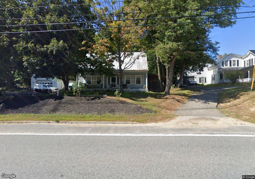
1617 Federal Rd Livermore, ME 04253
Estimated Value: $228,000 - $311,000
--
Bed
--
Bath
988
Sq Ft
$267/Sq Ft
Est. Value
About This Home
This home is located at 1617 Federal Rd, Livermore, ME 04253 and is currently estimated at $263,395, approximately $266 per square foot. 1617 Federal Rd is a home with nearby schools including Spruce Mountain Primary School, Spruce Mountain Elementary School, and Spruce Mountain Middle School.
Ownership History
Date
Name
Owned For
Owner Type
Purchase Details
Closed on
Jun 15, 2021
Sold by
Bachelder Dail G and Bachelder Jean A
Bought by
Pool Linda M
Current Estimated Value
Home Financials for this Owner
Home Financials are based on the most recent Mortgage that was taken out on this home.
Original Mortgage
$75,000
Outstanding Balance
$67,607
Interest Rate
2.9%
Mortgage Type
Purchase Money Mortgage
Estimated Equity
$195,788
Purchase Details
Closed on
Jan 24, 2005
Sold by
Bachelder Jean A and Ellis Jerol B
Bought by
Bachelder Jean A and Bachelder Dail G
Create a Home Valuation Report for This Property
The Home Valuation Report is an in-depth analysis detailing your home's value as well as a comparison with similar homes in the area
Home Values in the Area
Average Home Value in this Area
Purchase History
| Date | Buyer | Sale Price | Title Company |
|---|---|---|---|
| Pool Linda M | -- | None Available | |
| Bachelder Jean A | -- | -- |
Source: Public Records
Mortgage History
| Date | Status | Borrower | Loan Amount |
|---|---|---|---|
| Open | Pool Linda M | $75,000 |
Source: Public Records
Tax History Compared to Growth
Tax History
| Year | Tax Paid | Tax Assessment Tax Assessment Total Assessment is a certain percentage of the fair market value that is determined by local assessors to be the total taxable value of land and additions on the property. | Land | Improvement |
|---|---|---|---|---|
| 2025 | $2,863 | $151,482 | $32,600 | $118,882 |
| 2024 | $2,590 | $151,482 | $32,600 | $118,882 |
| 2023 | $2,462 | $151,482 | $32,600 | $118,882 |
| 2022 | $2,424 | $151,482 | $32,600 | $118,882 |
| 2021 | $2,424 | $151,482 | $32,600 | $118,882 |
| 2020 | $2,310 | $151,482 | $32,600 | $118,882 |
| 2019 | $1,781 | $109,596 | $28,600 | $80,996 |
| 2018 | $1,754 | $109,596 | $28,600 | $80,996 |
| 2017 | $1,797 | $109,596 | $28,600 | $80,996 |
| 2016 | $1,754 | $109,596 | $28,600 | $80,996 |
| 2015 | $1,754 | $109,596 | $28,600 | $80,996 |
| 2014 | $1,556 | $109,596 | $28,600 | $80,996 |
Source: Public Records
Map
Nearby Homes
- 51 Church St
- 1671 Federal Rd
- 137 Canton Rd
- 1785 Federal Rd
- Lot 45-8 Wyatt's Way
- 62 Norton Rd
- 1081 Federal Rd
- 726 Jewett Hill Rd
- 35 Mason Rd
- 2539 Auburn Rd
- Lot16 Torrey Hill Rd
- 21 Stonewall Dr
- 167 Howes Corner Rd
- 61 Rocky Mountain Way
- 309 Strickland Ferry Rd
- Lot C Fern Way
- Lot 9B Pulsifer Rd
- 9 Pulsifer Rd
- 881 River Rd
- 642 Federal Rd
- 1609 Federal Rd
- 1612 Federal Rd
- 1605 Federal Rd
- 1602 Federal Rd
- 1622 Federal Rd
- 13 Church St
- 25 Bryant Rd
- 18 Church St
- 1635 Federal Rd
- 6 Bear Mountain Rd
- 0 Boothby Rd Unit 846965
- 0 Boothby Rd Unit 831048
- 0 Boothby Rd Unit 756097
- 0 Boothby Rd Unit 906302
- 0 Boothby Rd Unit 1201707
- 0 Boothby Rd Unit 1253935
- 0 Boothby Rd Unit 1253931
- 0 Boothby Rd Unit 1253927
- 0 Boothby Rd Unit 1334059
- 0 Boothby Rd Unit 1334055