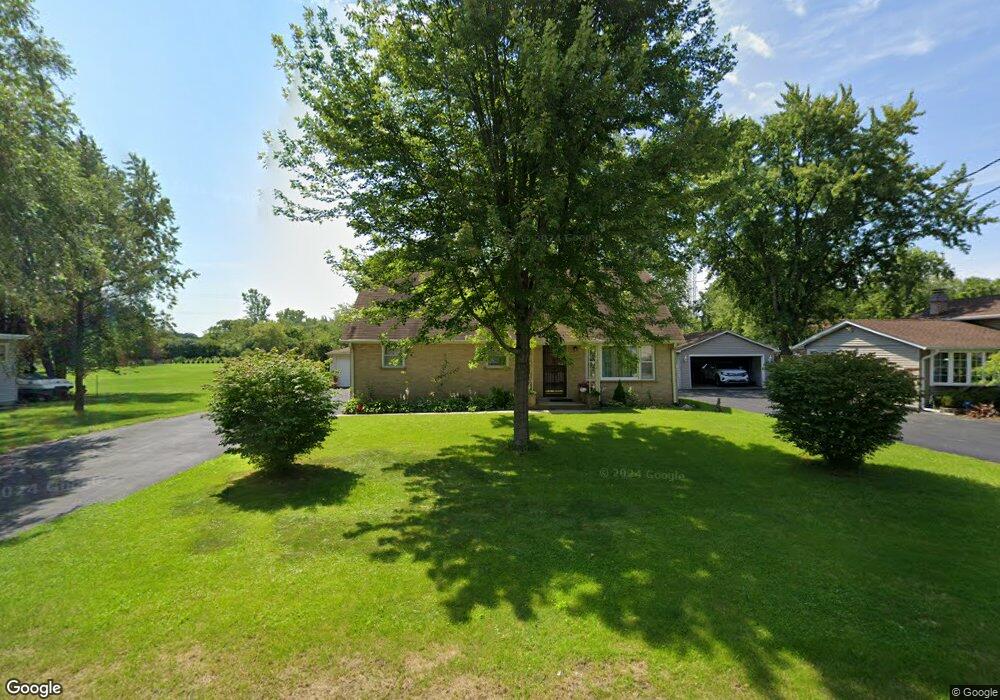
1617 Macarthur Dr Waukegan, IL 60087
Lake County Gardens NeighborhoodEstimated Value: $253,000 - $264,932
3
Beds
1
Bath
1,247
Sq Ft
$208/Sq Ft
Est. Value
About This Home
This home is located at 1617 Macarthur Dr, Waukegan, IL 60087 and is currently estimated at $259,983, approximately $208 per square foot. 1617 Macarthur Dr is a home located in Lake County with nearby schools including H R McCall Elementary School, Jack Benny Middle School, and Waukegan High School.
Ownership History
Date
Name
Owned For
Owner Type
Purchase Details
Closed on
Dec 12, 2018
Sold by
Binning Joyce M and Joyce M Binning Declaration Of
Bought by
Cardoza Santos J and Cardoza Concepcion P
Current Estimated Value
Home Financials for this Owner
Home Financials are based on the most recent Mortgage that was taken out on this home.
Original Mortgage
$95,000
Outstanding Balance
$83,697
Interest Rate
4.8%
Mortgage Type
New Conventional
Estimated Equity
$176,286
Purchase Details
Closed on
Feb 3, 2015
Sold by
Binning Joyce and Binning Ronald L
Bought by
Binning Joyce M
Create a Home Valuation Report for This Property
The Home Valuation Report is an in-depth analysis detailing your home's value as well as a comparison with similar homes in the area
Home Values in the Area
Average Home Value in this Area
Purchase History
| Date | Buyer | Sale Price | Title Company |
|---|---|---|---|
| Cardoza Santos J | $145,000 | First American Title | |
| Binning Joyce M | -- | None Available |
Source: Public Records
Mortgage History
| Date | Status | Borrower | Loan Amount |
|---|---|---|---|
| Open | Cardoza Santos J | $95,000 |
Source: Public Records
Tax History Compared to Growth
Tax History
| Year | Tax Paid | Tax Assessment Tax Assessment Total Assessment is a certain percentage of the fair market value that is determined by local assessors to be the total taxable value of land and additions on the property. | Land | Improvement |
|---|---|---|---|---|
| 2024 | $5,602 | $75,287 | $19,938 | $55,349 |
| 2023 | $5,737 | $67,405 | $17,851 | $49,554 |
| 2022 | $5,737 | $64,687 | $19,121 | $45,566 |
| 2021 | $4,955 | $53,531 | $15,562 | $37,969 |
| 2020 | $4,973 | $49,871 | $14,498 | $35,373 |
| 2019 | $4,955 | $45,699 | $13,285 | $32,414 |
| 2018 | $2,248 | $51,541 | $14,102 | $37,439 |
| 2017 | $2,409 | $45,599 | $12,476 | $33,123 |
| 2016 | $2,617 | $39,624 | $10,841 | $28,783 |
| 2015 | $2,858 | $35,464 | $9,703 | $25,761 |
| 2014 | $3,005 | $27,917 | $5,368 | $22,549 |
| 2012 | $4,285 | $30,245 | $5,816 | $24,429 |
Source: Public Records
Map
Nearby Homes
- 1636 Rice St
- 37966 N Cornell Rd
- 3211 Rugby Ct
- 1612 Whitney St
- 3411 N Lewis Ave
- 37905 N Loyola Ave
- 2613 N Lewis Ave
- 38127 N Shore Ave
- 38362 N Manor Ave
- 3101 Country Club Ln
- 2350 N Lewis Ave
- 1730 W Beach Rd
- 12312 W Audrey Ave
- 38697 N Cedar Ave
- 10241 W Bairstow Ave
- 2708 Dana Ave
- 2705 Dana Ave
- 2232 Walnut St
- 301 W Eagle Ct
- 0 Traditions Dr
- 1619 Macarthur Dr
- 1700 Macarthur Dr
- 1533 Macarthur Dr
- 1704 Macarthur Dr
- 1610 Macarthur Dr
- 1601 Macarthur Dr
- 1711 Macarthur Dr
- 3101 Cornell Rd
- 1604 Macarthur Dr
- 3111 Cornell Rd
- 1600 Macarthur Dr
- 3115 Cornell Rd
- 1527 Macarthur Dr
- 1523 Macarthur Dr
- 3117 Cornell Rd
- 3090 Cornell Rd
- 1530 Macarthur Dr
- 3100 Cornell Rd
- 1521 Macarthur Dr
- 3112 Cornell Rd