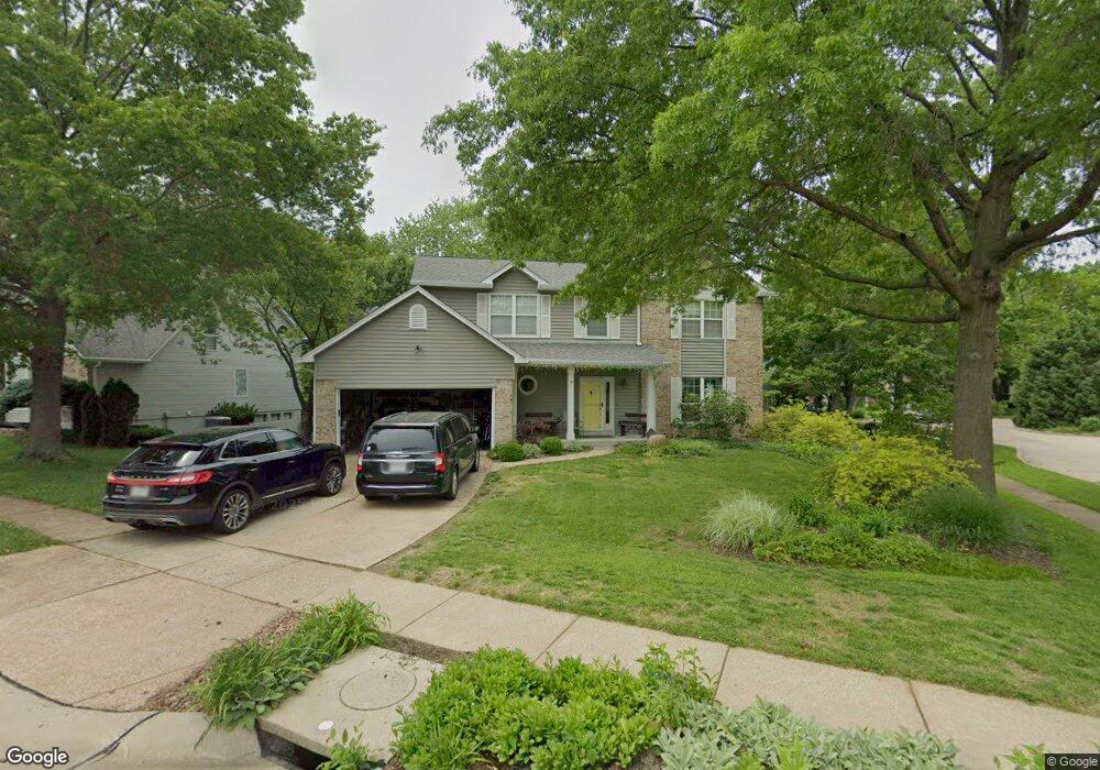
16170 Surfview Ct Grover, MO 63040
Estimated Value: $467,317 - $507,000
4
Beds
3
Baths
2,446
Sq Ft
$201/Sq Ft
Est. Value
About This Home
This home is located at 16170 Surfview Ct, Grover, MO 63040 and is currently estimated at $492,579, approximately $201 per square foot. 16170 Surfview Ct is a home located in St. Louis County with nearby schools including Fairway Elementary School, Wildwood Middle School, and Eureka Senior High School.
Ownership History
Date
Name
Owned For
Owner Type
Purchase Details
Closed on
Dec 29, 2005
Sold by
Landry Roger C and Regnery Michael N
Bought by
Mitchell Aaron A and Mitchell Kaori K
Current Estimated Value
Home Financials for this Owner
Home Financials are based on the most recent Mortgage that was taken out on this home.
Original Mortgage
$203,000
Outstanding Balance
$113,175
Interest Rate
6.23%
Mortgage Type
Fannie Mae Freddie Mac
Estimated Equity
$379,404
Purchase Details
Closed on
Oct 26, 2001
Sold by
Hall William F and Hall Maria M
Bought by
Landry Roger C and Landry Laurie G
Home Financials for this Owner
Home Financials are based on the most recent Mortgage that was taken out on this home.
Original Mortgage
$199,150
Interest Rate
6.59%
Create a Home Valuation Report for This Property
The Home Valuation Report is an in-depth analysis detailing your home's value as well as a comparison with similar homes in the area
Home Values in the Area
Average Home Value in this Area
Purchase History
| Date | Buyer | Sale Price | Title Company |
|---|---|---|---|
| Mitchell Aaron A | $283,000 | None Available | |
| Landry Roger C | $248,950 | -- |
Source: Public Records
Mortgage History
| Date | Status | Borrower | Loan Amount |
|---|---|---|---|
| Open | Mitchell Aaron A | $203,000 | |
| Previous Owner | Landry Roger C | $199,150 | |
| Closed | Landry Roger C | $14,750 |
Source: Public Records
Tax History
| Year | Tax Paid | Tax Assessment Tax Assessment Total Assessment is a certain percentage of the fair market value that is determined by local assessors to be the total taxable value of land and additions on the property. | Land | Improvement |
|---|---|---|---|---|
| 2025 | $5,203 | $84,800 | $29,930 | $54,870 |
| 2024 | $5,203 | $74,830 | $18,700 | $56,130 |
| 2023 | $5,199 | $74,830 | $18,700 | $56,130 |
| 2022 | $4,728 | $63,200 | $18,700 | $44,500 |
| 2021 | $4,693 | $63,200 | $18,700 | $44,500 |
| 2020 | $4,642 | $59,600 | $16,830 | $42,770 |
| 2019 | $4,660 | $59,600 | $16,830 | $42,770 |
| 2018 | $4,109 | $49,550 | $11,230 | $38,320 |
| 2017 | $4,011 | $49,550 | $11,230 | $38,320 |
| 2016 | $4,281 | $50,860 | $11,230 | $39,630 |
Source: Public Records
Map
Nearby Homes
- 413 Lea Harbor Ct
- 16346 Copperwood Ln
- 724 Lakeshore Meadows Dr
- 720 Summer Oak Dr
- 2 Hermitage II at Regal Pines Enclave
- 2 Sequoia at Regal Pines Enclave
- 2 Pin Oak at Regal Pines Enclave
- 2 Maple Expanded at Regal Pines Enclave
- 2549 Westglen Farms Dr
- 16004 Cinderella Ct
- 2 Belmont at Regal Pines Meadows
- 16008 Cinderella Ct
- 2 Meadows
- 2 Nottingham at Regal Pines Enclave
- 16016 Cinderella Ct
- 2 Burlington at Regal Pines Meadows
- 16033 Cinderella Ct
- 2529 Westglen Farms Dr
- 2 Hickory at Regal Pines Enclave
- 16038 Pierside Ln
- 16166 Surfview Ct
- 506 Lighthouse Point Dr
- 505 Lighthouse Point Dr
- 462 Lighthouse Point Dr
- 16160 Surfview Ct
- 512 Lighthouse Point Dr
- 16161 Surfview Ct
- 16181 Surfview Ct
- 16188 Surfview Ct
- 204 Cove Landing Dr
- 511 Lighthouse Point Dr
- 458 Lighthouse Point Dr
- 16154 Surfview Ct
- 518 Lighthouse Point Dr
- 200 Cove Landing Dr
- 16187 Surfview Ct
- 16194 Surfview Ct
- 455 Lighthouse Point Dr
- 16148 Surfview Ct
- 454 Lighthouse Point Dr
Your Personal Tour Guide
Ask me questions while you tour the home.