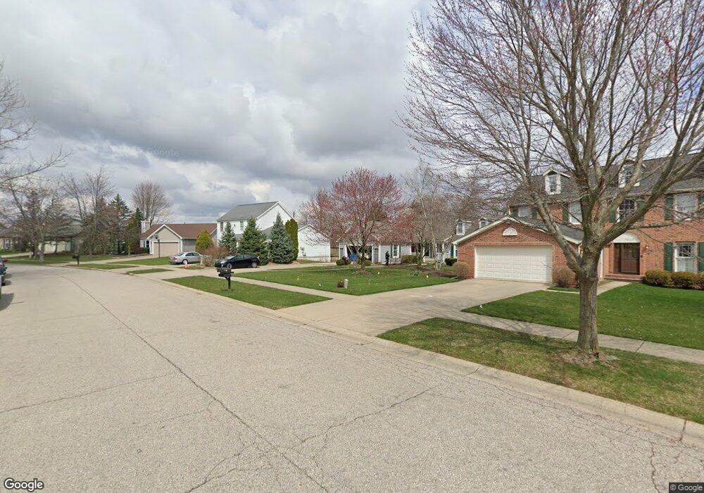
1618 Briar Ridge Dr Unit 20 Ann Arbor, MI 48108
Estimated Value: $470,956 - $581,000
4
Beds
3
Baths
2,900
Sq Ft
$183/Sq Ft
Est. Value
About This Home
This home is located at 1618 Briar Ridge Dr Unit 20, Ann Arbor, MI 48108 and is currently estimated at $531,489, approximately $183 per square foot. 1618 Briar Ridge Dr Unit 20 is a home located in Washtenaw County with nearby schools including Bryant Elementary School, Pattengill Elementary School, and Tappan Middle School.
Ownership History
Date
Name
Owned For
Owner Type
Purchase Details
Closed on
Aug 15, 2018
Sold by
King Rosalind M and Dieterich Henry
Bought by
Dieterich Rosalind M and Dieterich Henry
Current Estimated Value
Purchase Details
Closed on
Apr 27, 2006
Sold by
Schifter Erich S and Schifter Karen K
Bought by
King Rosalind M and Dieterich Henry
Home Financials for this Owner
Home Financials are based on the most recent Mortgage that was taken out on this home.
Original Mortgage
$248,000
Interest Rate
6.37%
Create a Home Valuation Report for This Property
The Home Valuation Report is an in-depth analysis detailing your home's value as well as a comparison with similar homes in the area
Home Values in the Area
Average Home Value in this Area
Purchase History
| Date | Buyer | Sale Price | Title Company |
|---|---|---|---|
| Dieterich Rosalind M | -- | None Available | |
| King Rosalind M | $310,000 | Ab |
Source: Public Records
Mortgage History
| Date | Status | Borrower | Loan Amount |
|---|---|---|---|
| Previous Owner | King Rosalind M | $248,000 |
Source: Public Records
Tax History Compared to Growth
Tax History
| Year | Tax Paid | Tax Assessment Tax Assessment Total Assessment is a certain percentage of the fair market value that is determined by local assessors to be the total taxable value of land and additions on the property. | Land | Improvement |
|---|---|---|---|---|
| 2025 | $6,876 | $220,118 | $0 | $0 |
| 2024 | $4,599 | $211,875 | $0 | $0 |
| 2023 | $6,993 | $189,700 | $0 | $0 |
| 2022 | $6,693 | $200,700 | $0 | $0 |
| 2021 | $5,971 | $199,800 | $0 | $0 |
| 2020 | $6,338 | $172,200 | $0 | $0 |
| 2019 | $5,971 | $171,800 | $171,800 | $0 |
| 2018 | $5,884 | $181,800 | $0 | $0 |
| 2017 | $5,706 | $168,800 | $0 | $0 |
| 2016 | $3,631 | $142,774 | $0 | $0 |
| 2015 | -- | $142,347 | $0 | $0 |
| 2014 | -- | $137,900 | $0 | $0 |
| 2013 | -- | $137,900 | $0 | $0 |
Source: Public Records
Map
Nearby Homes
- 1579 Oakfield Dr Unit 123
- 1573 Oakfield Dr Unit 120
- 1631 Weatherstone Dr
- 1533 Weatherstone Dr
- 1468 Fox Pointe Cir
- 1623 Long Meadow Trail Unit 59
- 1354 Fox Pointe Cir
- 1452 Millbrook Trail Unit 178
- 1429 Millbrook Trail Unit 172
- 5431 Poppydrew Ln Unit 58
- 1307 Millbrook Trail
- 1998 Bancroft Dr
- 3426 Breckland Ct Unit 59
- 1670 W Ellsworth Rd
- 3956 Bridle Pass Unit 28
- 4107 Boulder Pond Dr Unit 33
- 2936 Signature Blvd Unit 24
- 2944 Signature Blvd
- 2130 Park Dr Unit 1
- 2134 Park Dr Unit 2
- 1608 Briar Ridge Dr
- 1636 Briar Ridge Dr
- 1654 Briar Ridge Dr
- 1629 Briar Ridge Dr
- 1672 Briar Ridge Dr
- 1568 Fall Creek Ln Unit 1
- 1661 Briar Ridge Dr
- 1556 Fall Creek Ln
- 0 Fall Creek Ln
- 1587 Oakfield Dr Unit 118
- 1591 Oakfield Dr Unit 122
- 1583 Oakfield Dr
- 1683 Briar Ridge Dr Unit 13
- 1575 Oakfield Dr Unit 119
- 1581 Oakfield Dr Unit 115
- 1581 Oakfield Dr Unit 115-Bldg14
- 1581 Oakfield Dr Unit 14 115
- 1581 Oakfield Dr Unit 18 115
- 1581 Oakfield Dr
- 1589 Oakfield Dr