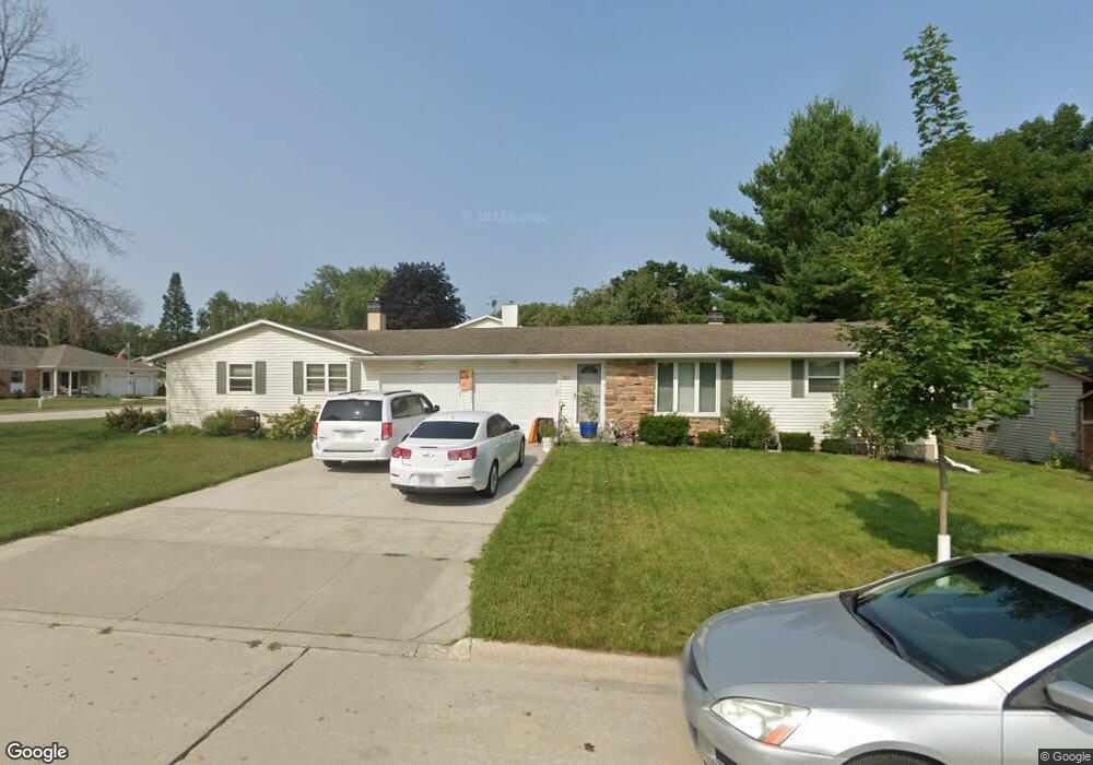
1618 King Arthur Dr Green Bay, WI 54304
MacArthur Heights NeighborhoodEstimated Value: $307,000 - $365,000
--
Bed
--
Bath
--
Sq Ft
8,233
Sq Ft Lot
About This Home
This home is located at 1618 King Arthur Dr, Green Bay, WI 54304 and is currently estimated at $345,165. 1618 King Arthur Dr is a home located in Brown County with nearby schools including MacArthur Elementary School, Lombardi Middle School, and Southwest High School.
Ownership History
Date
Name
Owned For
Owner Type
Purchase Details
Closed on
Apr 9, 2018
Sold by
Katers John S and Katers Mary E
Bought by
Katers John S and Katers Mary E
Current Estimated Value
Purchase Details
Closed on
Mar 26, 2001
Sold by
Brunette Brenda L
Bought by
Katers John S and Katers Mary E
Home Financials for this Owner
Home Financials are based on the most recent Mortgage that was taken out on this home.
Original Mortgage
$106,800
Outstanding Balance
$39,693
Interest Rate
7.13%
Estimated Equity
$305,472
Create a Home Valuation Report for This Property
The Home Valuation Report is an in-depth analysis detailing your home's value as well as a comparison with similar homes in the area
Home Values in the Area
Average Home Value in this Area
Purchase History
| Date | Buyer | Sale Price | Title Company |
|---|---|---|---|
| Katers John S | -- | None Available | |
| Katers John S | $133,500 | Liberty Title & Abstract Inc |
Source: Public Records
Mortgage History
| Date | Status | Borrower | Loan Amount |
|---|---|---|---|
| Open | Katers John S | $106,800 |
Source: Public Records
Tax History Compared to Growth
Tax History
| Year | Tax Paid | Tax Assessment Tax Assessment Total Assessment is a certain percentage of the fair market value that is determined by local assessors to be the total taxable value of land and additions on the property. | Land | Improvement |
|---|---|---|---|---|
| 2024 | $4,150 | $211,800 | $30,800 | $181,000 |
| 2023 | $4,022 | $211,800 | $30,800 | $181,000 |
| 2022 | $3,889 | $211,800 | $30,800 | $181,000 |
| 2021 | $3,387 | $139,300 | $27,400 | $111,900 |
| 2020 | $3,361 | $139,300 | $27,400 | $111,900 |
| 2019 | $3,283 | $139,300 | $27,400 | $111,900 |
| 2018 | $3,187 | $139,300 | $27,400 | $111,900 |
| 2017 | $3,105 | $139,300 | $27,400 | $111,900 |
| 2016 | $3,065 | $139,300 | $27,400 | $111,900 |
| 2015 | $3,039 | $139,300 | $27,400 | $111,900 |
| 2014 | $3,211 | $139,300 | $27,400 | $111,900 |
| 2013 | $3,211 | $139,300 | $27,400 | $111,900 |
Source: Public Records
Map
Nearby Homes
- 2441 Matchwood Ln
- 2439 W Point Rd
- 2550 He Nis Ra Ln
- 1973 Knotty Pine Dr
- 2466 Parkwood Dr
- 2640 He Nis Ra Ln
- 1921 Beech Tree Dr
- 2060 Trissino Way
- 2044 Ann Ln
- 2060 Wintergreen Ct
- 1514 Ashley Ct
- 1433 Baumgart Rd Unit 1435
- 1471 Parkway Dr
- 1450 Woodmont Way
- 1306 Nelson St Unit 1308
- 1570 Mesa Dr
- 2031 Bradbury Ln
- 1779 9th St
- 1522 Argonne Dr
- 1428 Argonne Dr
- 2468 Valiant Ln
- 2461 He Nis Ra Ln
- 2465 He Nis Ra Ln
- 2472 Valiant Ln
- 2451 Matchwood Ln
- 2461 Valiant Ln
- 1701 King Arthur Dr
- 2465 Valiant Ln
- 2475 He Nis Ra Ln
- 2450 Matchwood Ln
- 2478 Valiant Ln
- 1705 King Arthur Dr
- 2471 Valiant Ln
- 2479 He Nis Ra Ln
- 1605 King Arthur Dr
- 2460 Forestville Dr
- 2450 Forestville Dr
- 2482 Valiant Ln
- 2464 He Nis Ra Ln
- 2440 Matchwood Ln