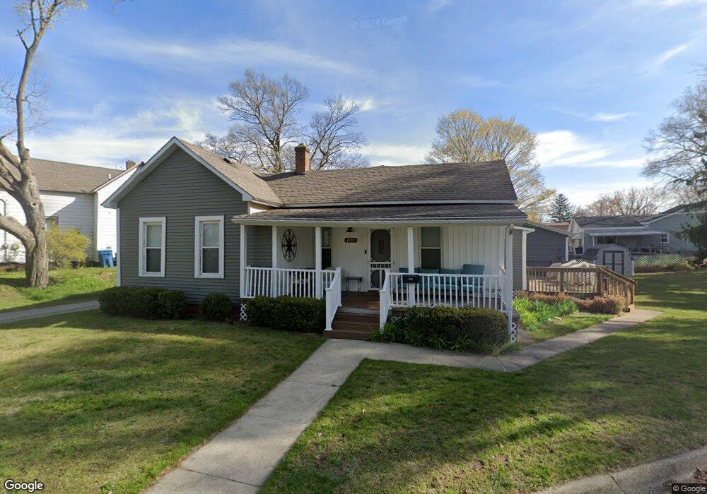
1618 Palmer Ave Muskegon, MI 49441
Nims NeighborhoodEstimated Value: $187,000 - $205,000
2
Beds
1
Bath
1,360
Sq Ft
$147/Sq Ft
Est. Value
About This Home
This home is located at 1618 Palmer Ave, Muskegon, MI 49441 and is currently estimated at $199,567, approximately $146 per square foot. 1618 Palmer Ave is a home located in Muskegon County with nearby schools including Muskegon Montessori Academy for Environmental Change, Muskegon Catholic Central School, and St. Francis De Sales Elementary School.
Ownership History
Date
Name
Owned For
Owner Type
Purchase Details
Closed on
Mar 4, 2020
Sold by
Chabotte Marie L and Chabotte Marie
Bought by
Fredericksen Tobias E and Harwood Abbey L
Current Estimated Value
Purchase Details
Closed on
Oct 20, 2017
Sold by
Dudgeon Janet
Bought by
Chabotte Marie
Purchase Details
Closed on
Feb 12, 2007
Sold by
Vanwyck John D
Bought by
Chabotte Marie L
Purchase Details
Closed on
Feb 23, 2004
Sold by
Dudgeon Lee J and Dudgeon Janet
Bought by
Vanwyck John D and Vanwyck Marie L
Create a Home Valuation Report for This Property
The Home Valuation Report is an in-depth analysis detailing your home's value as well as a comparison with similar homes in the area
Home Values in the Area
Average Home Value in this Area
Purchase History
| Date | Buyer | Sale Price | Title Company |
|---|---|---|---|
| Fredericksen Tobias E | -- | None Available | |
| Chabotte Marie | -- | None Available | |
| Chabotte Marie L | -- | None Available | |
| Vanwyck John D | $30,000 | -- |
Source: Public Records
Tax History Compared to Growth
Tax History
| Year | Tax Paid | Tax Assessment Tax Assessment Total Assessment is a certain percentage of the fair market value that is determined by local assessors to be the total taxable value of land and additions on the property. | Land | Improvement |
|---|---|---|---|---|
| 2025 | $1,717 | $87,000 | $0 | $0 |
| 2024 | $453 | $71,300 | $0 | $0 |
| 2023 | $433 | $62,500 | $0 | $0 |
| 2022 | $1,604 | $51,500 | $0 | $0 |
| 2021 | $1,576 | $45,700 | $0 | $0 |
| 2020 | $1,458 | $39,500 | $0 | $0 |
| 2019 | $1,432 | $35,200 | $0 | $0 |
| 2018 | $1,958 | $30,700 | $0 | $0 |
| 2017 | $1,127 | $29,100 | $0 | $0 |
| 2016 | $293 | $27,900 | $0 | $0 |
| 2015 | -- | $28,100 | $0 | $0 |
| 2014 | $288 | $28,000 | $0 | $0 |
| 2013 | -- | $26,400 | $0 | $0 |
Source: Public Records
Map
Nearby Homes
- 1794 Lakeshore Dr
- 2058 Blodgett St
- 1819 Fair Ave
- 1878 Lakeshore Dr
- 2260 Estes St
- 1965 Harrison Ave
- 1564 Ridge Ave
- 1151 W Dale Ave
- 2293 Torrent St
- 1270 Palmer Ave
- 1135 W Dale Ave
- 1408 Lexington Ave
- 952 Boardwalk Cove Dr
- 2405 Estes St
- 1555 Beardsley Ave
- 2432 Blodgett St
- 2096 Morton Ave
- 988 W Larch Ave
- 1636 Franklin St
- 1729 Winchester Dr
- 1586 Palmer Ave
- 1928 Frisbie St
- 1924 Frisbie St
- 1580 Palmer Ave
- 1918 Frisbie St
- 1629 Lakeshore Dr
- 1623 Lakeshore Dr
- 1637 Lakeshore Dr
- 1583 Palmer Ave
- 1576 Palmer Ave
- 1621 Lakeshore Dr
- 1887 Vanderlinde St
- 1615 Lakeshore Dr
- 1575 Palmer Ave
- 1895 Vanderlinde St
- 1567 Palmer Ave
- 1605 Lakeshore Dr
- 1958 Roilson St
- 1892 Vanderlinde St
- 1544 Montgomery Ave