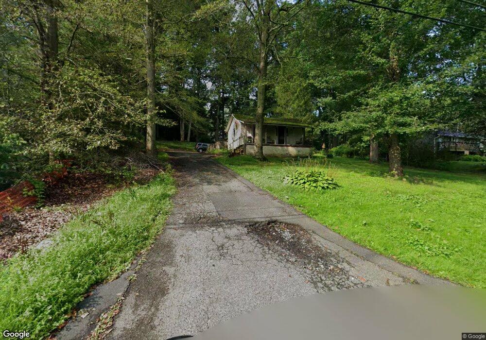
1618 Ruffs Mill Rd Bel Air, MD 21015
Estimated Value: $202,000 - $345,000
Studio
1
Bath
912
Sq Ft
$301/Sq Ft
Est. Value
About This Home
This home is located at 1618 Ruffs Mill Rd, Bel Air, MD 21015 and is currently estimated at $274,932, approximately $301 per square foot. 1618 Ruffs Mill Rd is a home located in Harford County with nearby schools including Dublin Elementary School, Southampton Middle School, and C. Milton Wright High School.
Ownership History
Date
Name
Owned For
Owner Type
Purchase Details
Closed on
Dec 13, 1995
Sold by
Mcgrady Leonard E
Bought by
Brown Michael W and Brown Carol A
Current Estimated Value
Purchase Details
Closed on
May 1, 1995
Sold by
Household Fin Iii
Bought by
Mcgrady Leonard E
Home Financials for this Owner
Home Financials are based on the most recent Mortgage that was taken out on this home.
Original Mortgage
$20,000
Interest Rate
8.33%
Purchase Details
Closed on
Mar 15, 1995
Sold by
Danoff Gerald
Bought by
Household Fin Iii
Home Financials for this Owner
Home Financials are based on the most recent Mortgage that was taken out on this home.
Original Mortgage
$20,000
Interest Rate
8.33%
Create a Home Valuation Report for This Property
The Home Valuation Report is an in-depth analysis detailing your home's value as well as a comparison with similar homes in the area
Purchase History
| Date | Buyer | Sale Price | Title Company |
|---|---|---|---|
| Brown Michael W | $105,000 | -- | |
| Mcgrady Leonard E | $28,000 | -- | |
| Household Fin Iii | $54,547 | -- |
Source: Public Records
Mortgage History
| Date | Status | Borrower | Loan Amount |
|---|---|---|---|
| Previous Owner | Household Fin Iii | $20,000 | |
| Closed | Brown Michael W | -- |
Source: Public Records
Tax History
| Year | Tax Paid | Tax Assessment Tax Assessment Total Assessment is a certain percentage of the fair market value that is determined by local assessors to be the total taxable value of land and additions on the property. | Land | Improvement |
|---|---|---|---|---|
| 2025 | $1,766 | $160,900 | $96,700 | $64,200 |
| 2024 | $1,766 | $156,533 | $0 | $0 |
| 2023 | $1,718 | $152,167 | $0 | $0 |
| 2022 | $1,671 | $147,800 | $96,700 | $51,100 |
| 2021 | $1,766 | $147,800 | $96,700 | $51,100 |
| 2020 | $1,766 | $147,800 | $96,700 | $51,100 |
| 2019 | $1,838 | $154,100 | $110,000 | $44,100 |
| 2018 | $1,803 | $152,400 | $0 | $0 |
| 2017 | $1,783 | $154,100 | $0 | $0 |
| 2016 | -- | $149,000 | $0 | $0 |
| 2015 | $1,688 | $149,000 | $0 | $0 |
| 2014 | $1,688 | $149,000 | $0 | $0 |
Source: Public Records
Map
Nearby Homes
- 1221 Prospect Mill Rd
- 1831 Still Pond Way
- 1652 Livingston Dr
- 1810 Wye Mills Ln
- 2108 Moorland Dr
- 2102 Moorland Dr
- 1836 Bramble Brook Ln
- 1407 Eagle Ridge Run
- 2600 Sandy Hook Rd
- 2229-A Ady Rd
- 305 Baratheon Ln
- 1838 Braavos Ct
- 1008 Goose Cross Ct
- 2647 Hoopes Rd
- 917 Buckland Place
- 735 Farnham Place
- 1415 Hardley Ct
- 2605 Ady Rd
- 1204 Athens Ct
- 505 Kilkenny Ct
- 1620 Ruffs Mill Rd
- 1614 Ruffs Mill Rd
- 2236 Thomas Run Rd
- 2214 Thomas Run Rd
- 1610 Ruffs Mill Rd
- 1622 Ruffs Mill Rd
- 2237 Thomas Run Rd
- 2234 Thomas Run Rd
- 1701 Ruffs Mill Rd
- 2228 Thomas Run Rd
- 2243 Thomas Run Rd
- 1700 Ruffs Mill Rd
- 1706 Ruffs Mill Rd
- 2244 Thomas Run Rd
- 2226 Thomas Run Rd
- 2249 Thomas Run Rd
- 1708 Ruffs Mill Rd
- 1712 Ruffs Mill Rd
- 2211 Thomas Run Rd
- 2212 Thomas Run Rd
Your Personal Tour Guide
Ask me questions while you tour the home.