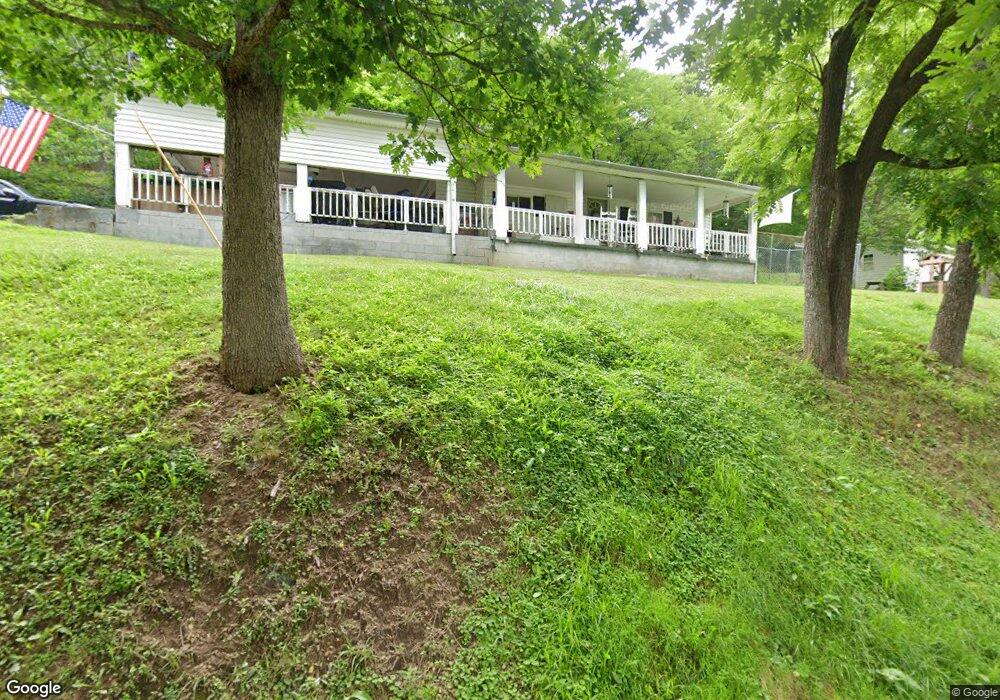
1619 Carroll Cir Grayson, KY 41143
Estimated Value: $57,588 - $153,000
2
Beds
1
Bath
1,056
Sq Ft
$108/Sq Ft
Est. Value
About This Home
This home is located at 1619 Carroll Cir, Grayson, KY 41143 and is currently estimated at $114,397, approximately $108 per square foot. 1619 Carroll Cir is a home located in Carter County with nearby schools including Prichard Elementary School, East Carter Middle School, and East Carter County High School.
Ownership History
Date
Name
Owned For
Owner Type
Purchase Details
Closed on
Sep 16, 2020
Sold by
Strother Mark and Commercial Bank Of Grayson
Bought by
Clark Harry S and Clark Anita J
Current Estimated Value
Home Financials for this Owner
Home Financials are based on the most recent Mortgage that was taken out on this home.
Original Mortgage
$10,400
Interest Rate
2.9%
Mortgage Type
Future Advance Clause Open End Mortgage
Create a Home Valuation Report for This Property
The Home Valuation Report is an in-depth analysis detailing your home's value as well as a comparison with similar homes in the area
Purchase History
| Date | Buyer | Sale Price | Title Company |
|---|---|---|---|
| Clark Harry S | $13,000 | None Available |
Source: Public Records
Mortgage History
| Date | Status | Borrower | Loan Amount |
|---|---|---|---|
| Closed | Clark Harry S | $10,400 |
Source: Public Records
Tax History
| Year | Tax Paid | Tax Assessment Tax Assessment Total Assessment is a certain percentage of the fair market value that is determined by local assessors to be the total taxable value of land and additions on the property. | Land | Improvement |
|---|---|---|---|---|
| 2024 | $201 | $23,480 | $0 | $0 |
| 2023 | $202 | $23,480 | $0 | $0 |
| 2022 | $112 | $13,000 | $0 | $0 |
| 2021 | $115 | $13,000 | $0 | $0 |
| 2020 | $310 | $35,000 | $5,000 | $30,000 |
| 2019 | $309 | $35,000 | $5,000 | $30,000 |
| 2018 | $0 | $35,000 | $5,000 | $30,000 |
| 2017 | $0 | $35,000 | $5,000 | $30,000 |
| 2016 | $0 | $35,000 | $5,000 | $30,000 |
| 2015 | -- | $35,000 | $5,000 | $30,000 |
| 2014 | -- | $31,000 | $0 | $0 |
| 2011 | -- | $31,000 | $0 | $0 |
Source: Public Records
Map
Nearby Homes
- 102 Wildcat Dr
- 0 Upper Stinson Rd
- 1180 E Maple St
- 3.95 acres Plantation Dr
- Lot #2 Greenbrier Plantations Phase 1
- Lot #10 Greenbrier Plantations Phase 1
- 100 Driftwood Ln
- Lot #7 Greenbrier Plantations Phase 1
- Lot #11 Greenbrier Plantations Phase 1
- Lot #15 Greenbrier Plantations Phase 1
- Lot #13 Greenbrier Plantations Phase 1
- 84 Woodcrest Rd
- 2659 E US Highway 60
- 218 Fox Run Rd
- 817 Cherrywood Ln
- 6 Damron St
- 710 Elm St
- 711 Circle Dr
- 1010 Canoe Run
- 65 7th St
- 1717 Carroll Cir
- 1707 E Us Highway 60
- 1725 Carroll Cir
- 1711 E Us Highway 60
- 1711 U S 60
- 216 Stinson Rd
- 1600 E Us Highway 60
- 1731 Carroll Cir
- 201 Stone St
- 1508 Robinson St
- 205 Stone St
- 1500 E Us Highway 60
- 1504 Robinson St
- 1503 Robinson St
- 1501 Robinson St
- 165 Wildcat Dr
- 155 Wildcat Dr
- 145 Wildcat Dr
- 135 Wildcat Dr
- 154 Wildcat Dr
Your Personal Tour Guide
Ask me questions while you tour the home.