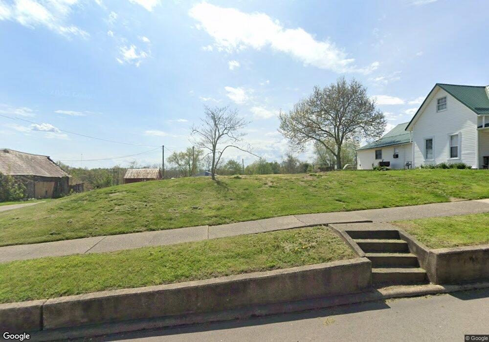
1619 Penn St Stockport, OH 43787
Estimated Value: $106,000 - $121,000
3
Beds
1
Bath
1,533
Sq Ft
$74/Sq Ft
Est. Value
About This Home
This home is located at 1619 Penn St, Stockport, OH 43787 and is currently estimated at $113,500, approximately $74 per square foot. 1619 Penn St is a home located in Morgan County with nearby schools including Morgan High School.
Ownership History
Date
Name
Owned For
Owner Type
Purchase Details
Closed on
Oct 17, 2012
Sold by
Baker James H
Bought by
Price Tonya Marie
Current Estimated Value
Purchase Details
Closed on
Aug 8, 2011
Sold by
Harper Electrie and Harper Electrie
Bought by
Baker James H
Purchase Details
Closed on
Feb 11, 2004
Sold by
Graham Don
Bought by
Harper Ralph
Purchase Details
Closed on
Nov 7, 1995
Sold by
Graham Dwight R and Graham Pearl
Bought by
Graham Dwight R and Graham Pearl
Purchase Details
Closed on
Sep 19, 1995
Sold by
Graham Dwight R and Graham Pearl
Bought by
Graham Dwight R and Graham Pearl
Create a Home Valuation Report for This Property
The Home Valuation Report is an in-depth analysis detailing your home's value as well as a comparison with similar homes in the area
Home Values in the Area
Average Home Value in this Area
Purchase History
| Date | Buyer | Sale Price | Title Company |
|---|---|---|---|
| Price Tonya Marie | -- | None Available | |
| Baker James H | $20,000 | None Available | |
| Harper Ralph | $27,500 | -- | |
| Graham Dwight R | -- | -- | |
| Graham Dwight R | -- | -- |
Source: Public Records
Tax History Compared to Growth
Tax History
| Year | Tax Paid | Tax Assessment Tax Assessment Total Assessment is a certain percentage of the fair market value that is determined by local assessors to be the total taxable value of land and additions on the property. | Land | Improvement |
|---|---|---|---|---|
| 2024 | $85 | $2,510 | $2,510 | $0 |
| 2023 | $85 | $10,560 | $2,040 | $8,520 |
| 2022 | $354 | $10,560 | $2,040 | $8,520 |
| 2021 | $359 | $10,600 | $2,040 | $8,560 |
| 2019 | $343 | $9,690 | $1,860 | $7,830 |
| 2018 | $331 | $9,690 | $1,860 | $7,830 |
| 2017 | $337 | $9,598 | $1,593 | $8,005 |
| 2016 | $338 | $9,598 | $1,593 | $8,005 |
| 2015 | $338 | $9,633 | $1,593 | $8,040 |
| 2014 | $349 | $9,633 | $1,593 | $8,040 |
| 2013 | $349 | $9,633 | $1,593 | $8,040 |
Source: Public Records
Map
Nearby Homes
- 1673 S State Route 377
- 0 Benjamin Rd
- 643 Townsend Rd
- 0 Downing Rd
- 781 Downing Rd
- 0 Coler Rd
- 681 Downing Rd
- 0 Upper Douda Rd Unit 225030416
- 160 N Riverview Rd
- 7.38 acres County Road 13
- 3265 Tieber Rd
- 75 S River Rd SE
- 1715 South St
- 1770 Broadway St
- 0 Meadow St Unit Lot 9 5158299
- 0 Meadow St Unit Lot 9 225008020
- 3205 Goshen Run Rd
- 1920 North St
- 1960 Broadway St
- 2444 Ervin Ln
- 1619 Penn St
- 1615 Penn St
- 1615 Penn St
- 1623 Penn St
- 1611 Penn St
- 1616 Penn St
- 1637 Penn St
- 1620 S State Route 377
- 1612 S State Route 377
- 1520 S State Route 377
- 1540 S State Route 377
- 1510 S State Route 377
- 1500 S State Route 377
- 1606 Ohio 377
- 1601 Penn St
- 1649 Penn St
- 1600 S State Route 377
- 1593 Penn St
- 1651 S State Route 377
- 1589 Penn St