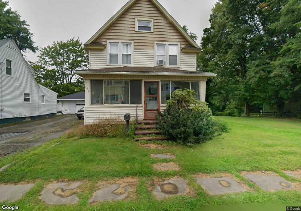
162 Carnegie St Conneaut, OH 44030
Estimated Value: $107,000 - $124,000
3
Beds
1
Bath
1,344
Sq Ft
$87/Sq Ft
Est. Value
About This Home
This home is located at 162 Carnegie St, Conneaut, OH 44030 and is currently estimated at $116,768, approximately $86 per square foot. 162 Carnegie St is a home located in Ashtabula County with nearby schools including Lakeshore Primary Elementary School, Gateway Elementary School, and Conneaut Middle School.
Ownership History
Date
Name
Owned For
Owner Type
Purchase Details
Closed on
Mar 18, 2007
Sold by
Homesales Inc
Bought by
Neubauer David D and Neubauer Yvonne A
Current Estimated Value
Purchase Details
Closed on
Sep 4, 2003
Sold by
Hud
Bought by
Williams Gary
Home Financials for this Owner
Home Financials are based on the most recent Mortgage that was taken out on this home.
Original Mortgage
$63,300
Interest Rate
6.18%
Mortgage Type
Unknown
Create a Home Valuation Report for This Property
The Home Valuation Report is an in-depth analysis detailing your home's value as well as a comparison with similar homes in the area
Home Values in the Area
Average Home Value in this Area
Purchase History
| Date | Buyer | Sale Price | Title Company |
|---|---|---|---|
| Neubauer David D | $30,000 | Chicago Title | |
| Williams Gary | $60,000 | Lakeside Title & Escrow |
Source: Public Records
Mortgage History
| Date | Status | Borrower | Loan Amount |
|---|---|---|---|
| Previous Owner | Williams Gary | $63,300 |
Source: Public Records
Tax History Compared to Growth
Tax History
| Year | Tax Paid | Tax Assessment Tax Assessment Total Assessment is a certain percentage of the fair market value that is determined by local assessors to be the total taxable value of land and additions on the property. | Land | Improvement |
|---|---|---|---|---|
| 2024 | $1,987 | $27,160 | $5,110 | $22,050 |
| 2023 | $1,287 | $27,160 | $5,110 | $22,050 |
| 2022 | $1,060 | $19,670 | $3,920 | $15,750 |
| 2021 | $1,078 | $19,670 | $3,920 | $15,750 |
| 2020 | $1,077 | $19,670 | $3,920 | $15,750 |
| 2019 | $1,080 | $19,360 | $3,330 | $16,030 |
| 2018 | $1,031 | $19,360 | $3,330 | $16,030 |
| 2017 | $1,073 | $19,360 | $3,330 | $16,030 |
| 2016 | $1,105 | $22,650 | $3,890 | $18,760 |
| 2015 | $1,116 | $22,650 | $3,890 | $18,760 |
| 2014 | $988 | $22,650 | $3,890 | $18,760 |
| 2013 | $694 | $16,320 | $4,380 | $11,940 |
Source: Public Records
Map
Nearby Homes