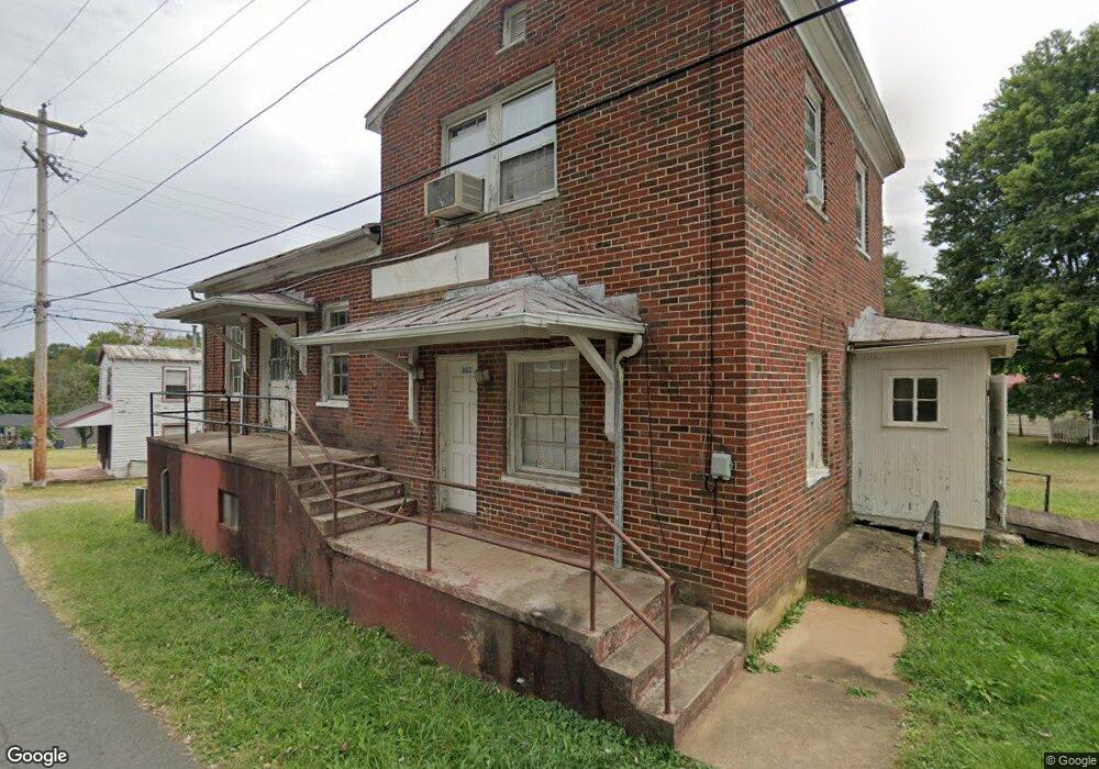
162 Depot St Amherst, VA 24521
Estimated Value: $96,366
Studio
--
Bath
1,856
Sq Ft
$52/Sq Ft
Est. Value
About This Home
This home is located at 162 Depot St, Amherst, VA 24521 and is currently estimated at $96,366, approximately $51 per square foot. 162 Depot St is a home located in Amherst County with nearby schools including Amherst Elementary School, Amherst Middle School, and Amherst County High School.
Ownership History
Date
Name
Owned For
Owner Type
Purchase Details
Closed on
Mar 15, 2024
Sold by
Rucker Wannetta W and Wright Joan P
Bought by
Khanna Salina
Current Estimated Value
Home Financials for this Owner
Home Financials are based on the most recent Mortgage that was taken out on this home.
Original Mortgage
$85,000
Outstanding Balance
$83,171
Interest Rate
6.64%
Mortgage Type
New Conventional
Estimated Equity
$13,195
Purchase Details
Closed on
May 9, 2007
Sold by
Winfree Michael L and Reavis Ralph
Bought by
Wright Ronald W and Rucker Wannetta W
Create a Home Valuation Report for This Property
The Home Valuation Report is an in-depth analysis detailing your home's value as well as a comparison with similar homes in the area
Purchase History
| Date | Buyer | Sale Price | Title Company |
|---|---|---|---|
| Khanna Salina | $104,900 | Fidelity National Title | |
| Khanna Salina | $104,900 | Fidelity National Title | |
| Wright Ronald W | -- | None Available |
Source: Public Records
Mortgage History
| Date | Status | Borrower | Loan Amount |
|---|---|---|---|
| Open | Khanna Salina | $85,000 | |
| Closed | Khanna Salina | $85,000 |
Source: Public Records
Tax History
| Year | Tax Paid | Tax Assessment Tax Assessment Total Assessment is a certain percentage of the fair market value that is determined by local assessors to be the total taxable value of land and additions on the property. | Land | Improvement |
|---|---|---|---|---|
| 2026 | $667 | $109,400 | $33,000 | $76,400 |
| 2025 | $640 | $104,900 | $27,500 | $77,400 |
| 2024 | $640 | $104,900 | $27,500 | $77,400 |
| 2023 | $640 | $104,900 | $27,500 | $77,400 |
| 2022 | $640 | $104,900 | $27,500 | $77,400 |
| 2021 | $640 | $104,900 | $27,500 | $77,400 |
| 2020 | $640 | $104,900 | $27,500 | $77,400 |
| 2019 | $611 | $100,200 | $27,500 | $72,700 |
| 2018 | $611 | $100,200 | $27,500 | $72,700 |
| 2017 | $611 | $100,200 | $27,500 | $72,700 |
| 2016 | $611 | $100,200 | $27,500 | $72,700 |
| 2015 | $281 | $100,200 | $27,500 | $72,700 |
| 2014 | $561 | $100,200 | $27,500 | $72,700 |
Source: Public Records
Map
Nearby Homes
- 113 Garland Ave
- 282 S Main St
- 150 Mount Olive Rd
- 426 S Main St
- 144 Maple Ln
- 260 N Main St
- 9 Mill Race Dr
- 108 Montfair Dr
- 0 Ridge Dr
- 128 Walnut St
- 138 Vista Dr
- 178 Dulwich Dr Unit 178
- Lot 3 Fox Hall Dr
- 135 Yahweh Dr
- 272 Grandview Dr
- 0 Fox Hall Dr
- 133 Deerfield Dr
- 273 Airsports Dr
- 137 Higginbotham Creek Rd
- 107 Emory Way
Your Personal Tour Guide
Ask me questions while you tour the home.