Estimated Value: $246,502 - $278,000
3
Beds
2
Baths
1,694
Sq Ft
$158/Sq Ft
Est. Value
About This Home
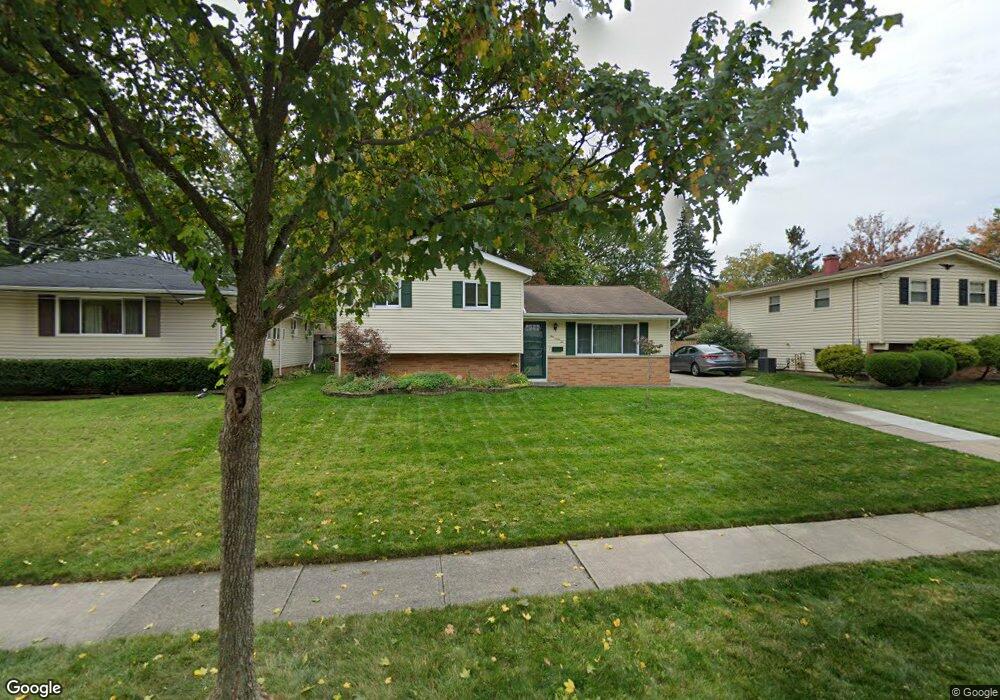
This home is located at 162 Dorland Ave, Berea, OH 44017 and is currently estimated at $267,376, approximately $157 per square foot. 162 Dorland Ave is a home located in Cuyahoga County with nearby schools including Grindstone Elementary School, Berea-Midpark Middle School, and Berea-Midpark High School.
Ownership History
Date
Name
Owned For
Owner Type
Purchase Details
Closed on
Apr 8, 2009
Sold by
Spirnak Thomas P
Bought by
Spirnak Thomas P and Spirnak Shelia R
Current Estimated Value
Home Financials for this Owner
Home Financials are based on the most recent Mortgage that was taken out on this home.
Original Mortgage
$104,000
Outstanding Balance
$66,343
Interest Rate
5.11%
Mortgage Type
New Conventional
Estimated Equity
$201,033
Purchase Details
Closed on
Aug 30, 1991
Sold by
Spirnak Andrew G
Bought by
Spirnak Thomas P
Purchase Details
Closed on
Nov 1, 1989
Sold by
Ertell William G and Ertell Kathleen
Bought by
Spirnak Andrew G
Purchase Details
Closed on
Jan 1, 1975
Bought by
Ertell William G and Ertell Kathleen
Create a Home Valuation Report for This Property
The Home Valuation Report is an in-depth analysis detailing your home's value as well as a comparison with similar homes in the area
Home Values in the Area
Average Home Value in this Area
Purchase History
| Date | Buyer | Sale Price | Title Company |
|---|---|---|---|
| Spirnak Thomas P | -- | Maximum Title | |
| Spirnak Thomas P | $80,000 | -- | |
| Spirnak Andrew G | $84,000 | -- | |
| Ertell William G | -- | -- |
Source: Public Records
Mortgage History
| Date | Status | Borrower | Loan Amount |
|---|---|---|---|
| Open | Spirnak Thomas P | $104,000 |
Source: Public Records
Tax History Compared to Growth
Tax History
| Year | Tax Paid | Tax Assessment Tax Assessment Total Assessment is a certain percentage of the fair market value that is determined by local assessors to be the total taxable value of land and additions on the property. | Land | Improvement |
|---|---|---|---|---|
| 2024 | $3,636 | $72,380 | $11,865 | $60,515 |
| 2023 | $3,952 | $57,230 | $10,500 | $46,730 |
| 2022 | $3,928 | $57,225 | $10,500 | $46,725 |
| 2021 | $3,894 | $57,230 | $10,500 | $46,730 |
| 2020 | $3,719 | $48,480 | $8,890 | $39,590 |
| 2019 | $3,620 | $138,500 | $25,400 | $113,100 |
| 2018 | $3,335 | $48,480 | $8,890 | $39,590 |
| 2017 | $3,296 | $41,200 | $8,120 | $33,080 |
| 2016 | $3,272 | $41,200 | $8,120 | $33,080 |
| 2015 | $3,255 | $41,200 | $8,120 | $33,080 |
| 2014 | $3,255 | $43,370 | $8,540 | $34,830 |
Source: Public Records
Map
Nearby Homes
- 9401 Pheasant Run Place
- 84 Sprague Rd
- 104 Whitehall Dr
- 8627 Courtland Dr
- 740 Fair St
- 8036 Fair Rd
- 148 Meadow Cir
- 243 Jananna Dr
- 74 Aaron St
- 23 Hamilton St
- 19419 Fowles Rd
- 8902 Lincolnshire Blvd
- 20424 Scotch Pine Way
- 18737 Evergreen Dr
- 21176 Hickory Branch Trail
- 9829 Plum Brook Ln
- 10353 Oak Branch Trail
- 19890 Idlewood Trail
- 255 Fairpark Dr
- 10839 Prospect Rd
- 168 Dorland Ave
- 156 Dorland Ave
- 174 Dorland Ave
- 150 Dorland Ave
- 161 Milton St
- 167 Milton St
- 155 Milton St
- 180 Dorland Ave
- 159 Dorland Ave
- 144 Dorland Ave
- 165 Dorland Ave
- 173 Milton St
- 149 Milton St
- 169 Dorland Ave
- 153 Dorland Ave
- 175 Dorland Ave
- 147 Dorland Ave
- 184 Dorland Ave
- 179 Milton St
- 136 Dorland Ave