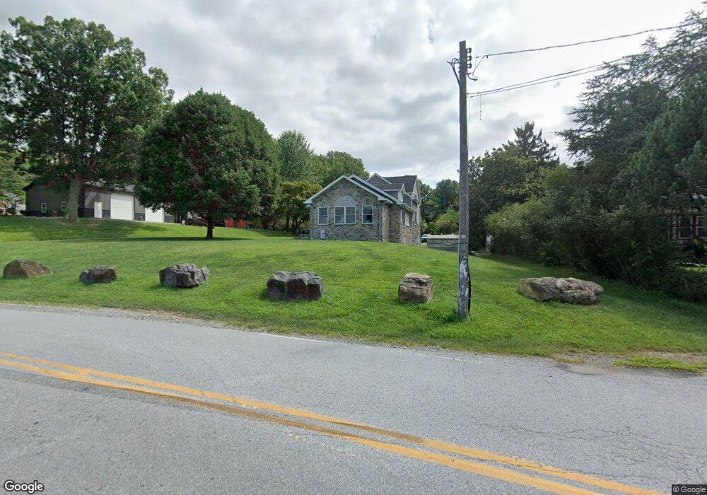
162 Ewart Rd Avondale, PA 19311
Estimated Value: $515,000 - $816,000
3
Beds
3
Baths
3,096
Sq Ft
$212/Sq Ft
Est. Value
About This Home
This home is located at 162 Ewart Rd, Avondale, PA 19311 and is currently estimated at $655,763, approximately $211 per square foot. 162 Ewart Rd is a home located in Chester County with nearby schools including Kennett Middle School, Kennett High School, and Sanford School.
Ownership History
Date
Name
Owned For
Owner Type
Purchase Details
Closed on
Dec 13, 2007
Sold by
Witter Obrigawitch Jill A and Witter Morgan Stanley Dean
Bought by
Wilhelm Ashley Lynn
Current Estimated Value
Purchase Details
Closed on
Jul 16, 1999
Sold by
Probst George A and England Verna L
Bought by
Benitz Jill and Obrigawitch Jill A
Home Financials for this Owner
Home Financials are based on the most recent Mortgage that was taken out on this home.
Original Mortgage
$155,000
Interest Rate
7.39%
Create a Home Valuation Report for This Property
The Home Valuation Report is an in-depth analysis detailing your home's value as well as a comparison with similar homes in the area
Home Values in the Area
Average Home Value in this Area
Purchase History
| Date | Buyer | Sale Price | Title Company |
|---|---|---|---|
| Wilhelm Ashley Lynn | $210,000 | None Available | |
| Benitz Jill | $177,000 | -- |
Source: Public Records
Mortgage History
| Date | Status | Borrower | Loan Amount |
|---|---|---|---|
| Previous Owner | Benitz Jill | $155,000 |
Source: Public Records
Tax History Compared to Growth
Tax History
| Year | Tax Paid | Tax Assessment Tax Assessment Total Assessment is a certain percentage of the fair market value that is determined by local assessors to be the total taxable value of land and additions on the property. | Land | Improvement |
|---|---|---|---|---|
| 2025 | $9,364 | $233,810 | $36,980 | $196,830 |
| 2024 | $9,364 | $233,810 | $36,980 | $196,830 |
| 2023 | $9,050 | $233,810 | $36,980 | $196,830 |
| 2022 | $8,648 | $226,740 | $36,980 | $189,760 |
| 2021 | $8,561 | $226,740 | $36,980 | $189,760 |
| 2020 | $8,398 | $226,740 | $36,980 | $189,760 |
| 2019 | $8,284 | $226,740 | $36,980 | $189,760 |
| 2018 | $8,155 | $226,740 | $36,980 | $189,760 |
| 2017 | $7,988 | $226,740 | $36,980 | $189,760 |
| 2016 | $430 | $226,740 | $36,980 | $189,760 |
| 2015 | $430 | $226,740 | $36,980 | $189,760 |
| 2014 | $430 | $226,740 | $36,980 | $189,760 |
Source: Public Records
Map
Nearby Homes
- 9129 Gap Newport Pike
- 104 Saint Andrews Dr
- 111 Saint Andrews Dr
- 104 Shinnecock Hill
- 139 Sharp Rd
- 683 Mc Govern Rd
- 109 Regency Ct
- 122 Round Hill Rd
- 104 Kittanset Ct
- 22 Eynon Ct
- 567 Southwood Rd
- 551 Southwood Rd
- 707 Letitia Dr
- 12 W Shore Ct
- 6011 Whitney Ct
- 1331 Broad Run Rd
- 1131 Valley Rd
- 118 Pleasant Bank Ln
- 112 Cameron Dr
- 27 Southampton Parish Rd
- 6819 Limestone Rd
- 164 Ewart Rd
- 6811 Limestone Rd
- 167 Ewart Rd
- 9131 Gap Newport Pike
- 1173 Kaolin Rd
- 166 Ewart Rd
- 9127 Gap Newport Pike
- 163 Sheehan Rd
- 9125 Gap Newport Pike
- 177 Ewart Rd
- 178 Ewart Rd
- 174 Ewart Rd
- 9133 Gap Newport Pike
- 1 Perrone Way
- 157 Sheehan Rd
- 162 Sheehan Rd
- 9120 Gap Newport Pike
- 9145 Gap Newport Pike
- 121 Whitney Dr