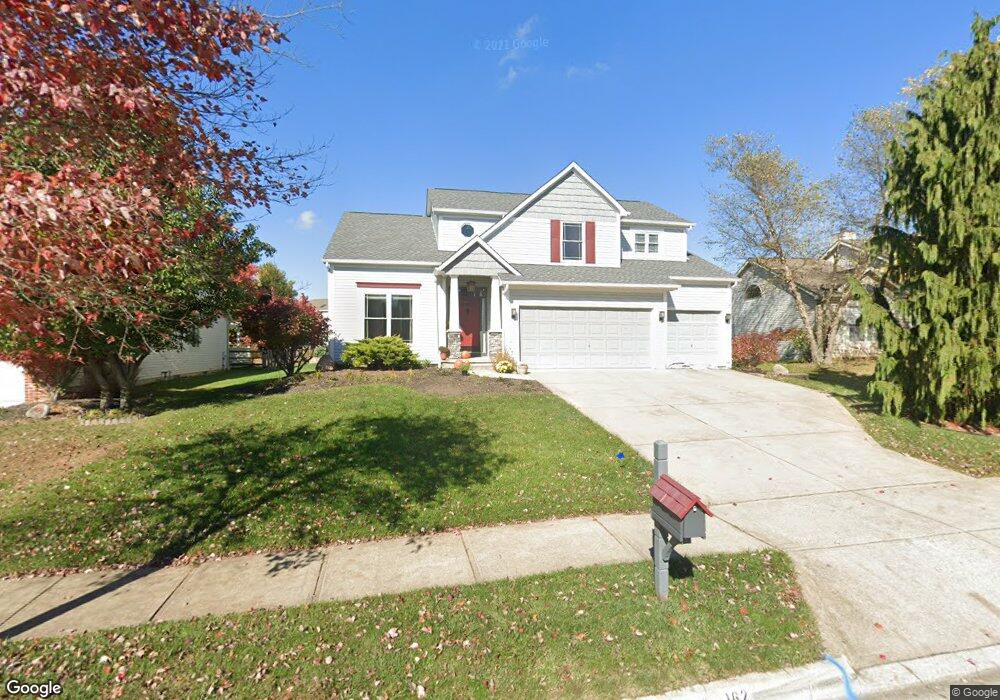
162 Hawthorn Blvd Delaware, OH 43015
Estimated Value: $457,292 - $506,000
3
Beds
3
Baths
2,477
Sq Ft
$190/Sq Ft
Est. Value
About This Home
This home is located at 162 Hawthorn Blvd, Delaware, OH 43015 and is currently estimated at $471,573, approximately $190 per square foot. 162 Hawthorn Blvd is a home located in Delaware County with nearby schools including Laura Woodward Elementary School, John C. Dempsey Middle School, and Rutherford B. Hayes High School.
Ownership History
Date
Name
Owned For
Owner Type
Purchase Details
Closed on
Jul 21, 2005
Sold by
Mely Stephen M and Purkey Anna M
Bought by
Tortorice Michael and Tortorice Monica
Current Estimated Value
Home Financials for this Owner
Home Financials are based on the most recent Mortgage that was taken out on this home.
Original Mortgage
$177,900
Interest Rate
5.74%
Mortgage Type
Fannie Mae Freddie Mac
Create a Home Valuation Report for This Property
The Home Valuation Report is an in-depth analysis detailing your home's value as well as a comparison with similar homes in the area
Home Values in the Area
Average Home Value in this Area
Purchase History
| Date | Buyer | Sale Price | Title Company |
|---|---|---|---|
| Tortorice Michael | $217,900 | Chicago Title |
Source: Public Records
Mortgage History
| Date | Status | Borrower | Loan Amount |
|---|---|---|---|
| Closed | Tortorice Michael | $177,900 |
Source: Public Records
Tax History Compared to Growth
Tax History
| Year | Tax Paid | Tax Assessment Tax Assessment Total Assessment is a certain percentage of the fair market value that is determined by local assessors to be the total taxable value of land and additions on the property. | Land | Improvement |
|---|---|---|---|---|
| 2024 | $6,298 | $130,170 | $27,130 | $103,040 |
| 2023 | $6,310 | $130,170 | $27,130 | $103,040 |
| 2022 | $5,465 | $97,900 | $17,710 | $80,190 |
| 2021 | $5,584 | $97,900 | $17,710 | $80,190 |
| 2020 | $5,654 | $97,900 | $17,710 | $80,190 |
| 2019 | $5,283 | $82,920 | $16,100 | $66,820 |
| 2018 | $5,356 | $82,920 | $16,100 | $66,820 |
| 2017 | $5,259 | $68,950 | $13,300 | $55,650 |
| 2016 | $4,079 | $68,950 | $13,300 | $55,650 |
| 2015 | $4,102 | $68,950 | $13,300 | $55,650 |
| 2014 | $4,167 | $68,950 | $13,300 | $55,650 |
| 2013 | $4,190 | $68,950 | $13,300 | $55,650 |
Source: Public Records
Map
Nearby Homes
- 123 Hawthorn Blvd
- 45 Elba Crt
- 144 Wagner Way
- 45 Elba Ct
- 1410 Stratford Rd
- 130 Cottswold Dr
- 1 Bunty Station Rd
- 354 Passina Rd
- 38 Littondale Dr
- Emmett Plan at Stockdale Farms - Designer Collection
- Winston Plan at Stockdale Farms - Designer Collection
- Carrington Plan at Stockdale Farms - Designer Collection
- Wyatt Plan at Stockdale Farms - Designer Collection
- Blair Plan at Stockdale Farms - Designer Collection
- Grandin Plan at Stockdale Farms - Designer Collection
- Charles Plan at Stockdale Farms - Designer Collection
- Calvin Plan at Stockdale Farms - Designer Collection
- Avery Plan at Stockdale Farms - Designer Collection
- 181 Campo St
- 21 Birch Row Dr
- 168 Hawthorn Blvd
- 156 Hawthorn Blvd
- 173 Dogwood Dr
- 174 Hawthorn Blvd
- 167 Dogwood Dr
- 150 Hawthorn Blvd
- 114 Ash St
- 161 Dogwood Dr
- 179 Dogwood Dr
- 119 Ash St
- 180 Hawthorn Blvd
- 159 Hawthorn Blvd
- 159 Thornapple Tr
- 144 Hawthorn Blvd
- 153 Hawthorn Blvd
- 155 Dogwood Dr
- 147 Hawthorn Blvd
- 125 Ash St
- 186 Hawthorn Blvd
- 177 Hawthorn Blvd