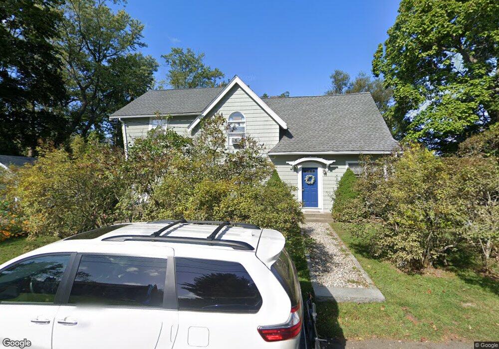
162 Hawthorne Ln Unit 162 Concord, MA 01742
Estimated Value: $1,315,000 - $1,493,000
4
Beds
2
Baths
2,423
Sq Ft
$581/Sq Ft
Est. Value
About This Home
This home is located at 162 Hawthorne Ln Unit 162, Concord, MA 01742 and is currently estimated at $1,408,894, approximately $581 per square foot. 162 Hawthorne Ln Unit 162 is a home located in Middlesex County with nearby schools including Alcott Elementary School, Concord Middle School, and The Fenn School.
Ownership History
Date
Name
Owned For
Owner Type
Purchase Details
Closed on
Oct 22, 2013
Sold by
Moser Patricia J and Feinberg Stephen A
Bought by
Vigne William M and Vigne Meghan
Current Estimated Value
Home Financials for this Owner
Home Financials are based on the most recent Mortgage that was taken out on this home.
Original Mortgage
$426,000
Outstanding Balance
$321,098
Interest Rate
4.58%
Mortgage Type
New Conventional
Estimated Equity
$1,087,796
Create a Home Valuation Report for This Property
The Home Valuation Report is an in-depth analysis detailing your home's value as well as a comparison with similar homes in the area
Home Values in the Area
Average Home Value in this Area
Purchase History
| Date | Buyer | Sale Price | Title Company |
|---|---|---|---|
| Vigne William M | $532,500 | -- | |
| Vigne William M | $532,500 | -- |
Source: Public Records
Mortgage History
| Date | Status | Borrower | Loan Amount |
|---|---|---|---|
| Open | Vigne William M | $426,000 | |
| Closed | Vigne William M | $426,000 |
Source: Public Records
Tax History Compared to Growth
Tax History
| Year | Tax Paid | Tax Assessment Tax Assessment Total Assessment is a certain percentage of the fair market value that is determined by local assessors to be the total taxable value of land and additions on the property. | Land | Improvement |
|---|---|---|---|---|
| 2025 | $14,821 | $1,117,700 | $568,400 | $549,300 |
| 2024 | $14,402 | $1,096,900 | $568,400 | $528,500 |
| 2023 | $12,328 | $951,200 | $516,700 | $434,500 |
| 2022 | $13,132 | $889,700 | $413,400 | $476,300 |
| 2021 | $12,350 | $839,000 | $413,400 | $425,600 |
| 2020 | $11,950 | $839,800 | $413,400 | $426,400 |
| 2019 | $11,224 | $791,000 | $401,300 | $389,700 |
| 2018 | $10,449 | $731,200 | $382,200 | $349,000 |
| 2017 | $10,163 | $722,300 | $364,000 | $358,300 |
| 2016 | $9,766 | $701,600 | $364,000 | $337,600 |
| 2015 | $9,160 | $641,000 | $337,100 | $303,900 |
Source: Public Records
Map
Nearby Homes
- 140 Revolutionary Rd
- 35 Chestnut St
- 96 Independence Rd
- 646 Cambridge Turnpike
- 61B Walden St
- 143 Everett St
- 38-40 Court Ln
- 58 Peter Spring Rd
- 9 Garland Rd
- 46 Sudbury Rd
- 84 Bruce Rd
- 16 Hatch Farm Ln
- 10 Hatch Farm Ln
- 16 Old Cambridge Turnpike
- 28 Hatch Farm Ln
- 232 Sudbury Rd
- 236 Fairhaven Rd
- 14 Thoreau St
- 22 Belknap Ct
- 644 Old Bedford Rd
- 162 Hawthorne Ln
- 148 Hawthorne Ln
- 174 Hawthorne Ln
- 155 Hawthorne Ln
- 171 Hawthorne Ln
- 188 Hawthorne Ln
- 141 Hawthorne Ln
- 140 Hawthorne Ln
- 189 Hawthorne Ln
- 121 Hawthorne Ln
- 212 Hawthorne Ln
- 109 Hawthorne Ln
- 109 Hawthorne Ln Unit 2
- 109 Hawthorne Ln Unit 1
- 367 Cambridge Turnpike
- 97 Hawthorne Ln
- 383 Cambridge Turnpike
- 76 Hawthorne Ln
- 14 Mildred Cir
- 79 Hawthorne Ln