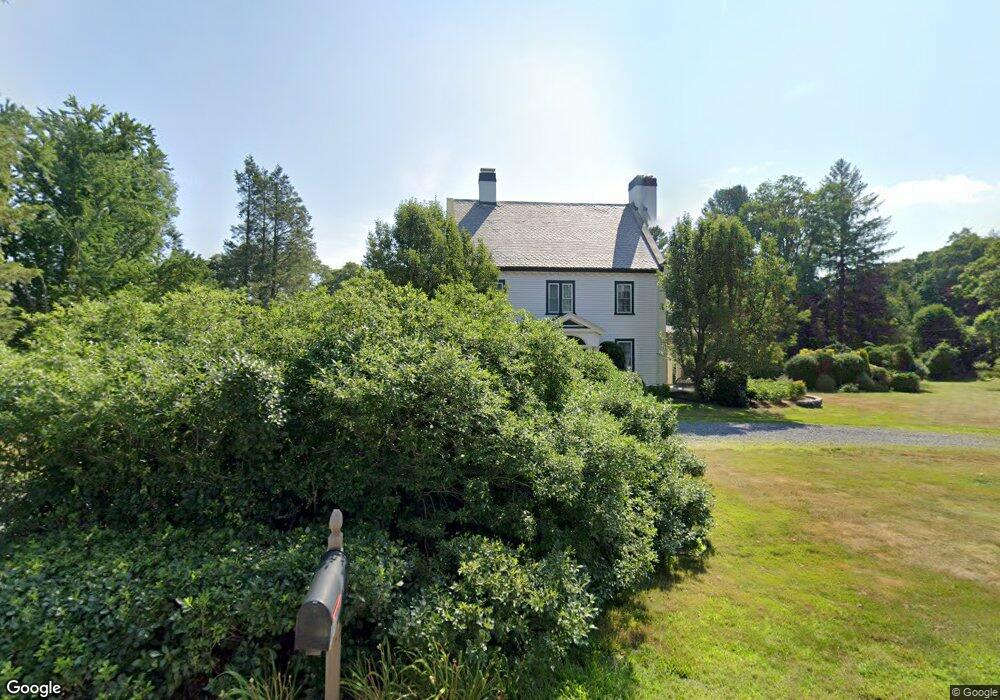
162 Highland St Holliston, MA 01746
Estimated Value: $1,160,000 - $1,421,000
4
Beds
4
Baths
4,145
Sq Ft
$314/Sq Ft
Est. Value
About This Home
This home is located at 162 Highland St, Holliston, MA 01746 and is currently estimated at $1,302,415, approximately $314 per square foot. 162 Highland St is a home located in Middlesex County with nearby schools including Miller Elementary School, Robert H. Adams Middle School, and Holliston High School.
Ownership History
Date
Name
Owned For
Owner Type
Purchase Details
Closed on
Mar 16, 1999
Sold by
Newsom David G and Newsom Carol L
Bought by
Nesbitt Steven B and Nesbitt Susan C
Current Estimated Value
Purchase Details
Closed on
Nov 4, 1994
Sold by
Donovan James C
Bought by
Newsom David G and Newsom Carol L
Create a Home Valuation Report for This Property
The Home Valuation Report is an in-depth analysis detailing your home's value as well as a comparison with similar homes in the area
Home Values in the Area
Average Home Value in this Area
Purchase History
| Date | Buyer | Sale Price | Title Company |
|---|---|---|---|
| Nesbitt Steven B | $475,000 | -- | |
| Newsom David G | $189,000 | -- |
Source: Public Records
Mortgage History
| Date | Status | Borrower | Loan Amount |
|---|---|---|---|
| Open | Newsom David G | $226,000 | |
| Closed | Newsom David G | $239,000 |
Source: Public Records
Tax History Compared to Growth
Tax History
| Year | Tax Paid | Tax Assessment Tax Assessment Total Assessment is a certain percentage of the fair market value that is determined by local assessors to be the total taxable value of land and additions on the property. | Land | Improvement |
|---|---|---|---|---|
| 2025 | $16,471 | $1,124,300 | $296,100 | $828,200 |
| 2024 | $15,191 | $1,008,700 | $296,100 | $712,600 |
| 2023 | $13,986 | $908,200 | $247,700 | $660,500 |
| 2022 | $13,668 | $786,400 | $247,700 | $538,700 |
| 2021 | $13,880 | $777,600 | $238,900 | $538,700 |
| 2020 | $13,033 | $691,400 | $238,900 | $452,500 |
| 2019 | $12,531 | $665,500 | $208,500 | $457,000 |
| 2018 | $12,425 | $665,500 | $208,500 | $457,000 |
| 2017 | $11,949 | $645,200 | $200,500 | $444,700 |
| 2016 | $12,123 | $645,200 | $200,500 | $444,700 |
| 2015 | $11,957 | $617,000 | $158,100 | $458,900 |
Source: Public Records
Map
Nearby Homes
- 8 Raymond Way
- 120 Prospect St
- 150 Westfield Dr
- 152 Turner Rd Unit 43
- 152 Turner Rd Unit 14
- 97 Meeting House Path Unit 97
- 147 Turner Rd Unit 80
- 74 Meeting House Path
- 72 Meeting House Path
- 277 Meeting House Path
- 59 Turner Rd
- 49 Prospect St
- 32 Colonial Way
- 157 Leland Farm Rd
- 20 Hargrave Ave
- 54 Westfield Dr
- 95 Brooksmont Dr Unit 26
- 133 Brooksmont Dr Unit 43
- 56 Roy Ave
- 25 Prospect St
- 142 Highland St
- 182 Highland St
- 182 Highland St
- 151 Highland St
- 179 Highland St
- 108 Highland St
- 100 Highland St
- 198 Highland St
- 7 Summit Pointe Dr
- 215 Highland St
- 91 Highland St
- 78 Highland St
- 9 Summit Pointe Dr
- 76 Highland St
- 75 Highland St
- 74 Highland St
- 10 Summit Pointe Dr
- 1 Highland St
- 81 Highland St
- 15 Summit Pointe Dr