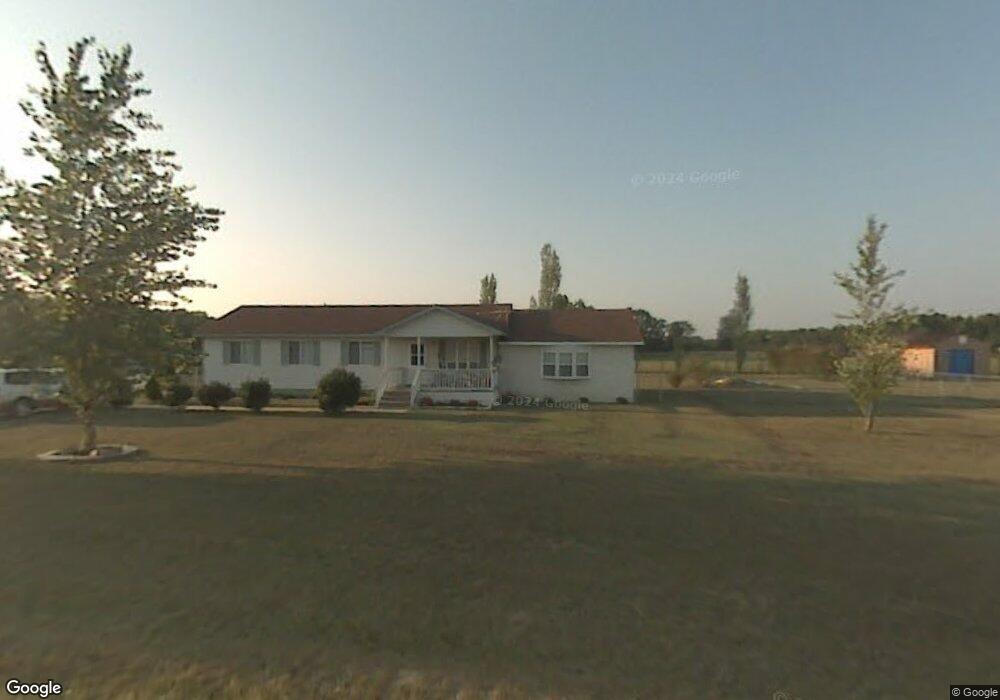
162 L McMillian Rd Raeford, NC 28376
Estimated Value: $216,000 - $261,000
--
Bed
2
Baths
1,632
Sq Ft
$148/Sq Ft
Est. Value
About This Home
This home is located at 162 L McMillian Rd, Raeford, NC 28376 and is currently estimated at $242,120, approximately $148 per square foot. 162 L McMillian Rd is a home located in Hoke County with nearby schools including West Hoke Elementary School, West Hoke Middle, and Hoke County High.
Ownership History
Date
Name
Owned For
Owner Type
Purchase Details
Closed on
Oct 5, 2017
Sold by
Bobbie J Collins
Bought by
Mcmillian Lonnie and Mcmillian Rachel
Current Estimated Value
Home Financials for this Owner
Home Financials are based on the most recent Mortgage that was taken out on this home.
Original Mortgage
$103,785
Outstanding Balance
$86,551
Interest Rate
3.85%
Estimated Equity
$155,569
Create a Home Valuation Report for This Property
The Home Valuation Report is an in-depth analysis detailing your home's value as well as a comparison with similar homes in the area
Home Values in the Area
Average Home Value in this Area
Purchase History
| Date | Buyer | Sale Price | Title Company |
|---|---|---|---|
| Mcmillian Lonnie | -- | -- |
Source: Public Records
Mortgage History
| Date | Status | Borrower | Loan Amount |
|---|---|---|---|
| Open | Mcmillian Lonnie | $103,785 | |
| Closed | Mcmillian Lonnie | -- |
Source: Public Records
Tax History Compared to Growth
Tax History
| Year | Tax Paid | Tax Assessment Tax Assessment Total Assessment is a certain percentage of the fair market value that is determined by local assessors to be the total taxable value of land and additions on the property. | Land | Improvement |
|---|---|---|---|---|
| 2025 | $1,177 | $126,180 | $9,380 | $116,800 |
| 2024 | $1,177 | $126,180 | $9,380 | $116,800 |
| 2023 | $1,177 | $126,180 | $9,380 | $116,800 |
| 2022 | $1,156 | $126,180 | $9,380 | $116,800 |
| 2021 | $1,172 | $125,040 | $9,380 | $115,660 |
| 2020 | $1,191 | $125,040 | $9,380 | $115,660 |
| 2019 | $1,191 | $125,040 | $9,380 | $115,660 |
| 2018 | $1,191 | $125,040 | $9,380 | $115,660 |
| 2017 | $1,162 | $121,650 | $9,380 | $112,270 |
| 2016 | $1,083 | $114,670 | $9,380 | $105,290 |
| 2015 | $1,083 | $114,670 | $9,380 | $105,290 |
| 2014 | $1,062 | $114,670 | $9,380 | $105,290 |
| 2013 | -- | $104,260 | $7,500 | $96,760 |
Source: Public Records
Map
Nearby Homes
- 151 Williford Dr
- 281 Apple Tree Cir
- 0 Mockingbird Hill (Lot 1) Rd Unit 746301
- 0 Mockingbird Hill (Lot 2) Rd
- 833 W Prospect Ave
- 320 Traveller Way
- 203 United Rd
- 528 Traveller Way
- 350 Traveller Way
- 415 Traveller Way
- 514 Ashley Heights (Lot 87) Dr
- 574 Ashley Heights (Lot 91) Dr
- 533 Ashley Heights (Lot 21) Dr
- 350 Traveller (Lot 7) Way
- 485 Ashley Heights (Lot 22) Dr
- 259 Palomo Place
- 206 Palomo Place
- 130 L McMillian Rd
- 223 L McMillian Rd
- 250 L McMillian Rd
- 100 L McMillian Rd
- 420 Lemont Dr
- 555 Lemont Dr
- 596 Thomas Dr
- 551 Lemont Dr
- 431 Lemont Dr
- 592 Thomas Dr
- 347 Lemont Dr
- 593 Thomas Dr
- 1039 Edgewater Dr
- 550 Thomas Dr
- 533 Thomas Dr
- 687 Lemont Dr
- 977 Lemont Dr
- 0 Thomas Dr Unit 395373
- 290 Mayor Ct
- 287 Mayor Ct