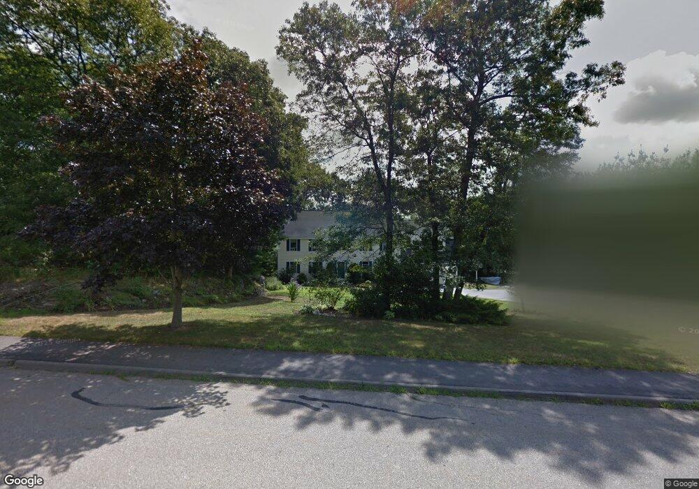
162 Littlefield Ln Marlborough, MA 01752
Estimated Value: $1,025,000 - $1,057,000
4
Beds
3
Baths
3,618
Sq Ft
$288/Sq Ft
Est. Value
About This Home
This home is located at 162 Littlefield Ln, Marlborough, MA 01752 and is currently estimated at $1,041,140, approximately $287 per square foot. 162 Littlefield Ln is a home located in Middlesex County with nearby schools including Marlborough High School, New Covenant Christian School, and Glenhaven Academy - JRI School.
Ownership History
Date
Name
Owned For
Owner Type
Purchase Details
Closed on
Oct 26, 1998
Sold by
Hooper Gary A and Hooper Geraldine K
Bought by
Strella Stephen A and Strella Geralyn F
Current Estimated Value
Home Financials for this Owner
Home Financials are based on the most recent Mortgage that was taken out on this home.
Original Mortgage
$328,800
Outstanding Balance
$72,716
Interest Rate
6.74%
Mortgage Type
Purchase Money Mortgage
Estimated Equity
$968,424
Create a Home Valuation Report for This Property
The Home Valuation Report is an in-depth analysis detailing your home's value as well as a comparison with similar homes in the area
Home Values in the Area
Average Home Value in this Area
Purchase History
| Date | Buyer | Sale Price | Title Company |
|---|---|---|---|
| Strella Stephen A | $411,000 | -- |
Source: Public Records
Mortgage History
| Date | Status | Borrower | Loan Amount |
|---|---|---|---|
| Open | Strella Stephen A | $328,800 | |
| Previous Owner | Strella Stephen A | $312,000 | |
| Previous Owner | Strella Stephen A | $291,200 |
Source: Public Records
Tax History Compared to Growth
Tax History
| Year | Tax Paid | Tax Assessment Tax Assessment Total Assessment is a certain percentage of the fair market value that is determined by local assessors to be the total taxable value of land and additions on the property. | Land | Improvement |
|---|---|---|---|---|
| 2025 | $9,205 | $933,600 | $275,300 | $658,300 |
| 2024 | $9,073 | $886,000 | $250,300 | $635,700 |
| 2023 | $8,952 | $775,700 | $207,300 | $568,400 |
| 2022 | $8,624 | $657,300 | $197,800 | $459,500 |
| 2021 | $8,708 | $631,000 | $168,200 | $462,800 |
| 2020 | $4,767 | $597,600 | $154,700 | $442,900 |
| 2019 | $8,158 | $579,800 | $151,800 | $428,000 |
| 2018 | $8,209 | $561,100 | $141,400 | $419,700 |
| 2017 | $8,532 | $556,900 | $143,700 | $413,200 |
| 2016 | $8,715 | $568,100 | $143,700 | $424,400 |
| 2015 | $8,944 | $567,500 | $155,700 | $411,800 |
Source: Public Records
Map
Nearby Homes
- 28 Stetson Dr
- 551 Sudbury St
- 618 Sudbury St
- 168 Blanchette Dr
- 3 Stonehill Rd
- 16 Minehan Ln
- 17 Mcneil Cir
- 1 Red Oak Dr
- 688 Boston Post Rd E Unit 202
- 688 Boston Post Rd E Unit 304
- 688 Boston Post Rd E Unit 100
- 688 Boston Post Rd E Unit 324
- 688 Boston Post Rd E Unit 228
- 38 Collins Dr
- 114 Linda Cir
- 624 Boston Post Rd E Unit 7
- 111 Hager St
- 608 Boston Post Rd E Unit 11
- 596 Boston Post Rd E Unit 13
- 596 Boston Post Rd E
- 150 Littlefield Ln
- 178 Littlefield Ln
- 163 Littlefield Ln
- 149 Littlefield Ln
- 32 Haskell Ln
- 130 Littlefield Ln
- 179 Littlefield Ln
- 26 Graham Path
- 135 Littlefield Ln
- 42 Graham Path
- 12 Graham Path
- 116 Littlefield Ln
- 98 Hamilton Cir
- 119 Littlefield Ln
- 60 Graham Path
- 101 Hamilton Cir
- 203 Littlefield Ln
- 7 Flint Dr
- 74 Hamilton Cir
- 30 Hamilton Cir