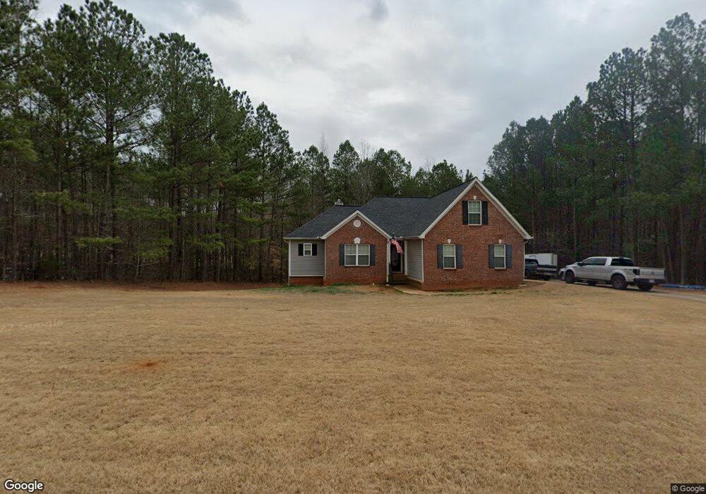
162 Loam Dr Unit 45 McDonough, GA 30252
Estimated Value: $314,000 - $337,000
3
Beds
2
Baths
2,028
Sq Ft
$161/Sq Ft
Est. Value
About This Home
This home is located at 162 Loam Dr Unit 45, McDonough, GA 30252 and is currently estimated at $326,806, approximately $161 per square foot. 162 Loam Dr Unit 45 is a home located in Henry County with nearby schools including Rock Spring Elementary School, Ola Middle School, and Ola High School.
Ownership History
Date
Name
Owned For
Owner Type
Purchase Details
Closed on
Apr 19, 2016
Sold by
Sr & Sr Investments Llc Sr
Bought by
Weihl Freemond D
Current Estimated Value
Home Financials for this Owner
Home Financials are based on the most recent Mortgage that was taken out on this home.
Original Mortgage
$161,029
Outstanding Balance
$130,267
Interest Rate
4.25%
Mortgage Type
FHA
Estimated Equity
$196,539
Purchase Details
Closed on
Dec 8, 2008
Sold by
Federal National Mortgage Association
Bought by
Sr & Sr Investments Llc
Purchase Details
Closed on
Feb 5, 2008
Sold by
Aurora Ln Svcs Llc
Bought by
Fedl Natl Mtg Assoc
Purchase Details
Closed on
Feb 10, 2006
Sold by
K B & T Homes Inc
Bought by
Oquendo Gilberto
Home Financials for this Owner
Home Financials are based on the most recent Mortgage that was taken out on this home.
Original Mortgage
$187,625
Interest Rate
6.14%
Mortgage Type
New Conventional
Create a Home Valuation Report for This Property
The Home Valuation Report is an in-depth analysis detailing your home's value as well as a comparison with similar homes in the area
Home Values in the Area
Average Home Value in this Area
Purchase History
| Date | Buyer | Sale Price | Title Company |
|---|---|---|---|
| Weihl Freemond D | $164,000 | -- | |
| Sr & Sr Investments Llc | -- | -- | |
| Fedl Natl Mtg Assoc | -- | -- | |
| Aurora Ln Svcs Llc | $188,216 | -- | |
| Oquendo Gilberto | $197,500 | -- |
Source: Public Records
Mortgage History
| Date | Status | Borrower | Loan Amount |
|---|---|---|---|
| Open | Weihl Freemond D | $161,029 | |
| Previous Owner | Oquendo Gilberto | $187,625 |
Source: Public Records
Tax History Compared to Growth
Tax History
| Year | Tax Paid | Tax Assessment Tax Assessment Total Assessment is a certain percentage of the fair market value that is determined by local assessors to be the total taxable value of land and additions on the property. | Land | Improvement |
|---|---|---|---|---|
| 2024 | $3,907 | $136,760 | $20,000 | $116,760 |
| 2023 | $3,478 | $136,640 | $16,000 | $120,640 |
| 2022 | $3,549 | $118,280 | $16,000 | $102,280 |
| 2021 | $2,943 | $92,640 | $16,000 | $76,640 |
| 2020 | $2,896 | $90,640 | $14,800 | $75,840 |
| 2019 | $2,867 | $89,440 | $14,000 | $75,440 |
| 2018 | $2,523 | $74,840 | $12,000 | $62,840 |
| 2016 | $2,517 | $63,120 | $10,000 | $53,120 |
| 2015 | $2,475 | $60,160 | $8,000 | $52,160 |
| 2014 | $2,273 | $54,400 | $7,200 | $47,200 |
Source: Public Records
Map
Nearby Homes
- 106 Loam Dr
- 209 Amber Ct
- 180 Mackey Rd
- 170 Mackey Rd
- 41 Giles Dr
- 1908 Munford Place
- 0 Mackey Rd Unit 10539146
- 6830 Peeksville Rd
- 507 Judith Ct Unit 3
- 227 Aves Ct
- 518 Gallantry Trail
- 4075 O Henry Ct
- 415 Pamela Ct
- 1120 Stroud Rd
- 1100 Stroud Rd
- 2001 Jefferson Way
- 2082 Stroud Rd
- 88 Maddox Dr
- 78 Maddox Dr
- 68 Maddox Dr
- 162 Loam Dr
- 166 Loam Dr
- 158 Loam Dr
- 110 Loam Dr
- 167 Loam Dr
- 163 Loam Dr
- 154 Loam Dr
- 114 Loam Dr
- 171 Loam Dr Unit 3
- 171 Loam Dr
- 0 Loam Dr Unit 8681011
- 0 Loam Dr Unit 8406816
- 0 Loam Dr Unit 7306669
- 0 Loam Dr Unit 7422405
- 0 Loam Dr Unit 7140069
- 0 Loam Dr Unit 7050077
- 0 Loam Dr Unit 9015104
- 0 Loam Dr Unit 8812685
- 0 Loam Dr Unit 8891082
- 0 Loam Dr Unit 3157230