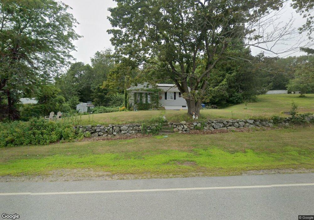
162 Maple Ave Rutland, MA 01543
Estimated Value: $405,581 - $431,000
3
Beds
1
Bath
1,156
Sq Ft
$361/Sq Ft
Est. Value
About This Home
This home is located at 162 Maple Ave, Rutland, MA 01543 and is currently estimated at $417,395, approximately $361 per square foot. 162 Maple Ave is a home located in Worcester County with nearby schools including Wachusett Regional High School.
Ownership History
Date
Name
Owned For
Owner Type
Purchase Details
Closed on
Nov 20, 2012
Sold by
Hetu Robert A and Hetu Linda J
Bought by
Stevenson Charles K
Current Estimated Value
Home Financials for this Owner
Home Financials are based on the most recent Mortgage that was taken out on this home.
Original Mortgage
$163,800
Outstanding Balance
$112,783
Interest Rate
3.39%
Mortgage Type
New Conventional
Estimated Equity
$304,612
Purchase Details
Closed on
Oct 5, 2006
Sold by
Hetu Robert A
Bought by
Hetu Linda J and Hetu Robert A
Purchase Details
Closed on
Aug 28, 1997
Sold by
Thompson Philip C and Thompson Grace E
Bought by
Hetu Robert A
Home Financials for this Owner
Home Financials are based on the most recent Mortgage that was taken out on this home.
Original Mortgage
$88,000
Interest Rate
7.41%
Mortgage Type
Purchase Money Mortgage
Create a Home Valuation Report for This Property
The Home Valuation Report is an in-depth analysis detailing your home's value as well as a comparison with similar homes in the area
Home Values in the Area
Average Home Value in this Area
Purchase History
| Date | Buyer | Sale Price | Title Company |
|---|---|---|---|
| Stevenson Charles K | $160,000 | -- | |
| Hetu Linda J | -- | -- | |
| Hetu Robert A | $110,000 | -- | |
| Hetu Linda J | -- | -- | |
| Hetu Robert A | $110,000 | -- |
Source: Public Records
Mortgage History
| Date | Status | Borrower | Loan Amount |
|---|---|---|---|
| Open | Stevenson Charles K | $163,800 | |
| Closed | Hetu Robert A | $163,800 | |
| Previous Owner | Hetu Robert A | $88,000 |
Source: Public Records
Tax History Compared to Growth
Tax History
| Year | Tax Paid | Tax Assessment Tax Assessment Total Assessment is a certain percentage of the fair market value that is determined by local assessors to be the total taxable value of land and additions on the property. | Land | Improvement |
|---|---|---|---|---|
| 2025 | $4,709 | $330,700 | $83,800 | $246,900 |
| 2024 | $4,468 | $301,300 | $80,100 | $221,200 |
| 2023 | $4,112 | $299,700 | $75,500 | $224,200 |
| 2022 | $3,984 | $252,300 | $63,800 | $188,500 |
| 2021 | $3,754 | $224,800 | $63,800 | $161,000 |
| 2020 | $3,768 | $203,300 | $60,300 | $143,000 |
| 2019 | $3,725 | $196,000 | $57,400 | $138,600 |
| 2018 | $3,385 | $186,700 | $57,400 | $129,300 |
| 2017 | $3,323 | $181,400 | $57,400 | $124,000 |
| 2016 | $3,043 | $175,200 | $57,800 | $117,400 |
| 2015 | $2,854 | $161,700 | $57,800 | $103,900 |
| 2014 | $2,767 | $161,700 | $57,800 | $103,900 |
Source: Public Records
Map
Nearby Homes
- 176 Maple Ave Unit 1-38
- 176 Maple Ave Unit 3-25
- 176 Maple Ave Unit 2-26
- 189 Maple Ave
- 7 Prescott St
- 85 Maple Ave Unit A
- 21 Highland Park Rd
- 132 Fidelity Dr Unit 61
- 10 Fidelity Dr Unit 5
- 12 Fidelity Dr Unit 6
- 2 Forest Hill Dr
- 10 Beechwood Dr
- 27 Lewis St
- 6 Lewis St
- 12 Lewis St
- 11 Lewis St
- 21 Lewis St
- 14 Welch Ave Unit A
- 28 Forest Hill Dr
- 7 Emerald Rd
- 164 Maple Ave
- 184 Kenwood Dr
- 156 Maple Ave
- 165 Maple Ave
- 176,5-25 Maple Ave Unit 5-25
- 176,4-34 Maple Ave Unit 4-34
- 180 Kenwood Dr
- 176 Maple St Unit 208
- 176 Maple St Unit 2-22
- 176 Maple St Unit 1-1
- 95 Maple Ave
- 150 Maple Ave
- 181 Kenwood Dr
- 171 Maple Ave
- 178 Kenwood Dr
- 175 Kenwood Dr
- 176 Maple Ave Unit 2-2
- 176 Maple Ave Unit 2-01
- 176 Maple Ave Unit 2-1
- 176 Maple Ave Unit 7-6