Estimated Value: $297,000 - $339,000
3
Beds
2
Baths
2,649
Sq Ft
$121/Sq Ft
Est. Value
About This Home
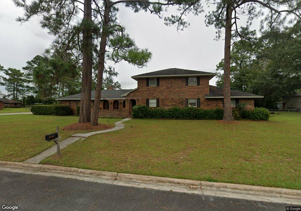
This home is located at 162 Newcastle St, Jesup, GA 31545 and is currently estimated at $321,816, approximately $121 per square foot. 162 Newcastle St is a home located in Wayne County with nearby schools including Bacon Elementary School, Martha Puckett Middle School, and Wayne County High School.
Ownership History
Date
Name
Owned For
Owner Type
Purchase Details
Closed on
Feb 23, 2007
Sold by
Olsen Norene
Bought by
Shanklin Calvin and Shanklin Kelda
Current Estimated Value
Purchase Details
Closed on
Sep 1, 1998
Bought by
Olsen Norene A
Purchase Details
Closed on
Jul 1, 1985
Purchase Details
Closed on
Jan 1, 1980
Purchase Details
Closed on
Sep 1, 1978
Purchase Details
Closed on
Feb 1, 1975
Purchase Details
Closed on
Oct 1, 1973
Create a Home Valuation Report for This Property
The Home Valuation Report is an in-depth analysis detailing your home's value as well as a comparison with similar homes in the area
Home Values in the Area
Average Home Value in this Area
Purchase History
| Date | Buyer | Sale Price | Title Company |
|---|---|---|---|
| Shanklin Calvin | $164,000 | -- | |
| Olsen Norene A | $139,000 | -- | |
| -- | $113,500 | -- | |
| -- | $4,800 | -- | |
| -- | -- | -- | |
| -- | -- | -- | |
| -- | -- | -- |
Source: Public Records
Tax History Compared to Growth
Tax History
| Year | Tax Paid | Tax Assessment Tax Assessment Total Assessment is a certain percentage of the fair market value that is determined by local assessors to be the total taxable value of land and additions on the property. | Land | Improvement |
|---|---|---|---|---|
| 2024 | $3,617 | $122,612 | $8,800 | $113,812 |
| 2023 | $2,543 | $109,595 | $8,800 | $100,795 |
| 2022 | $2,162 | $73,674 | $8,800 | $64,874 |
| 2021 | $2,316 | $73,674 | $8,800 | $64,874 |
| 2020 | $2,396 | $73,674 | $8,800 | $64,874 |
| 2019 | $2,467 | $73,674 | $8,800 | $64,874 |
| 2018 | $2,467 | $73,674 | $8,800 | $64,874 |
| 2017 | $2,124 | $73,674 | $8,800 | $64,874 |
| 2016 | $2,055 | $73,674 | $8,800 | $64,874 |
| 2014 | $2,061 | $73,674 | $8,800 | $64,874 |
| 2013 | -- | $73,673 | $8,800 | $64,873 |
Source: Public Records
Map
Nearby Homes
- 150 Newcastle St
- 241 W Magnolia St
- 155 Newcastle St
- 277 W Magnolia St
- 140 Newcastle St
- 145 Newcastle St
- 147 W Magnolia St
- 165 Newcastle St
- 192 Newcastle St
- 130 Newcastle St
- 135 Newcastle St
- 197 W Magnolia St
- 240 W Magnolia St
- 295 W Magnolia St
- 391 10th St
- 175 Newcastle St
- 290 W Magnolia St
- 125 Newcastle St
- 123 W Magnolia St
- 298 W Magnolia St