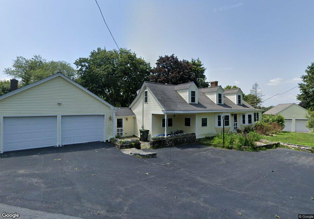
162 Rockmeadow Rd Uxbridge, MA 01569
Estimated Value: $500,000 - $622,000
2
Beds
2
Baths
1,686
Sq Ft
$323/Sq Ft
Est. Value
About This Home
This home is located at 162 Rockmeadow Rd, Uxbridge, MA 01569 and is currently estimated at $544,124, approximately $322 per square foot. 162 Rockmeadow Rd is a home located in Worcester County with nearby schools including Uxbridge High School, Our Lady of the Valley Regional School, and Whitinsville Christian School.
Ownership History
Date
Name
Owned For
Owner Type
Purchase Details
Closed on
May 15, 2024
Sold by
Vautrain Michael and Vautrain Katie L
Bought by
Vautrain Michael and Vautrain Katie L
Current Estimated Value
Purchase Details
Closed on
Sep 14, 2011
Sold by
Vautrain Michael
Bought by
Vautrain Michael and Vautrain Katie L
Home Financials for this Owner
Home Financials are based on the most recent Mortgage that was taken out on this home.
Original Mortgage
$173,973
Interest Rate
4.52%
Mortgage Type
Purchase Money Mortgage
Purchase Details
Closed on
Sep 2, 2011
Sold by
Merrick George
Bought by
Vautrain Michael
Home Financials for this Owner
Home Financials are based on the most recent Mortgage that was taken out on this home.
Original Mortgage
$173,973
Interest Rate
4.52%
Mortgage Type
Purchase Money Mortgage
Create a Home Valuation Report for This Property
The Home Valuation Report is an in-depth analysis detailing your home's value as well as a comparison with similar homes in the area
Home Values in the Area
Average Home Value in this Area
Purchase History
| Date | Buyer | Sale Price | Title Company |
|---|---|---|---|
| Vautrain Michael | -- | None Available | |
| Vautrain Michael | -- | None Available | |
| Vautrain Michael | -- | -- | |
| Vautrain Michael | $155,000 | -- | |
| Vautrain Michael | -- | -- | |
| Vautrain Michael | $155,000 | -- |
Source: Public Records
Mortgage History
| Date | Status | Borrower | Loan Amount |
|---|---|---|---|
| Previous Owner | Vautrain Michael | $173,973 |
Source: Public Records
Tax History Compared to Growth
Tax History
| Year | Tax Paid | Tax Assessment Tax Assessment Total Assessment is a certain percentage of the fair market value that is determined by local assessors to be the total taxable value of land and additions on the property. | Land | Improvement |
|---|---|---|---|---|
| 2025 | $5,968 | $455,200 | $154,700 | $300,500 |
| 2024 | $5,602 | $433,600 | $146,900 | $286,700 |
| 2023 | $5,346 | $383,200 | $126,900 | $256,300 |
| 2022 | $5,121 | $337,800 | $111,200 | $226,600 |
| 2021 | $5,213 | $329,500 | $111,200 | $218,300 |
| 2020 | $4,813 | $287,500 | $119,000 | $168,500 |
| 2019 | $5,044 | $290,700 | $130,800 | $159,900 |
| 2018 | $4,720 | $274,900 | $130,800 | $144,100 |
| 2017 | $4,866 | $286,900 | $125,500 | $161,400 |
| 2016 | $3,869 | $220,200 | $96,400 | $123,800 |
| 2015 | $3,795 | $218,100 | $96,400 | $121,700 |
Source: Public Records
Map
Nearby Homes
- 14 Woodland Rd
- 371 Hartford Ave E
- 46 Pouts Ln Unit 46
- 27 Taft Ave
- 230 Quaker St
- 30 Taft Ave
- 23 Uxbridge Rd
- 107 Henry St
- 256 Mendon St
- 20 Nature View Dr Unit 20
- 62 Millville Rd
- 24 Olde Canal Way Unit 24
- 22 Washington St
- 37 Elizabeth St
- 13A Asylum St
- 185 Prairie St
- 14 Kelley Rd
- 13 Kelley Rd
- next 191 Mendon Rd
- 75 Lake St
- 697 Hartford Ave E
- 157 Rockmeadow Rd
- 167 Rockmeadow Rd
- 700 E Hartford Ave
- 148 Rockmeadow Rd
- 10 Big Rock Rd
- 678 Hartford Ave E
- 702 Hartford Ave E
- 676 Hartford Ave E
- 147 Rockmeadow Rd
- 1 Lot#1 Big Rock Estates
- 5 Big Rock Rd
- 729 E Hartford Ave
- 678 Hartford Ave E
- 9 Big Rock Rd
- 671 Hartford Ave E
- 20 Big Rock Rd
- 674 Hartford Ave E
- 137 Rockmeadow Rd
- 19 Big Rock Rd