Estimated Value: $288,000 - $314,000
3
Beds
2
Baths
1,176
Sq Ft
$258/Sq Ft
Est. Value
About This Home
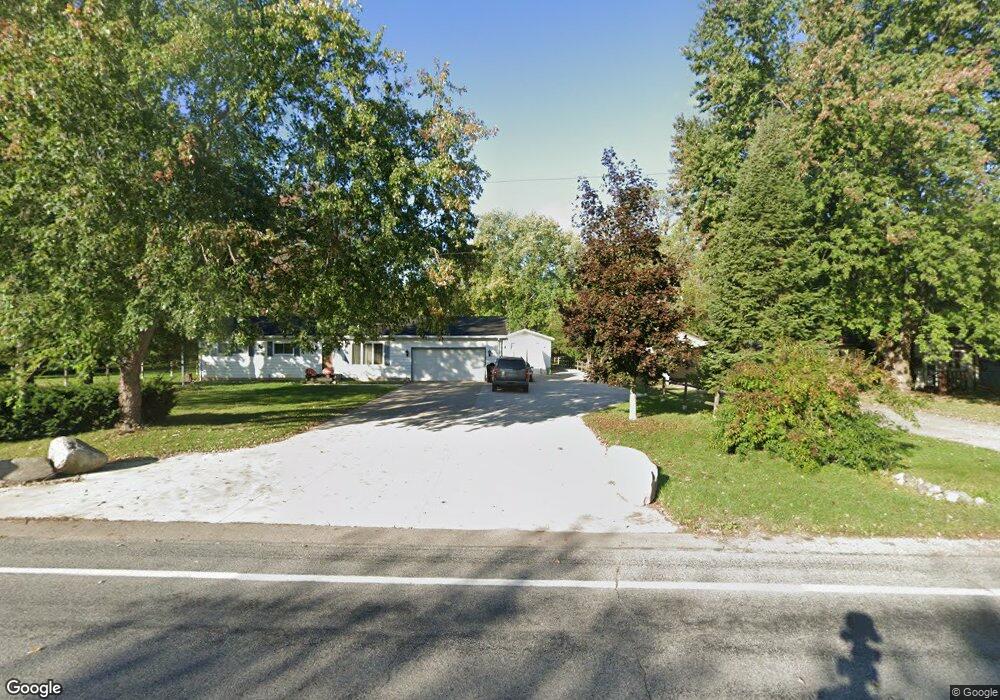
This home is located at 162 S Aurelius Rd, Mason, MI 48854 and is currently estimated at $303,676, approximately $258 per square foot. 162 S Aurelius Rd is a home located in Ingham County with nearby schools including Mason High School.
Ownership History
Date
Name
Owned For
Owner Type
Purchase Details
Closed on
Jan 7, 2025
Sold by
Stone Lonnie
Bought by
Stone Lonnie and Stone Natalie
Current Estimated Value
Purchase Details
Closed on
Jun 21, 2021
Sold by
Hentkowski Gene S and Hentkowski Elizabeth A
Bought by
Stone Lonnie
Home Financials for this Owner
Home Financials are based on the most recent Mortgage that was taken out on this home.
Original Mortgage
$213,675
Interest Rate
2.9%
Mortgage Type
FHA
Purchase Details
Closed on
Sep 17, 2001
Sold by
Peters Dennis Howard and Peters Audrey B
Bought by
Hentkowski Gene S and Hentkowski Elizabeth A
Home Financials for this Owner
Home Financials are based on the most recent Mortgage that was taken out on this home.
Original Mortgage
$112,000
Interest Rate
6.99%
Purchase Details
Closed on
Jun 30, 1997
Sold by
Oren Thomas C
Bought by
Peters Dennis H and Peters Audrey B
Purchase Details
Closed on
Jul 1, 1988
Create a Home Valuation Report for This Property
The Home Valuation Report is an in-depth analysis detailing your home's value as well as a comparison with similar homes in the area
Home Values in the Area
Average Home Value in this Area
Purchase History
| Date | Buyer | Sale Price | Title Company |
|---|---|---|---|
| Stone Lonnie | -- | None Listed On Document | |
| Stone Lonnie | -- | None Listed On Document | |
| Stone Lonnie | $250,000 | Liberty Title | |
| Hentkowski Gene S | $147,500 | First American Title Ins Co | |
| Peters Dennis H | $112,000 | -- | |
| -- | $74,400 | -- |
Source: Public Records
Mortgage History
| Date | Status | Borrower | Loan Amount |
|---|---|---|---|
| Previous Owner | Stone Lonnie | $213,675 | |
| Previous Owner | Hentkowski Gene S | $112,000 |
Source: Public Records
Tax History
| Year | Tax Paid | Tax Assessment Tax Assessment Total Assessment is a certain percentage of the fair market value that is determined by local assessors to be the total taxable value of land and additions on the property. | Land | Improvement |
|---|---|---|---|---|
| 2025 | $4,850 | $144,500 | $32,100 | $112,400 |
| 2024 | $28 | $139,000 | $31,600 | $107,400 |
| 2023 | $4,492 | $123,900 | $20,400 | $103,500 |
| 2022 | $4,248 | $110,000 | $26,300 | $83,700 |
| 2021 | $3,363 | $105,300 | $0 | $105,300 |
| 2020 | $3,891 | $96,100 | $21,500 | $74,600 |
| 2019 | $3,785 | $93,800 | $19,100 | $74,700 |
| 2018 | $3,119 | $87,300 | $19,100 | $68,200 |
| 2017 | $2,733 | $87,300 | $19,100 | $68,200 |
| 2016 | -- | $83,100 | $19,100 | $64,000 |
| 2015 | -- | $80,800 | $38,140 | $42,660 |
| 2014 | -- | $77,100 | $38,140 | $38,960 |
Source: Public Records
Map
Nearby Homes
- 376 Spicetree Ln Unit 47
- 380 Spicetree Ln Unit 48
- 49 Lilac Ln Unit 5
- 38 Lake Ridge Dr
- 4939 W Columbia Rd
- 372 S Eifert Rd
- 4789 Nichols Rd
- 0 S Aurelius Rd Unit 292647
- 331 N College Rd
- 0 Eifert Rd
- 1075 N Edgar Rd
- 657 Joan Dr
- 4535 Harper Rd
- 946 Hogsback Rd
- 248 Maple Run
- 1028 Hogsback Rd
- 3717 Meijer Ct
- 330 Oak Ridge St
- 323 Oak Ridge St
- 902 Eagles Nest Ct
- 160 S Aurelius Rd
- 150 S Aurelius Rd
- 198 S Aurelius Rd
- 140 S Aurelius Rd
- 195 S Aurelius Rd
- 123 S Aurelius Rd
- 200 S Aurelius Rd
- 4552 Elliott Rd
- 111 S Aurelius Rd
- 99 S Aurelius Rd
- 259 S Aurelius Rd
- 256 S Aurelius Rd
- 4588 Elliott Rd
- 69 S Aurelius Rd
- 58 S Aurelius Rd
- 52 S Aurelius Rd
- 48 S Aurelius Rd
- 42 S Aurelius Rd
- 47 S Aurelius Rd
- 4613 Elliott Rd
Your Personal Tour Guide
Ask me questions while you tour the home.