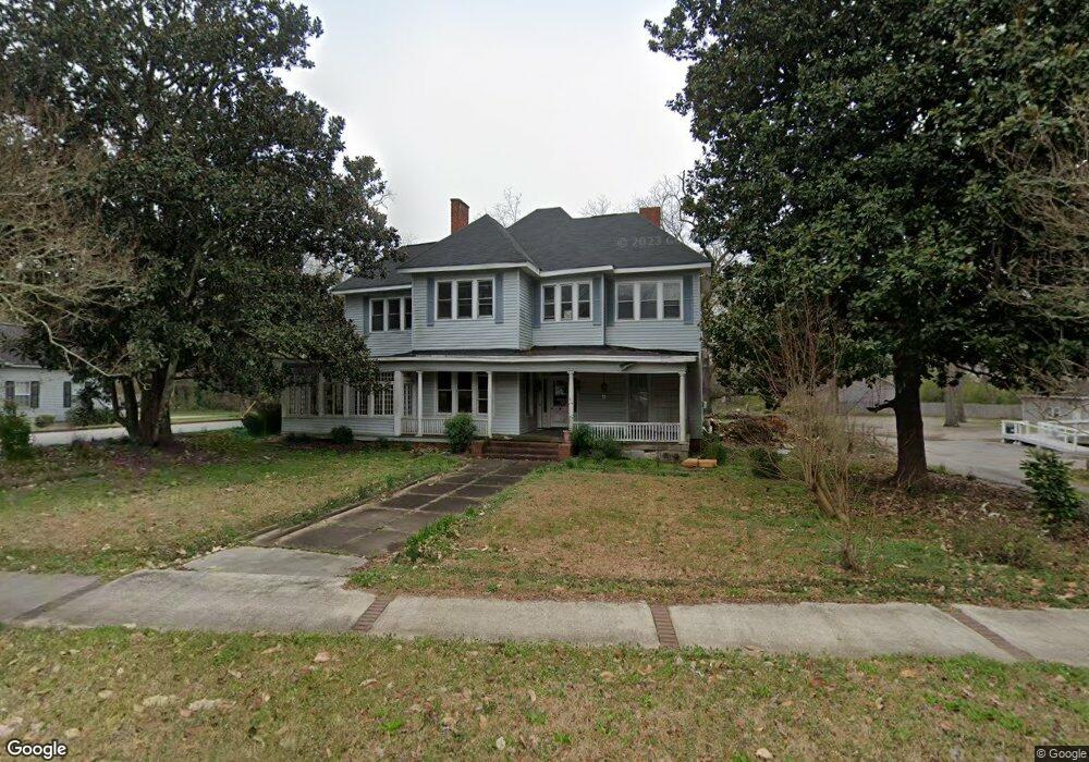
162 S Main St Jonesboro, GA 30236
Estimated Value: $244,000 - $323,000
7
Beds
3
Baths
4,186
Sq Ft
$65/Sq Ft
Est. Value
About This Home
This home is located at 162 S Main St, Jonesboro, GA 30236 and is currently estimated at $270,254, approximately $64 per square foot. 162 S Main St is a home located in Clayton County with nearby schools including Suder Elementary School, Mundys Mill Middle School, and Jonesboro High School.
Ownership History
Date
Name
Owned For
Owner Type
Purchase Details
Closed on
May 12, 2021
Sold by
Cruse Henri L
Bought by
Solano Badilla Cristian E
Current Estimated Value
Purchase Details
Closed on
Jul 15, 2019
Sold by
Henry James Z
Bought by
Cruse Henri L
Home Financials for this Owner
Home Financials are based on the most recent Mortgage that was taken out on this home.
Original Mortgage
$70,000
Interest Rate
3.82%
Mortgage Type
New Conventional
Create a Home Valuation Report for This Property
The Home Valuation Report is an in-depth analysis detailing your home's value as well as a comparison with similar homes in the area
Home Values in the Area
Average Home Value in this Area
Purchase History
| Date | Buyer | Sale Price | Title Company |
|---|---|---|---|
| Solano Badilla Cristian E | -- | -- | |
| Solano Badilla Cristian E | $165,000 | -- | |
| Cruse Henri L | $100,000 | -- | |
| Cruse Henri L | -- | -- |
Source: Public Records
Mortgage History
| Date | Status | Borrower | Loan Amount |
|---|---|---|---|
| Previous Owner | Cruse Henri L | $70,000 |
Source: Public Records
Tax History Compared to Growth
Tax History
| Year | Tax Paid | Tax Assessment Tax Assessment Total Assessment is a certain percentage of the fair market value that is determined by local assessors to be the total taxable value of land and additions on the property. | Land | Improvement |
|---|---|---|---|---|
| 2024 | $3,215 | $82,400 | $10,800 | $71,600 |
| 2023 | $2,535 | $70,200 | $10,800 | $59,400 |
| 2022 | $2,520 | $64,200 | $10,800 | $53,400 |
| 2021 | $2,728 | $69,080 | $7,200 | $61,880 |
| 2020 | $1,808 | $94,179 | $7,200 | $86,979 |
| 2019 | $920 | $54,670 | $5,600 | $49,070 |
| 2018 | $871 | $52,301 | $5,600 | $46,701 |
| 2017 | $824 | $48,154 | $5,600 | $42,554 |
| 2016 | $699 | $42,375 | $5,600 | $36,775 |
| 2015 | $675 | $0 | $0 | $0 |
| 2014 | $385 | $29,376 | $5,600 | $23,776 |
Source: Public Records
Map
Nearby Homes
- 192 Cloud St
- 135 Main St
- 116 Stewart Ave
- 215 King St
- 109 Stockbridge Rd
- 242 Lake Jodeco Rd
- 0 State Highway 54
- 304 Mercer Dr
- 7559 Tara Blvd
- 151 Irvin St
- 181 Dean St
- 116 Thornton Dr
- 1433 Butler St
- 1250 Grove Pkwy
- 776 Jeb Stuart Dr
- 8645 Embrey Dr
- 8857 Woodridge Ct
- 761 Robert e Lee Pkwy
- 1519 Red Briar Way
- 738 Dunaire Way
- 166 S Main St
- 0 Key St
- 0 Key St Unit 7511871
- 113 Burnside St
- 115 Burnside St
- 112 Burnside St
- 157 S Mcdonough St
- 117 Burnside St
- 167 S Mcdonough St
- 113 College St
- 176 S Main St
- 119 Burnside St
- 171 Cloud St
- 173 Cloud St
- S S Mcdonough St
- 175 Cloud St
- 128 Burnside St
- 128 Burnside St
- 121 College St
- 170 Cloud St