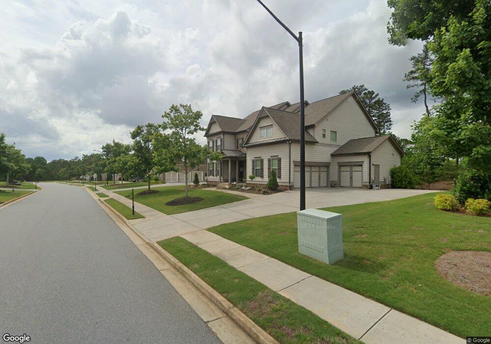
162 Sierra Cir Woodstock, GA 30188
Estimated Value: $882,000
5
Beds
4
Baths
4,411
Sq Ft
$200/Sq Ft
Est. Value
About This Home
This home is located at 162 Sierra Cir, Woodstock, GA 30188 and is currently estimated at $882,000, approximately $199 per square foot. 162 Sierra Cir is a home with nearby schools including Little River Elementary, Mill Creek Middle School, and River Ridge High School.
Ownership History
Date
Name
Owned For
Owner Type
Purchase Details
Closed on
Aug 3, 2021
Sold by
Maltby John B
Bought by
John Maltby And Jo Ann Maltby Liv Tr
Current Estimated Value
Purchase Details
Closed on
Jan 30, 2017
Sold by
Crp Eah Jm Ii Llc
Bought by
Maltby John B and Maltby Jo Ann B
Home Financials for this Owner
Home Financials are based on the most recent Mortgage that was taken out on this home.
Original Mortgage
$140,000
Interest Rate
4.32%
Mortgage Type
New Conventional
Purchase Details
Closed on
Sep 23, 2016
Sold by
Crp Eah Jm Llc
Bought by
Crp Eah Jm Ii Llc
Create a Home Valuation Report for This Property
The Home Valuation Report is an in-depth analysis detailing your home's value as well as a comparison with similar homes in the area
Home Values in the Area
Average Home Value in this Area
Purchase History
| Date | Buyer | Sale Price | Title Company |
|---|---|---|---|
| John Maltby And Jo Ann Maltby Liv Tr | -- | -- | |
| Maltby John B | $658,030 | -- | |
| Crp Eah Jm Ii Llc | $125,892 | -- |
Source: Public Records
Mortgage History
| Date | Status | Borrower | Loan Amount |
|---|---|---|---|
| Previous Owner | Maltby John B | $140,000 |
Source: Public Records
Tax History Compared to Growth
Tax History
| Year | Tax Paid | Tax Assessment Tax Assessment Total Assessment is a certain percentage of the fair market value that is determined by local assessors to be the total taxable value of land and additions on the property. | Land | Improvement |
|---|---|---|---|---|
| 2024 | $5,375 | $372,880 | $65,600 | $307,280 |
| 2023 | $5,071 | $373,840 | $65,600 | $308,240 |
| 2022 | $4,965 | $330,440 | $53,600 | $276,840 |
| 2021 | $3,827 | $255,480 | $38,000 | $217,480 |
| 2020 | $3,684 | $247,200 | $38,000 | $209,200 |
| 2019 | $3,950 | $256,480 | $38,000 | $218,480 |
| 2018 | $4,129 | $258,760 | $38,000 | $220,760 |
| 2017 | $1,106 | $575,000 | $38,000 | $192,000 |
| 2016 | $1,106 | $95,000 | $38,000 | $0 |
Source: Public Records
Map
Nearby Homes
- 205 Trickum Hills Ln
- 157 Trickum Hills Dr
- 570 W Oaks Dr
- 134 Sierra Cir
- 3415 Trickum Rd
- 202 Wild Ginger Bend
- 452 Maypop Ln
- Bramwell Plan at Havencroft
- Hendricks Plan at Havencroft
- Wynstone Plan at Havencroft
- Buckhorn Plan at Havencroft
- Worthdale Plan at Havencroft
- Ransdall Plan at Havencroft
- Kinton Plan at Havencroft
- 5100 Ravenwood Dr
- 416 Maypop Ln
- 223 Wild Ginger Bend
- 1877 Falcon Wood Dr NE
- 235 Wild Ginger Bend
- 160 Sierra Cir
- 164 Sierra Cir
- 161 Sierra Cir
- 158 Sierra Cir
- 166 Sierra Cir
- 119 Trickum Hills Dr
- 159 Sierra Cir
- 123 Trickum Hills Dr
- 163 Sierra Cir
- 117 Trickum Hills Dr
- 156 Sierra Cir
- 168 Sierra Cir
- 219 Leland Way
- 165 Sierra Cir
- 0 Sierra Cir Unit 8712365
- 0 Sierra Cir Unit 8633190
- 0 Sierra Cir Unit 8630905
- 0 Sierra Cir Unit 8510024
- 0 Sierra Cir Unit 8416473
- 0 Sierra Cir Unit 8469893