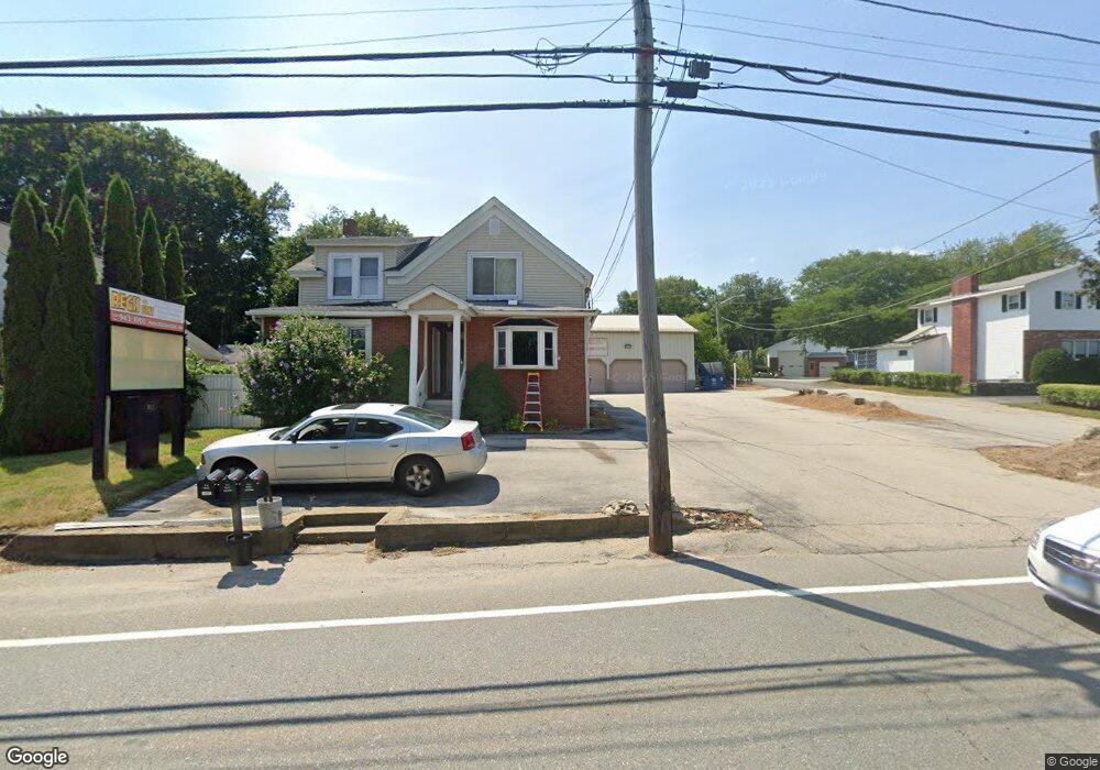
162 Thompson Rd Webster, MA 01570
Estimated Value: $580,805
3
Beds
3
Baths
4,296
Sq Ft
$135/Sq Ft
Est. Value
About This Home
This home is located at 162 Thompson Rd, Webster, MA 01570 and is currently estimated at $580,805, approximately $135 per square foot. 162 Thompson Rd is a home located in Worcester County with nearby schools including Park Avenue Elementary School, Webster Middle School, and Bartlett High School.
Ownership History
Date
Name
Owned For
Owner Type
Purchase Details
Closed on
Nov 8, 1995
Sold by
Narayan Shankar and Narayan Lakshmi
Bought by
Regis Raymond and Regis Jacqueline
Current Estimated Value
Home Financials for this Owner
Home Financials are based on the most recent Mortgage that was taken out on this home.
Original Mortgage
$104,000
Outstanding Balance
$1,458
Interest Rate
7.62%
Mortgage Type
Commercial
Estimated Equity
$579,347
Create a Home Valuation Report for This Property
The Home Valuation Report is an in-depth analysis detailing your home's value as well as a comparison with similar homes in the area
Home Values in the Area
Average Home Value in this Area
Purchase History
| Date | Buyer | Sale Price | Title Company |
|---|---|---|---|
| Regis Raymond | $130,000 | -- | |
| Regis Raymond | $130,000 | -- |
Source: Public Records
Mortgage History
| Date | Status | Borrower | Loan Amount |
|---|---|---|---|
| Open | Regis Raymond | $104,000 | |
| Closed | Regis Raymond | $104,000 |
Source: Public Records
Tax History
| Year | Tax Paid | Tax Assessment Tax Assessment Total Assessment is a certain percentage of the fair market value that is determined by local assessors to be the total taxable value of land and additions on the property. | Land | Improvement |
|---|---|---|---|---|
| 2025 | $5,555 | $467,600 | $68,500 | $399,100 |
| 2024 | $3,842 | $315,400 | $65,800 | $249,600 |
| 2023 | $3,694 | $295,500 | $62,700 | $232,800 |
| 2022 | $3,805 | $272,600 | $58,600 | $214,000 |
| 2021 | $3,445 | $251,500 | $53,300 | $198,200 |
| 2020 | $3,159 | $248,500 | $53,300 | $195,200 |
| 2019 | $3,115 | $244,300 | $51,800 | $192,500 |
| 2018 | $0 | $240,700 | $51,800 | $188,900 |
| 2017 | $0 | $229,500 | $50,700 | $178,800 |
| 2016 | -- | $231,700 | $50,700 | $181,000 |
| 2015 | -- | $227,800 | $49,700 | $178,100 |
Source: Public Records
Map
Nearby Homes
- 7 Nipmuck Dr
- 12 Cedar Dr
- 36 Lake Pkwy
- 125 Birch Island Rd
- 23 Stefaniak Ave Unit 1
- 00 Juniper Ln
- 0 Thompson Rd
- 27 Dresser St
- 10 Indian Point Rd
- 48 Lake St
- 66 Whitcomb St
- 45 Point Pleasant Rd
- 53-55 Point Pleasant Rd
- 13 5th Ave
- 1 Brook St
- 17 Mount Pleasant St
- 19 Myrtle Ave
- 0 Prospect St
- 5 Crosby St
- 613-615 S Main St
- 162 Thompson Rd Unit A
- 164 Thompson Rd
- 166 Thompson Rd
- 156 Thompson Rd
- 161 Thompson Rd
- 5 Rodman Rd
- 163 Thompson Rd
- 165 Thompson Rd
- 155 Thompson Rd
- 12 Kosmas St
- 169 Thompson Rd
- 170 Thompson Rd
- 170 Thompson Rd Unit 1
- 170 Thompson Rd Unit 2
- 14 Kosmas St
- 14 Kosmas St Unit 1
- 7 Kosmas St Unit 2
- 9 Kosmas St
- 9 Kosmas St Unit 1
- 171 Thompson Rd
Your Personal Tour Guide
Ask me questions while you tour the home.