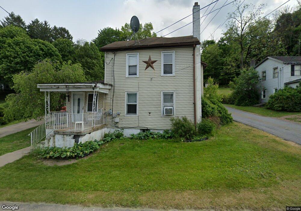
162 W Main St Weatherly, PA 18255
Estimated Value: $125,000 - $237,000
3
Beds
1
Bath
1,540
Sq Ft
$118/Sq Ft
Est. Value
About This Home
This home is located at 162 W Main St, Weatherly, PA 18255 and is currently estimated at $181,856, approximately $118 per square foot. 162 W Main St is a home located in Carbon County with nearby schools including Poplar Halls Elementary School, Oceanair Elementary School, and Weatherly Area Elementary School.
Ownership History
Date
Name
Owned For
Owner Type
Purchase Details
Closed on
Feb 28, 2024
Sold by
Maclachlan William
Bought by
Harris Christopher and Harris Amanda
Current Estimated Value
Home Financials for this Owner
Home Financials are based on the most recent Mortgage that was taken out on this home.
Original Mortgage
$84,225
Outstanding Balance
$77,893
Interest Rate
6.13%
Mortgage Type
New Conventional
Estimated Equity
$103,963
Purchase Details
Closed on
Nov 10, 2006
Sold by
Norsworthy Philip W and Norsworthy Joy
Bought by
Maclachlan William
Home Financials for this Owner
Home Financials are based on the most recent Mortgage that was taken out on this home.
Original Mortgage
$124,000
Interest Rate
6.33%
Mortgage Type
New Conventional
Create a Home Valuation Report for This Property
The Home Valuation Report is an in-depth analysis detailing your home's value as well as a comparison with similar homes in the area
Home Values in the Area
Average Home Value in this Area
Purchase History
| Date | Buyer | Sale Price | Title Company |
|---|---|---|---|
| Harris Christopher | $105,284 | None Listed On Document | |
| Maclachlan William | $155,000 | None Available |
Source: Public Records
Mortgage History
| Date | Status | Borrower | Loan Amount |
|---|---|---|---|
| Open | Harris Christopher | $84,225 | |
| Previous Owner | Maclachlan William | $124,000 |
Source: Public Records
Tax History Compared to Growth
Tax History
| Year | Tax Paid | Tax Assessment Tax Assessment Total Assessment is a certain percentage of the fair market value that is determined by local assessors to be the total taxable value of land and additions on the property. | Land | Improvement |
|---|---|---|---|---|
| 2025 | $3,857 | $49,679 | $7,750 | $41,929 |
| 2024 | $3,708 | $49,679 | $7,750 | $41,929 |
| 2023 | $3,398 | $49,679 | $7,750 | $41,929 |
| 2022 | $3,398 | $49,679 | $7,750 | $41,929 |
| 2021 | $3,348 | $49,679 | $7,750 | $41,929 |
| 2020 | $3,348 | $49,679 | $7,750 | $41,929 |
| 2019 | $3,176 | $49,679 | $7,750 | $41,929 |
| 2018 | $3,105 | $49,679 | $7,750 | $41,929 |
| 2017 | $3,031 | $49,679 | $7,750 | $41,929 |
| 2016 | -- | $49,679 | $7,750 | $41,929 |
| 2015 | -- | $49,679 | $7,750 | $41,929 |
| 2014 | -- | $49,679 | $7,750 | $41,929 |
Source: Public Records
Map
Nearby Homes
- 25 Franklin St
- 220 Entwistle St
- 223 Hudsondale St
- 283 Hudsondale St
- 6851 Buck Mountain Rd
- 829 E Main St
- 913A North St
- Lot C1.13 Packer Dr
- 0 Packer Dr
- 374 Packer Dr
- 1020 E Main St
- 0 Buck Mountain Rd Unit 747254
- 751 Hudson Dr
- 1634 S Lehigh Gorge Dr
- 307 Rockport Rd
- 70 Indian Run Rd
- 0 N Church and Buck Mountain Rd
- 97 Broad St
- 19 3rd St
- 0 Polonia Ct Unit 25-3325