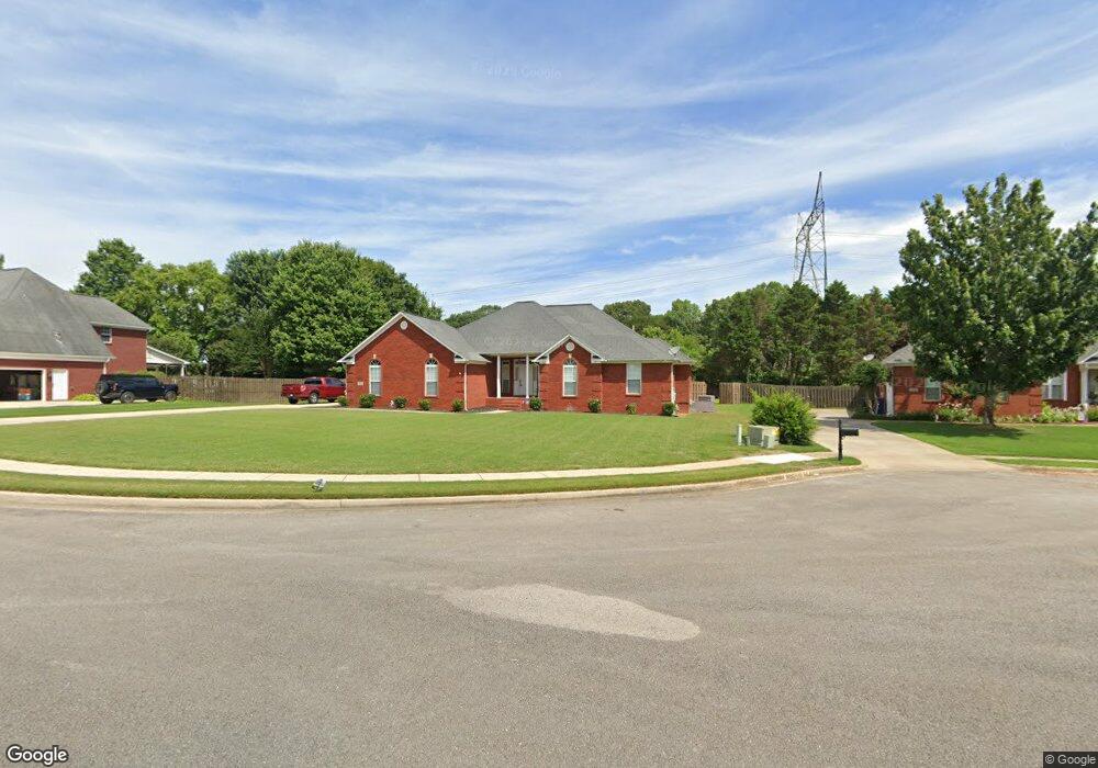
162 Whippoorwill Dr Huntsville, AL 35811
Ryland NeighborhoodEstimated Value: $360,122 - $427,000
3
Beds
2
Baths
2,186
Sq Ft
$176/Sq Ft
Est. Value
About This Home
This home is located at 162 Whippoorwill Dr, Huntsville, AL 35811 and is currently estimated at $384,281, approximately $175 per square foot. 162 Whippoorwill Dr is a home located in Madison County with nearby schools including Mt Carmel Elementary School, Riverton Intermediate School, and Buckhorn Middle School.
Ownership History
Date
Name
Owned For
Owner Type
Purchase Details
Closed on
May 13, 2024
Sold by
Scales Dwight B and Scales Dionne Y
Bought by
Scales Dwight B and Scales Dionne Y
Current Estimated Value
Home Financials for this Owner
Home Financials are based on the most recent Mortgage that was taken out on this home.
Original Mortgage
$244,400
Outstanding Balance
$241,158
Interest Rate
7.17%
Mortgage Type
New Conventional
Estimated Equity
$143,123
Purchase Details
Closed on
Jan 15, 2009
Sold by
Scales Dwight B and Scales Dionne Y
Bought by
Scales Dwight B
Home Financials for this Owner
Home Financials are based on the most recent Mortgage that was taken out on this home.
Original Mortgage
$206,298
Interest Rate
5.43%
Mortgage Type
FHA
Create a Home Valuation Report for This Property
The Home Valuation Report is an in-depth analysis detailing your home's value as well as a comparison with similar homes in the area
Home Values in the Area
Average Home Value in this Area
Purchase History
| Date | Buyer | Sale Price | Title Company |
|---|---|---|---|
| Scales Dwight B | $263,100 | None Listed On Document | |
| Scales Dwight B | -- | -- |
Source: Public Records
Mortgage History
| Date | Status | Borrower | Loan Amount |
|---|---|---|---|
| Open | Scales Dwight B | $244,400 | |
| Previous Owner | Scales Dwight B | $206,298 |
Source: Public Records
Tax History Compared to Growth
Tax History
| Year | Tax Paid | Tax Assessment Tax Assessment Total Assessment is a certain percentage of the fair market value that is determined by local assessors to be the total taxable value of land and additions on the property. | Land | Improvement |
|---|---|---|---|---|
| 2024 | $922 | $26,900 | $4,000 | $22,900 |
| 2023 | $922 | $26,320 | $4,000 | $22,320 |
| 2022 | $820 | $24,100 | $4,000 | $20,100 |
| 2021 | $741 | $21,940 | $4,000 | $17,940 |
| 2020 | $666 | $19,900 | $4,000 | $15,900 |
| 2019 | $640 | $19,180 | $4,000 | $15,180 |
| 2018 | $601 | $18,120 | $0 | $0 |
| 2017 | $586 | $17,700 | $0 | $0 |
| 2016 | $586 | $17,700 | $0 | $0 |
| 2015 | $586 | $17,700 | $0 | $0 |
| 2014 | $617 | $18,540 | $0 | $0 |
Source: Public Records
Map
Nearby Homes
- 296 Brevard Blvd
- 290 River Cove Rd
- 114 River Meadow Way
- 313 Merrydale Dr
- 122 Mykeys Way
- 145 Bridge Arbor Ln
- 100 Stone River Rd
- 132 Southfork Dr
- 606 Bell Factory Rd
- 143 River Mill Rd
- 309 Wanto Ln
- 115 Ranna Dr
- 121 Headen Ln
- 118 Stone River Rd
- 121 Ranna Dr
- 304 Wanto Ln
- 302 Wanto Ln
- 125 Ranna Dr
- 606 Homer Nance Rd
- The Shelburne Plan at Blue Ridge at Mount Carmel - Signature Series
- 164 Whippoorwill Dr
- 160 Whippoorwill Dr
- 161 Whippoorwill Dr
- 166 Whippoorwill Dr
- 163 Whippoorwill Dr
- 165 Whippoorwill Dr
- 101 Spring River Ct
- 156 Whippoorwill Dr
- 103 Spring River Ct
- 276 Brevard Blvd
- 272 Brevard Blvd
- 154 Whippoorwill Dr
- 278 Brevard Blvd
- 105 Spring River Ct
- 100 Spring River Ct
- 152 Whippoorwill Dr
- 268 Brevard Blvd
- 102 Spring River Ct
- 107 Spring River Ct
- 280 Brevard Blvd