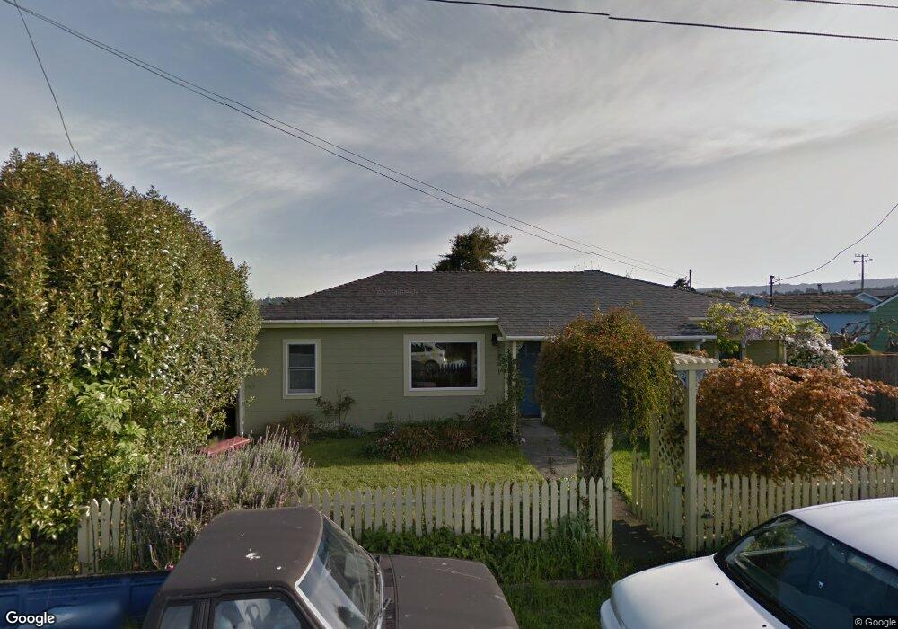
1620 29th St Arcata, CA 95521
Westwood-Vasside NeighborhoodEstimated Value: $422,947 - $484,000
Studio
--
Bath
--
Sq Ft
8,668
Sq Ft Lot Lot
About This Home
This home is located at 1620 29th St, Arcata, CA 95521 and is currently estimated at $447,737. 1620 29th St is a home located in Humboldt County with nearby schools including Pacific Union Elementary School, Arcata High School, and Trillium Charter School.
Ownership History
Date
Name
Owned For
Owner Type
Purchase Details
Closed on
Jul 26, 2001
Sold by
Nelson Steve and Nelson Steven J
Bought by
Parker James and Pelafigue Sophia
Current Estimated Value
Home Financials for this Owner
Home Financials are based on the most recent Mortgage that was taken out on this home.
Original Mortgage
$147,250
Outstanding Balance
$57,191
Interest Rate
7.09%
Estimated Equity
$390,546
Create a Home Valuation Report for This Property
The Home Valuation Report is an in-depth analysis detailing your home's value as well as a comparison with similar homes in the area
Home Values in the Area
Average Home Value in this Area
Purchase History
We collect this data history from publicly available records. To have your information removed, we recommend requesting removal directly through your county’s website.
| Date | Buyer | Sale Price | Title Company |
|---|---|---|---|
| Parker James | $155,000 | First American Title Co |
Source: Public Records
Mortgage History
We collect this data history from publicly available records. To have your information removed, we recommend requesting removal directly through your county’s website.
| Date | Status | Borrower | Loan Amount |
|---|---|---|---|
| Open | Parker James | $147,250 |
Source: Public Records
Tax History
| Year | Tax Paid | Tax Assessment Tax Assessment Total Assessment is a certain percentage of the fair market value that is determined by local assessors to be the total taxable value of land and additions on the property. | Land | Improvement |
|---|---|---|---|---|
| 2025 | $2,783 | $252,586 | $85,670 | $166,916 |
| 2024 | $2,783 | $247,635 | $83,991 | $163,644 |
| 2023 | $2,782 | $242,781 | $82,345 | $160,436 |
| 2022 | $2,764 | $238,022 | $80,731 | $157,291 |
| 2021 | $2,746 | $233,356 | $79,149 | $154,207 |
| 2020 | $2,601 | $230,964 | $78,338 | $152,626 |
| 2019 | $2,559 | $226,436 | $76,802 | $149,634 |
| 2018 | $2,393 | $221,997 | $75,297 | $146,700 |
| 2017 | $2,356 | $217,645 | $73,821 | $143,824 |
| 2016 | $2,292 | $213,378 | $72,374 | $141,004 |
| 2015 | $2,249 | $210,173 | $71,287 | $138,886 |
| 2014 | $2,216 | $206,057 | $69,891 | $136,166 |
Source: Public Records
Map
Nearby Homes
- 3030 Alliance Rd
- 3028 Alliance Rd
- 2966 Janes Creek Dr
- 1437 Stromberg Ave
- 3659 Spear Ave
- 1731 Stewart Ave
- 3122 St Louis Rd
- 1390 Grant Ave
- 2220 Wisteria Way
- 452 Tanglewood Rd
- 448 Tanglewood Rd
- 444 Tanglewood Rd
- 812 Diamond Dr
- 429 Evergreen Ave
- 2950 Terrace Ave
- 330 California Ave
- 380 Granite Ave
- 2084 Mustang Ln
- 2074 Mustang Ln
- 2048 Appaloosa Ln
Your Personal Tour Guide
Ask me questions while you tour the home.