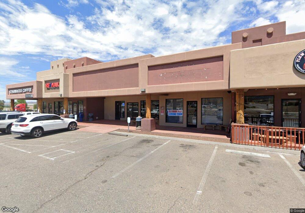
1620 Arizona 260 Camp Verde, AZ 86322
Estimated Value: $3,960,215
--
Bed
--
Bath
9,335
Sq Ft
$424/Sq Ft
Est. Value
About This Home
This home is located at 1620 Arizona 260, Camp Verde, AZ 86322 and is currently estimated at $3,960,215, approximately $424 per square foot. 1620 Arizona 260 is a home located in Yavapai County with nearby schools including Camp Verde Elementary School, Camp Verde Middle School, and Camp Verde High School.
Ownership History
Date
Name
Owned For
Owner Type
Purchase Details
Closed on
Aug 27, 2013
Sold by
Verde Valley Properties
Bought by
Verde Valley Center Llc
Current Estimated Value
Home Financials for this Owner
Home Financials are based on the most recent Mortgage that was taken out on this home.
Original Mortgage
$1,248,750
Outstanding Balance
$934,065
Interest Rate
4.46%
Mortgage Type
Commercial
Estimated Equity
$3,062,912
Purchase Details
Closed on
Jun 17, 2002
Sold by
Priimus Property & Casualty Ltd
Bought by
Verde Valley Properties
Home Financials for this Owner
Home Financials are based on the most recent Mortgage that was taken out on this home.
Original Mortgage
$500,000
Interest Rate
6.74%
Mortgage Type
Commercial
Purchase Details
Closed on
Sep 1, 2001
Sold by
The Carioca Company
Bought by
Priimus Property & Casualty Ltd
Create a Home Valuation Report for This Property
The Home Valuation Report is an in-depth analysis detailing your home's value as well as a comparison with similar homes in the area
Home Values in the Area
Average Home Value in this Area
Purchase History
| Date | Buyer | Sale Price | Title Company |
|---|---|---|---|
| Verde Valley Center Llc | $1,665,000 | Pioneer Title Agency Inc | |
| Verde Valley Properties | $750,000 | Yavapai Title Agency | |
| Priimus Property & Casualty Ltd | -- | -- |
Source: Public Records
Mortgage History
| Date | Status | Borrower | Loan Amount |
|---|---|---|---|
| Open | Verde Valley Center Llc | $1,248,750 | |
| Previous Owner | Verde Valley Properties | $500,000 |
Source: Public Records
Tax History Compared to Growth
Tax History
| Year | Tax Paid | Tax Assessment Tax Assessment Total Assessment is a certain percentage of the fair market value that is determined by local assessors to be the total taxable value of land and additions on the property. | Land | Improvement |
|---|---|---|---|---|
| 2026 | $14,686 | -- | -- | -- |
| 2024 | $14,942 | -- | -- | -- |
| 2023 | $14,942 | $224,874 | $61,619 | $163,255 |
| 2022 | $14,836 | $189,073 | $61,619 | $127,454 |
| 2021 | $15,523 | $203,967 | $61,619 | $142,348 |
| 2020 | $15,177 | $0 | $0 | $0 |
| 2019 | $15,007 | $0 | $0 | $0 |
| 2018 | $14,382 | $0 | $0 | $0 |
| 2017 | $14,202 | $0 | $0 | $0 |
| 2016 | $13,825 | $0 | $0 | $0 |
| 2015 | -- | $0 | $0 | $0 |
| 2014 | -- | $0 | $0 | $0 |
Source: Public Records
Map
Nearby Homes
- 803 Industrial Dr
- 0000 Industrial Dr
- 0 Homestead Pkwy
- 0000 W State Route 260 --
- 005b Highway 260
- 874 Industrial Dr
- 1226 W Peterson Rd
- 52 Mann Cir
- 49 Mann Cir
- 61 S Copper Canyon Loop
- 75 S Copper Canyon Loop
- 1145 W Thorton Rd
- 12 Ranch Dr
- 1053 W Wheeler Rd
- 1114 W Thorton Rd
- 80 S Copper Canyon Loop
- 104 S Copper Canyon Loop
- 0 S Spencer Trail Unit 6928264
- 740 W Buffalo Trail Unit 99
- 870 W Deep Gorge Rd
- 1620 W State Route 260 Unit C
- 320 W Industrial Dr
- 320 W Industrial Dr
- 02 W Industrial Dr
- 1500 Finnie Flat Rd
- 000 W Industral Dr
- 1580 N E Hywy 260 --
- 0 Davidson Dr Unit 1032680
- 0 Davidson Dr Unit 1032279
- 1575 Arizona 260
- 1550 W State Route 260 --
- 550 N Industrial Dr
- 523 Industrial Dr
- 0 Industrial Dr
- 00 Davidson Dr Dr Unit 3