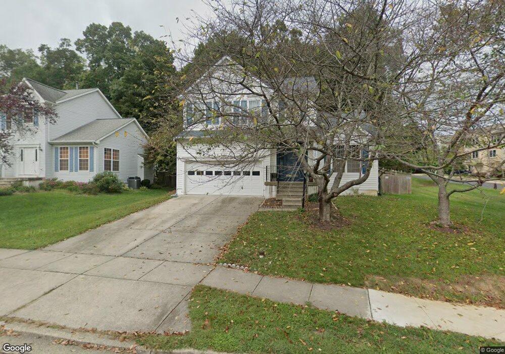
1620 Chapman Rd Crofton, MD 21114
Estimated Value: $640,682 - $728,000
Studio
3
Baths
1,637
Sq Ft
$429/Sq Ft
Est. Value
About This Home
This home is located at 1620 Chapman Rd, Crofton, MD 21114 and is currently estimated at $701,921, approximately $428 per square foot. 1620 Chapman Rd is a home located in Anne Arundel County with nearby schools including Crofton Elementary School, Crofton Middle School, and Crofton High School.
Ownership History
Date
Name
Owned For
Owner Type
Purchase Details
Closed on
Jan 30, 2003
Sold by
Kurz Jody L
Bought by
Prins David R and Wade Brenda L
Current Estimated Value
Purchase Details
Closed on
Mar 6, 1998
Sold by
The Ryland Group Inc
Bought by
Kurtz Jody L and Kurtz Steven J
Purchase Details
Closed on
Nov 10, 1997
Sold by
Crofton Property Ltd Ptnshp
Bought by
The Ryland Group Inc
Create a Home Valuation Report for This Property
The Home Valuation Report is an in-depth analysis detailing your home's value as well as a comparison with similar homes in the area
Home Values in the Area
Average Home Value in this Area
Purchase History
| Date | Buyer | Sale Price | Title Company |
|---|---|---|---|
| Prins David R | $350,000 | -- | |
| Kurtz Jody L | $225,076 | -- | |
| The Ryland Group Inc | $90,000 | -- |
Source: Public Records
Mortgage History
| Date | Status | Borrower | Loan Amount |
|---|---|---|---|
| Closed | Kurtz Jody L | -- |
Source: Public Records
Tax History
| Year | Tax Paid | Tax Assessment Tax Assessment Total Assessment is a certain percentage of the fair market value that is determined by local assessors to be the total taxable value of land and additions on the property. | Land | Improvement |
|---|---|---|---|---|
| 2025 | $4,730 | $530,867 | -- | -- |
| 2024 | $4,730 | $508,433 | $0 | $0 |
| 2023 | $4,593 | $486,000 | $280,800 | $205,200 |
| 2022 | $5,055 | $483,733 | $0 | $0 |
| 2020 | $4,135 | $479,200 | $285,800 | $193,400 |
| 2019 | $7,967 | $472,567 | $0 | $0 |
| 2018 | $4,725 | $465,933 | $0 | $0 |
| 2017 | $3,836 | $459,300 | $0 | $0 |
| 2016 | -- | $434,567 | $0 | $0 |
| 2015 | -- | $409,833 | $0 | $0 |
| 2014 | -- | $385,100 | $0 | $0 |
Source: Public Records
Map
Nearby Homes
- 2610 Tor Ct
- 2806 Erna Ct
- 2612 Tallwind Ct
- 2708 Strongs Ct
- 2505 Ambling Cir Unit 69
- 2709 Bains Ct
- 1542 Lowell Ct
- 1448 Orleans Ct
- 1490 Mara Vista Ct
- 1483 Chatham Ct Unit 64XA
- 1600 Twigs Ct
- 1521 Fenway Rd
- 2508 Stow Ct
- 2435 Vineyard Ln
- 1152 Jeffrey Dr
- 2620 Sequoia Ln
- 1710 Bargers Rd
- 2313 Westport Ln
- 2449 Medford Ct
- 2801 Klein Ct
- 1618 Chapman Rd
- 1616 Chapman Rd
- 2600 Worrell Ct
- 2602 Worrell Ct
- 2604 Worrell Ct
- 2606 Worrell Ct
- 2608 Worrell Ct
- 2501 Windy Oak Ct
- 2809 Andy Ct
- 2610 Worrell Ct
- 1614 Chapman Rd
- 1621 Chapman Rd
- 2503 Windy Oak Ct
- 1619 Chapman Rd
- 2505 Windy Oak Ct
- 2811 Andy Ct
- 2807 Andy Ct
- 1611 Wayland Ct
- 2500 Windy Oak Ct
- 1617 Chapman Rd
Your Personal Tour Guide
Ask me questions while you tour the home.