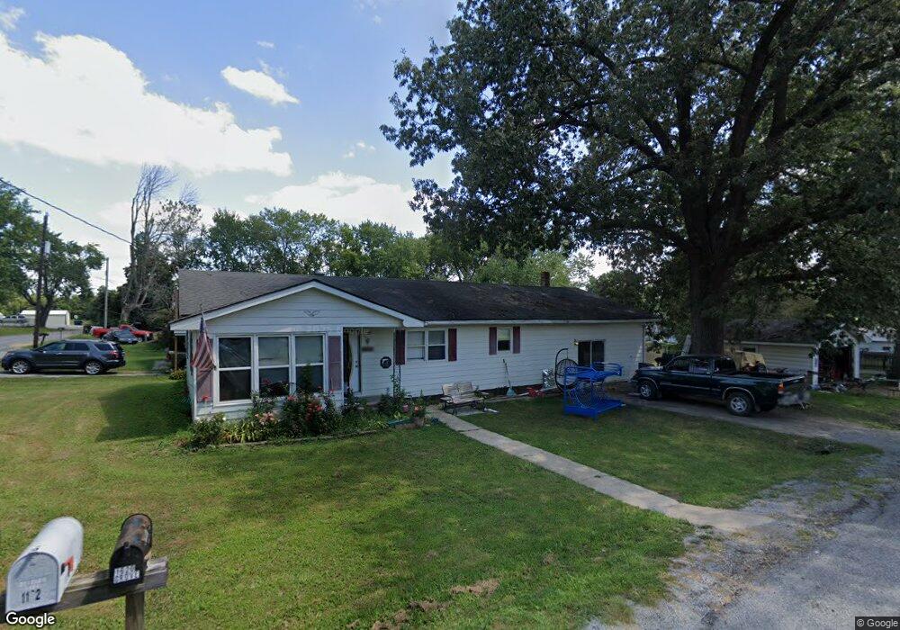
1620 Grove St Harrisburg, IL 62946
Estimated Value: $89,000 - $99,017
--
Bed
--
Bath
--
Sq Ft
0.29
Acres
About This Home
This home is located at 1620 Grove St, Harrisburg, IL 62946 and is currently estimated at $92,254. 1620 Grove St is a home with nearby schools including East Side Intermediate School, Harrisburg Middle School, and Harrisburg High School.
Ownership History
Date
Name
Owned For
Owner Type
Purchase Details
Closed on
Jan 19, 2018
Sold by
Fred Edward Melton Trust and Andrew M Freebourn Trust
Bought by
Hooven Daniel Lee and Hooven Dana Marie
Current Estimated Value
Purchase Details
Closed on
Jun 18, 2008
Sold by
Shewmaker Lorene
Bought by
Melton Edward
Purchase Details
Closed on
Jul 13, 2007
Sold by
Illinois Office Of State Guardian
Bought by
Shewmaker Lorene
Create a Home Valuation Report for This Property
The Home Valuation Report is an in-depth analysis detailing your home's value as well as a comparison with similar homes in the area
Home Values in the Area
Average Home Value in this Area
Purchase History
| Date | Buyer | Sale Price | Title Company |
|---|---|---|---|
| Hooven Daniel Lee | $90,000 | None Listed On Document | |
| Hooven Daniel Lee | $90,000 | None Listed On Document | |
| Melton Fred Edward | -- | Attorney | |
| Melton Edward | $27,500 | None Available | |
| Shewmaker Lorene | -- | None Available |
Source: Public Records
Tax History Compared to Growth
Tax History
| Year | Tax Paid | Tax Assessment Tax Assessment Total Assessment is a certain percentage of the fair market value that is determined by local assessors to be the total taxable value of land and additions on the property. | Land | Improvement |
|---|---|---|---|---|
| 2024 | $2,069 | $29,113 | $1,038 | $28,075 |
| 2023 | $899 | $13,769 | $880 | $12,889 |
| 2022 | $940 | $12,980 | $830 | $12,150 |
| 2021 | $943 | $13,381 | $856 | $12,525 |
| 2020 | $962 | $12,980 | $830 | $12,150 |
| 2019 | $980 | $12,980 | $830 | $12,150 |
| 2018 | $990 | $12,980 | $830 | $12,150 |
| 2017 | $975 | $12,980 | $830 | $12,150 |
| 2016 | $10 | $12,980 | $830 | $12,150 |
| 2015 | -- | $12,980 | $830 | $12,150 |
| 2014 | $1,287 | $12,980 | $830 | $12,150 |
| 2013 | $1,287 | $12,980 | $830 | $12,150 |
| 2012 | $1,287 | $12,980 | $830 | $12,150 |
Source: Public Records
Map
Nearby Homes
- 1120 Dorris Heights Rd
- 111 W Midkiff St
- 204 N Sherman St
- 430 W Church St
- 216 W Poplar St
- 202 W Poplar St
- 504 W South St
- 205 S Shaw St
- 305 W Church St
- 827 W Raymond St
- 405 S Shaw St
- 0 Ron Crank Dr Unit EB441387
- 104 Hickory St
- 210 W Lincoln St
- 305 W Lincoln St
- 215 S Jackson St
- 311 W Poplar St
- 18 S Mill St
- 500 W Sloan St
- 520 S Mckinley St
- 1017 Cedar St
- 1013 Cedar St
- 1101 Cedar St
- 1005 Cedar St
- 1615 Grape St
- 1020 Dorris Heights Rd
- 1113 Cedar St
- 1024 Cedar St
- 1016 Cedar St
- 1008 Dorris Heights Rd
- 1008 Cedar St
- 1621 Grape St
- 1102 Cedar St
- 1100 Dorris Heights Rd
- 1601 Grape St
- 1600 Brush St
- 1121 Cedar St
- 1000 Cedar St
- 925 Cedar St
- 920 Dorris Heights Rd