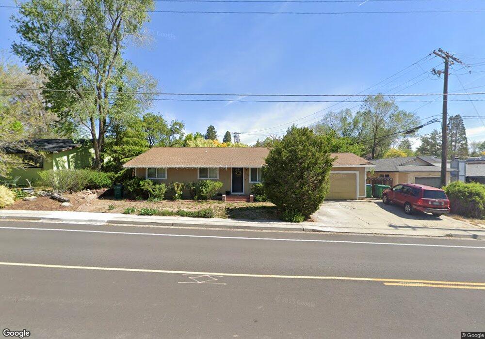
1620 Keystone Ave Reno, NV 89503
West University NeighborhoodEstimated Value: $476,000 - $517,000
4
Beds
2
Baths
1,480
Sq Ft
$334/Sq Ft
Est. Value
About This Home
This home is located at 1620 Keystone Ave, Reno, NV 89503 and is currently estimated at $494,236, approximately $333 per square foot. 1620 Keystone Ave is a home located in Washoe County with nearby schools including Peavine Elementary School, Archie Clayton Pre-AP Academy, and Reno High School.
Ownership History
Date
Name
Owned For
Owner Type
Purchase Details
Closed on
Jul 26, 2000
Sold by
Schoenberg Deborah K and Sexton Robert E
Bought by
Cornell Kurt G and Cornell Kristina P
Current Estimated Value
Home Financials for this Owner
Home Financials are based on the most recent Mortgage that was taken out on this home.
Original Mortgage
$134,900
Outstanding Balance
$46,805
Interest Rate
8.2%
Estimated Equity
$447,431
Create a Home Valuation Report for This Property
The Home Valuation Report is an in-depth analysis detailing your home's value as well as a comparison with similar homes in the area
Home Values in the Area
Average Home Value in this Area
Purchase History
| Date | Buyer | Sale Price | Title Company |
|---|---|---|---|
| Cornell Kurt G | $142,000 | Western Title Inc |
Source: Public Records
Mortgage History
| Date | Status | Borrower | Loan Amount |
|---|---|---|---|
| Open | Cornell Kurt G | $134,900 |
Source: Public Records
Tax History Compared to Growth
Tax History
| Year | Tax Paid | Tax Assessment Tax Assessment Total Assessment is a certain percentage of the fair market value that is determined by local assessors to be the total taxable value of land and additions on the property. | Land | Improvement |
|---|---|---|---|---|
| 2026 | $1,020 | $60,066 | $38,110 | $21,957 |
| 2025 | $1,328 | $60,451 | $37,391 | $23,061 |
| 2024 | $1,291 | $61,002 | $37,076 | $23,926 |
| 2023 | $1,291 | $59,290 | $36,005 | $23,286 |
| 2022 | $1,254 | $48,241 | $28,350 | $19,891 |
| 2021 | $1,217 | $39,603 | $19,341 | $20,262 |
| 2020 | $1,770 | $39,770 | $18,900 | $20,870 |
| 2019 | $1,146 | $39,474 | $18,900 | $20,574 |
| 2018 | $1,711 | $33,903 | $13,388 | $20,515 |
| 2017 | $1,080 | $32,357 | $11,435 | $20,922 |
| 2016 | $1,059 | $33,082 | $11,340 | $21,742 |
| 2015 | $1,059 | $30,598 | $8,505 | $22,093 |
| 2014 | $1,684 | $28,730 | $7,182 | $21,548 |
| 2013 | -- | $26,902 | $5,292 | $21,610 |
Source: Public Records
Map
Nearby Homes
- 1375 Wesley Dr
- 1415 Kings Row
- 1620 Harold Dr
- 1510 Majestic Dr Unit one
- 850 W 11th St
- 1670 Majestic Dr
- 2120 Keystone Ave
- 1840 Windsor Way
- 948 Washington St
- 1535 Van Ness Ave
- 2000 Royal Dr
- 407 Imperial Blvd
- 880 Ruby Ave
- 903 W 7th St
- 720 Stoker Ave
- 960 Ralston St
- 1140 The Strand
- 2080 Marlette Ave
- 1935 Marlette Ave
- 1450 Wyoming Ave
- 1612 Keystone Ave
- 1630 Keystone Ave
- 1606 Keystone Ave
- 1640 Keystone Ave
- 1660 W 12th St
- 1660 W 12th St Unit 2
- 1720 W 12th St
- 1598 Keystone Ave
- 1640 W 12th St
- 1635 Keystone Ave
- 1655 Keystone Ave
- 1750 W 12th St
- 1675 Keystone Ave
- 1690 Keystone Ave
- 1345 Williams Cir
- 80 Anson Dr
- 1340 Williams Cir
- 1520 W 12th St
- 1605 Keystone Ave
- 1578 Keystone Ave