Estimated Value: $513,214 - $546,000
Studio
--
Bath
1,608
Sq Ft
$329/Sq Ft
Est. Value
About This Home
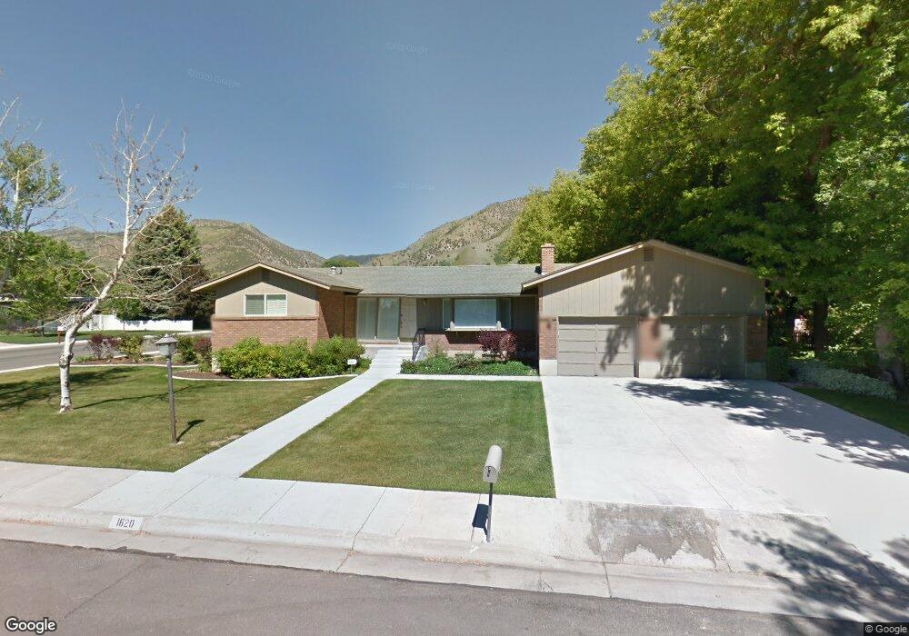
This home is located at 1620 N 1515 E, Logan, UT 84341 and is currently estimated at $528,554, approximately $328 per square foot. 1620 N 1515 E is a home with nearby schools including Greenville School, Cedar Ridge School, and Cedar Ridge Middle School.
Ownership History
Date
Name
Owned For
Owner Type
Purchase Details
Closed on
Apr 15, 2022
Sold by
Joseph And Sarah Fenton Family Revocable
Bought by
Daniels Devin D
Current Estimated Value
Home Financials for this Owner
Home Financials are based on the most recent Mortgage that was taken out on this home.
Original Mortgage
$298,600
Outstanding Balance
$282,169
Interest Rate
5%
Mortgage Type
New Conventional
Estimated Equity
$246,385
Purchase Details
Closed on
Oct 25, 2018
Sold by
Fenton Joseph R and Fenton Sarah S
Bought by
Fenton Joseph R and Fenton Sarah S
Create a Home Valuation Report for This Property
The Home Valuation Report is an in-depth analysis detailing your home's value as well as a comparison with similar homes in the area
Home Values in the Area
Average Home Value in this Area
Purchase History
| Date | Buyer | Sale Price | Title Company |
|---|---|---|---|
| Daniels Devin D | -- | Land Title | |
| Fenton Joseph R | -- | None Available |
Source: Public Records
Mortgage History
| Date | Status | Borrower | Loan Amount |
|---|---|---|---|
| Open | Daniels Devin D | $298,600 |
Source: Public Records
Tax History Compared to Growth
Tax History
| Year | Tax Paid | Tax Assessment Tax Assessment Total Assessment is a certain percentage of the fair market value that is determined by local assessors to be the total taxable value of land and additions on the property. | Land | Improvement |
|---|---|---|---|---|
| 2025 | $1,825 | $255,395 | $0 | $0 |
| 2024 | $2,227 | $290,050 | $0 | $0 |
| 2023 | $2,267 | $276,300 | $0 | $0 |
| 2022 | $2,094 | $243,905 | $0 | $0 |
| 2021 | $1,974 | $356,380 | $66,100 | $290,280 |
| 2020 | $1,819 | $308,000 | $66,100 | $241,900 |
| 2019 | $1,646 | $266,190 | $66,100 | $200,090 |
| 2018 | $1,503 | $235,668 | $66,100 | $169,568 |
| 2017 | $1,357 | $111,960 | $0 | $0 |
| 2016 | $1,378 | $111,960 | $0 | $0 |
| 2015 | $1,383 | $111,960 | $0 | $0 |
| 2014 | $1,317 | $109,230 | $0 | $0 |
| 2013 | -- | $109,230 | $0 | $0 |
Source: Public Records
Map
Nearby Homes
- 1454 N 1400 E
- 1727 E 1500 N
- Sydney Plan at Mountainside Estates
- Providence Plan at Mountainside Estates
- Maryland Plan at Mountainside Estates
- Rochester Plan at Mountainside Estates
- Oakley Plan at Mountainside Estates
- Harmony Plan at Mountainside Estates
- 1374 N 1250 E
- 1374 N 1250 E Unit 48
- 1586 N Sharptail Cir
- 1891 E 1500 N
- 1901 Southpointe Ct
- 1902 E 1500 N
- 1357 E 1220 N
- 1451 N Aspen Dr
- 1405 N Aspen Dr
- 2025 N 1550 E
- Cedar Ridge Plan at Foothill Lofts
- Viewside Plan at Foothill Lofts