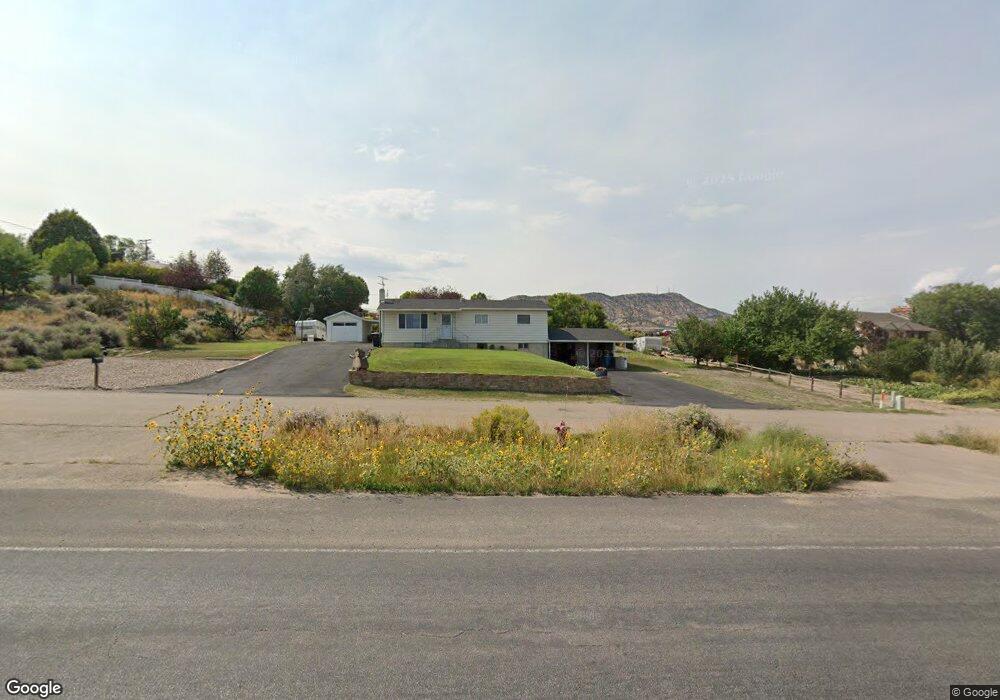
1620 S 2500 W Vernal, UT 84078
Estimated Value: $295,534 - $352,000
--
Bed
--
Bath
1,144
Sq Ft
$286/Sq Ft
Est. Value
About This Home
This home is located at 1620 S 2500 W, Vernal, UT 84078 and is currently estimated at $327,134, approximately $285 per square foot. 1620 S 2500 W is a home located in Uintah County with nearby schools including Maeser School, Vernal Middle School, and Uintah Middle School.
Ownership History
Date
Name
Owned For
Owner Type
Purchase Details
Closed on
May 16, 2022
Sold by
Jean Mortenson Trust and Coreyne Mortensen Trust
Bought by
Coreyne Mortenson Trust and Mortenson
Current Estimated Value
Purchase Details
Closed on
Sep 25, 2007
Sold by
Mortenson Val J and Mortenson Coreyne
Bought by
Mortenson Val Jean and Mortenson Coreyne
Purchase Details
Closed on
Jan 3, 2007
Sold by
Mortenson Val Jean and Mortenson Val J
Bought by
Mortenson Val J and Mortenson Coreyne
Create a Home Valuation Report for This Property
The Home Valuation Report is an in-depth analysis detailing your home's value as well as a comparison with similar homes in the area
Home Values in the Area
Average Home Value in this Area
Purchase History
| Date | Buyer | Sale Price | Title Company |
|---|---|---|---|
| Coreyne Mortenson Trust | -- | None Listed On Document | |
| Coreyne Mortenson Trust | -- | None Listed On Document | |
| Mortenson Val Jean | -- | -- | |
| Mortenson Val J | -- | -- |
Source: Public Records
Tax History Compared to Growth
Tax History
| Year | Tax Paid | Tax Assessment Tax Assessment Total Assessment is a certain percentage of the fair market value that is determined by local assessors to be the total taxable value of land and additions on the property. | Land | Improvement |
|---|---|---|---|---|
| 2024 | $1,388 | $165,108 | $37,773 | $127,335 |
| 2023 | $1,388 | $147,644 | $32,557 | $115,087 |
| 2022 | $1,286 | $124,626 | $32,557 | $92,069 |
| 2021 | $1,350 | $59,076 | $17,906 | $41,169 |
| 2020 | $1,315 | $107,410 | $32,557 | $74,853 |
| 2019 | $1,019 | $82,205 | $26,280 | $55,925 |
| 2018 | $984 | $79,542 | $26,280 | $53,262 |
| 2017 | $10 | $82,292 | $29,030 | $53,262 |
| 2016 | $1,014 | $90,040 | $29,030 | $61,010 |
| 2015 | $968 | $93,251 | $29,030 | $64,221 |
| 2014 | $938 | $91,413 | $30,250 | $61,163 |
| 2013 | $958 | $91,413 | $30,250 | $61,163 |
Source: Public Records
Map
Nearby Homes
- 2849 W 1800 S
- 1559 S 2950 W
- 3227 W 1750 S
- 2068 W 1000 S
- 3396 W 1700 S Unit 108
- 723 S 2500 W
- 2384 W 700 S
- 2230 W 700 S Unit 2236
- 660 S 2500 W
- 604 S 2150 W
- 567 W 1550 S Unit 12
- 538 W 1550 S Unit 9
- 1209 S 1500 W
- 1015 S 1500 W
- 553 W 1500 S Unit 4
- 541 W 1500 S Unit 3
- 565 W 1500 S Unit 5
- 1453 975 S
- 1353 W 1000 S
- 3193 W 440 S
- 1600 S 2500 W
- 1630 S 2500 W
- 2550 W 1800 S
- 2552 W 1660 S
- 2575 W 1500 S
- 2530 W 1700 S
- 2515 W 1800 S
- 1526 S 2500 W
- 2525 W 1700 S
- 1480 S 2500 W
- 1459 S 2500 W
- 1456 S 2500 W
- 2340 W Highway 40
- 1460 S 2500 W
- 2331 W Highway 40
- 1420 S 2500 W
- 2439 W Highway 40
- 2533 W 1400 S Unit 2539
- 2356 W 1500 S
- 2655 W 1800 S