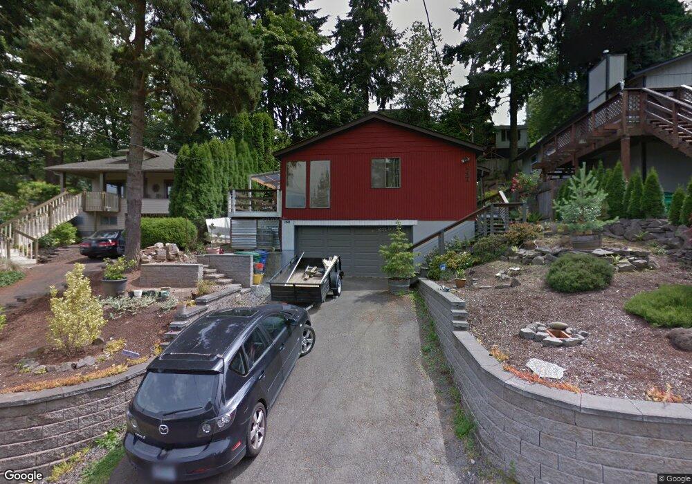
1620 SW Logan St Portland, OR 97219
Hillsdale NeighborhoodEstimated Value: $507,000 - $578,175
2
Beds
2
Baths
968
Sq Ft
$561/Sq Ft
Est. Value
About This Home
This home is located at 1620 SW Logan St, Portland, OR 97219 and is currently estimated at $543,294, approximately $561 per square foot. 1620 SW Logan St is a home located in Multnomah County with nearby schools including Rieke Elementary School, Robert Gray Middle School, and Ida B. Wells-Barnett High School.
Ownership History
Date
Name
Owned For
Owner Type
Purchase Details
Closed on
May 9, 2006
Sold by
Norris Cynthia
Bought by
Oneill Erin J and Oneill Tiffani A
Current Estimated Value
Home Financials for this Owner
Home Financials are based on the most recent Mortgage that was taken out on this home.
Original Mortgage
$220,000
Outstanding Balance
$124,668
Interest Rate
6.12%
Mortgage Type
Purchase Money Mortgage
Estimated Equity
$418,626
Purchase Details
Closed on
Aug 9, 2005
Sold by
Adobe Llc
Bought by
Deason Sherry and Deason John
Create a Home Valuation Report for This Property
The Home Valuation Report is an in-depth analysis detailing your home's value as well as a comparison with similar homes in the area
Home Values in the Area
Average Home Value in this Area
Purchase History
| Date | Buyer | Sale Price | Title Company |
|---|---|---|---|
| Oneill Erin J | $275,000 | Lawyers Title Ins | |
| Deason Sherry | -- | Ticor Title |
Source: Public Records
Mortgage History
| Date | Status | Borrower | Loan Amount |
|---|---|---|---|
| Open | Oneill Erin J | $220,000 |
Source: Public Records
Tax History Compared to Growth
Tax History
| Year | Tax Paid | Tax Assessment Tax Assessment Total Assessment is a certain percentage of the fair market value that is determined by local assessors to be the total taxable value of land and additions on the property. | Land | Improvement |
|---|---|---|---|---|
| 2025 | $7,400 | $274,880 | -- | -- |
| 2024 | $7,134 | $266,880 | -- | -- |
| 2023 | $6,860 | $259,110 | $0 | $0 |
| 2022 | $6,711 | $251,570 | $0 | $0 |
| 2021 | $6,598 | $244,250 | $0 | $0 |
| 2020 | $6,052 | $237,140 | $0 | $0 |
| 2019 | $5,830 | $230,240 | $0 | $0 |
| 2018 | $5,659 | $223,540 | $0 | $0 |
| 2017 | $5,423 | $217,030 | $0 | $0 |
| 2016 | $4,963 | $210,710 | $0 | $0 |
| 2015 | $4,830 | $204,580 | $0 | $0 |
| 2014 | $4,421 | $198,630 | $0 | $0 |
Source: Public Records
Map
Nearby Homes
- 1834 SW Miles St
- 7290 SW 13th Ave
- 2119 SW Nevada Ct
- 2320 SW Canby Ct
- 7308 SW 13th Dr
- 7131 SW 12th Ave
- 8046 SW Capitol Hill Rd
- 8040 SW Capitol Hill Rd
- 1515 SW Carson St
- 6835 SW Capitol Hill Rd Unit 30
- 1323 SW Carson St
- 2612 SW Moss St
- 6731 SW 11th Dr
- 8329 SW 24th Ave Unit 3
- 2616 SW Hume Ct Unit 28
- 7776 SW 5th Ave
- 2820 SW Nevada Ct
- 2644 SW Hume Ct
- 660 SW Evans St
- 2531 SW Spring Garden St
- 1612 SW Logan St
- 1638 SW Logan St
- 1610 SW Logan St
- 1716 SW Logan St
- 1711 SW Custer St
- 1717 SW Custer St
- 1703 SW Custer St
- 1643 SW Custer St
- 1641 SW Custer St
- 7435 SW 17th Dr
- 1740 SW Logan St
- 7505 SW 17th Dr
- 1733 SW Custer St
- 1715 SW Logan St
- 1633 SW Custer St
- 1802 SW Logan St
- 1739 SW Logan St
- 1809 SW Custer St
- 7442 SW 17th Dr
- 7415 SW 17th Dr