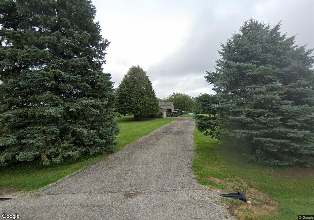
1620 Wilson Rd South Charleston, OH 45368
Estimated Value: $284,000 - $332,658
4
Beds
2
Baths
1,372
Sq Ft
$224/Sq Ft
Est. Value
About This Home
This home is located at 1620 Wilson Rd, South Charleston, OH 45368 and is currently estimated at $306,915, approximately $223 per square foot. 1620 Wilson Rd is a home located in Clark County with nearby schools including Northeastern Elementary School and Northeastern Middle & High School.
Ownership History
Date
Name
Owned For
Owner Type
Purchase Details
Closed on
Mar 21, 2008
Sold by
Robbins William E and Robbins Erika C
Bought by
Bond John W and Bond Samantha A
Current Estimated Value
Home Financials for this Owner
Home Financials are based on the most recent Mortgage that was taken out on this home.
Original Mortgage
$180,000
Outstanding Balance
$112,438
Interest Rate
5.79%
Mortgage Type
FHA
Estimated Equity
$194,477
Purchase Details
Closed on
Aug 10, 1999
Sold by
Dible Michael E and Dible Elizabeth A
Bought by
Robbins William E and Robbins Erika C
Home Financials for this Owner
Home Financials are based on the most recent Mortgage that was taken out on this home.
Original Mortgage
$135,880
Interest Rate
7.77%
Mortgage Type
FHA
Purchase Details
Closed on
Aug 8, 1994
Sold by
Harrity Michael W
Bought by
Dible Michael E and Dible Elizabeth A
Home Financials for this Owner
Home Financials are based on the most recent Mortgage that was taken out on this home.
Original Mortgage
$87,630
Interest Rate
8.53%
Mortgage Type
New Conventional
Create a Home Valuation Report for This Property
The Home Valuation Report is an in-depth analysis detailing your home's value as well as a comparison with similar homes in the area
Home Values in the Area
Average Home Value in this Area
Purchase History
| Date | Buyer | Sale Price | Title Company |
|---|---|---|---|
| Bond John W | $180,000 | Attorney | |
| Robbins William E | $137,000 | -- | |
| Dible Michael E | $107,000 | -- |
Source: Public Records
Mortgage History
| Date | Status | Borrower | Loan Amount |
|---|---|---|---|
| Open | Bond John W | $180,000 | |
| Closed | Robbins William E | $135,880 | |
| Previous Owner | Dible Michael E | $87,630 |
Source: Public Records
Tax History Compared to Growth
Tax History
| Year | Tax Paid | Tax Assessment Tax Assessment Total Assessment is a certain percentage of the fair market value that is determined by local assessors to be the total taxable value of land and additions on the property. | Land | Improvement |
|---|---|---|---|---|
| 2024 | $3,014 | $71,940 | $17,260 | $54,680 |
| 2023 | $3,014 | $71,940 | $17,260 | $54,680 |
| 2022 | $3,025 | $71,940 | $17,260 | $54,680 |
| 2021 | $2,720 | $54,850 | $12,980 | $41,870 |
| 2020 | $2,718 | $54,850 | $12,980 | $41,870 |
| 2019 | $2,772 | $54,850 | $12,980 | $41,870 |
| 2018 | $2,656 | $50,850 | $10,820 | $40,030 |
| 2017 | $2,277 | $50,845 | $10,815 | $40,030 |
| 2016 | $2,149 | $48,640 | $10,815 | $37,825 |
| 2015 | $2,046 | $44,209 | $10,815 | $33,394 |
| 2014 | $2,049 | $44,209 | $10,815 | $33,394 |
| 2013 | $2,061 | $44,209 | $10,815 | $33,394 |
Source: Public Records
Map
Nearby Homes
- 711 Wilson Rd
- 0 S Houston Pike
- 13183 E National Rd
- 8867 E National Rd
- 935 Sylvan Shores Dr
- 1026 George Allen Dr
- 0 N Urbana Lisbon Rd
- 1196 George Allen Dr
- 1990 S Buena Vista Rd
- 2321 N Houston
- 2367 N Houston Pike
- 1825 U S 42
- 9350 S Charleston Pike
- 3211 Old Columbus Rd
- 0 Vernon Asbury Rd Unit 11585913
- 0 E National Rd Unit 11448359
- 1471 Wilson Rd
- 1497 Wilson Rd
- 1573 Wilson Rd
- 1575 Wilson Rd
- 1407 Wilson Rd
- 1455 Wilson Rd
- 13105 Plattsburg Rd
- 12992 Plattsburg Rd
- 12992 Plattsburg Rd
- 12975 Plattsburg Rd
- 13141 Plattsburg Rd
- 1700 Wilson Rd
- 13193 Plattsburg Rd
- 12848 Plattsburg Rd
- 13213 Plattsburg Rd
- 13555 London Plattsburg Rd
- 2017 Summerford Rd
- 13555 Plattsburg Rd
- 2035 Summerford Rd
- 1661 Summerford Rd
