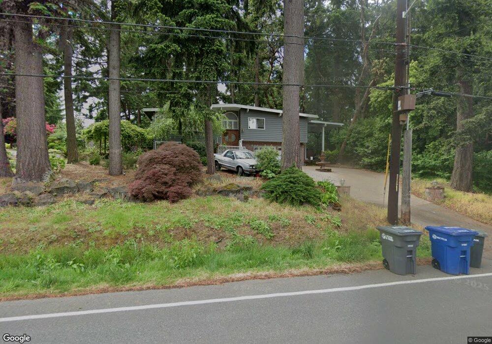
16207 21st Ave SW Burien, WA 98166
Maplewild NeighborhoodEstimated Value: $876,144 - $916,000
4
Beds
3
Baths
1,290
Sq Ft
$691/Sq Ft
Est. Value
About This Home
This home is located at 16207 21st Ave SW, Burien, WA 98166 and is currently estimated at $890,786, approximately $690 per square foot. 16207 21st Ave SW is a home located in King County with nearby schools including Gregory Heights Elementary School, Sylvester Middle School, and Highline High School.
Ownership History
Date
Name
Owned For
Owner Type
Purchase Details
Closed on
Nov 7, 2013
Sold by
Francisco Alicia M and Francisco Alicie M
Bought by
Francisco Alicia M
Current Estimated Value
Home Financials for this Owner
Home Financials are based on the most recent Mortgage that was taken out on this home.
Original Mortgage
$171,900
Outstanding Balance
$127,889
Interest Rate
4.17%
Mortgage Type
New Conventional
Estimated Equity
$762,897
Purchase Details
Closed on
May 21, 1996
Sold by
Fernley Ronald W and Fernley Mary J
Bought by
Francisco Alicie M
Home Financials for this Owner
Home Financials are based on the most recent Mortgage that was taken out on this home.
Original Mortgage
$163,875
Interest Rate
8.07%
Create a Home Valuation Report for This Property
The Home Valuation Report is an in-depth analysis detailing your home's value as well as a comparison with similar homes in the area
Home Values in the Area
Average Home Value in this Area
Purchase History
| Date | Buyer | Sale Price | Title Company |
|---|---|---|---|
| Francisco Alicia M | -- | First American | |
| Francisco Alicie M | $172,500 | Transnation Title Insurance |
Source: Public Records
Mortgage History
| Date | Status | Borrower | Loan Amount |
|---|---|---|---|
| Open | Francisco Alicia M | $171,900 | |
| Closed | Francisco Alicie M | $163,875 |
Source: Public Records
Tax History Compared to Growth
Tax History
| Year | Tax Paid | Tax Assessment Tax Assessment Total Assessment is a certain percentage of the fair market value that is determined by local assessors to be the total taxable value of land and additions on the property. | Land | Improvement |
|---|---|---|---|---|
| 2024 | $9,089 | $818,000 | $278,000 | $540,000 |
| 2023 | $8,827 | $762,000 | $253,000 | $509,000 |
| 2022 | $7,531 | $710,000 | $230,000 | $480,000 |
| 2021 | $6,980 | $609,000 | $203,000 | $406,000 |
| 2020 | $6,688 | $544,000 | $193,000 | $351,000 |
| 2018 | $6,398 | $506,000 | $176,000 | $330,000 |
| 2017 | $5,937 | $454,000 | $168,000 | $286,000 |
| 2016 | $5,232 | $426,000 | $156,000 | $270,000 |
| 2015 | $4,979 | $388,000 | $141,000 | $247,000 |
| 2014 | -- | $353,000 | $141,000 | $212,000 |
| 2013 | -- | $309,000 | $125,000 | $184,000 |
Source: Public Records
Map
Nearby Homes
- 16267 16th Ave SW
- 16206 Maplewild Ave SW
- 16003 15th Ave SW
- 15733 25th Ave SW
- 2148 SW 169th St
- 1470 SW 158th St
- 16717 Marine View Dr SW
- 16331 Maplewild Ave SW
- 15602 26th Ave SW
- 1307 SW 160th St
- 16021 11th Ave SW
- 2014 SW 152nd St
- 1233 SW 171st Place
- 922 SW 160th St
- 16747 32nd Ave SW
- 16433 9th Ave SW
- 3111 SW 170th St
- 16056 9th Ave SW Unit B
- 15455 10th Ave SW
- 16733 Maplewild Ave SW
- 2115 SW 162nd St
- 16223 21st Ave SW
- 16051 21st Ave SW
- 16208 21st Ave SW
- 2006 SW 162nd Ct
- 2120 SW 162nd St
- 16214 21st Ave SW
- 16048 21st Ave SW
- 2127 SW 162nd St
- 16229 21st Ave SW
- 16228 21st Ave SW
- 16055 21st Ave SW
- 16040 21st Ave SW
- 16045 21st Ave SW
- 2012 SW 162nd St
- 2121 SW 162nd Ct
- 16221 21st Ave SW
- 2007 SW 162nd St
- 16230 21st Ave SW
- 2017 SW 162nd Ct