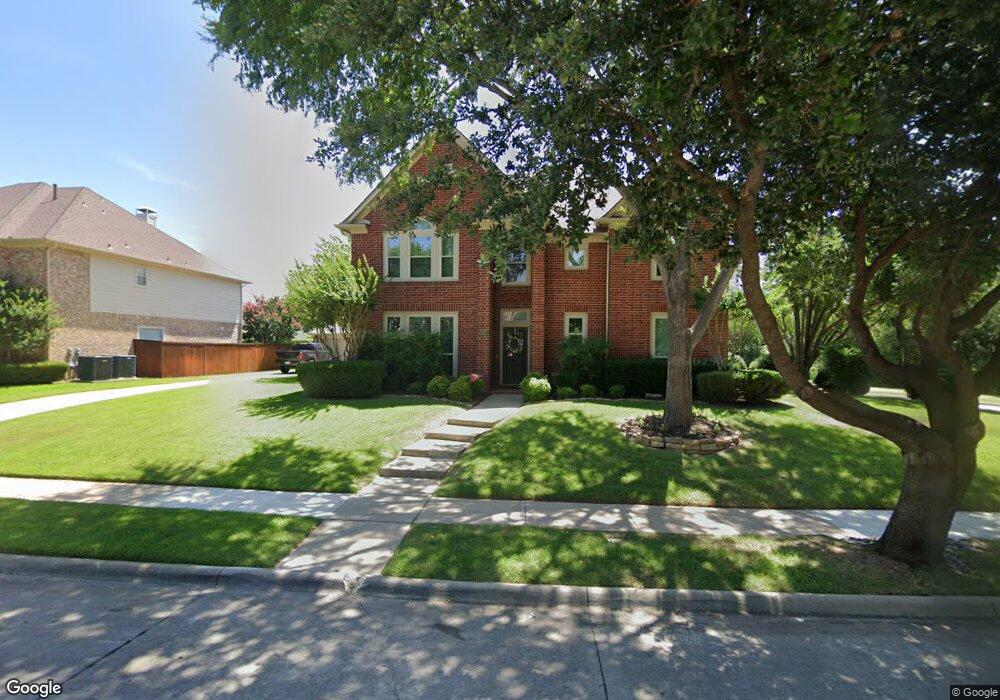
1621 Cat Mountain Trail Keller, TX 76248
Highland Oaks NeighborhoodEstimated Value: $641,000 - $724,000
4
Beds
3
Baths
3,406
Sq Ft
$201/Sq Ft
Est. Value
About This Home
This home is located at 1621 Cat Mountain Trail, Keller, TX 76248 and is currently estimated at $683,279, approximately $200 per square foot. 1621 Cat Mountain Trail is a home located in Tarrant County with nearby schools including Shady Grove Elementary School, Indian Springs Middle School, and Keller High School.
Ownership History
Date
Name
Owned For
Owner Type
Purchase Details
Closed on
Sep 26, 2005
Sold by
Dombkowski Robert A and Dombkowski Barbara A
Bought by
Loeffler Michael and Loeffler Alicia E
Current Estimated Value
Home Financials for this Owner
Home Financials are based on the most recent Mortgage that was taken out on this home.
Original Mortgage
$209,600
Outstanding Balance
$112,188
Interest Rate
5.76%
Mortgage Type
Fannie Mae Freddie Mac
Estimated Equity
$571,091
Purchase Details
Closed on
Nov 23, 1999
Sold by
Perry Homes
Bought by
Dombkowski Robert A and Dombkowski Barbara A
Home Financials for this Owner
Home Financials are based on the most recent Mortgage that was taken out on this home.
Original Mortgage
$183,300
Interest Rate
7.93%
Create a Home Valuation Report for This Property
The Home Valuation Report is an in-depth analysis detailing your home's value as well as a comparison with similar homes in the area
Home Values in the Area
Average Home Value in this Area
Purchase History
| Date | Buyer | Sale Price | Title Company |
|---|---|---|---|
| Loeffler Michael | -- | Rattikin Title | |
| Dombkowski Robert A | -- | Rattikin Title Co |
Source: Public Records
Mortgage History
| Date | Status | Borrower | Loan Amount |
|---|---|---|---|
| Open | Loeffler Michael | $209,600 | |
| Previous Owner | Dombkowski Robert A | $183,300 |
Source: Public Records
Tax History Compared to Growth
Tax History
| Year | Tax Paid | Tax Assessment Tax Assessment Total Assessment is a certain percentage of the fair market value that is determined by local assessors to be the total taxable value of land and additions on the property. | Land | Improvement |
|---|---|---|---|---|
| 2025 | $8,054 | $622,690 | $112,795 | $509,895 |
| 2024 | $8,054 | $622,690 | $112,795 | $509,895 |
| 2023 | $9,662 | $600,430 | $112,795 | $487,635 |
| 2022 | $10,195 | $528,083 | $112,795 | $415,288 |
| 2021 | $9,992 | $420,129 | $80,000 | $340,129 |
| 2020 | $10,110 | $421,817 | $80,000 | $341,817 |
| 2019 | $10,251 | $423,505 | $80,000 | $343,505 |
| 2018 | $8,820 | $370,148 | $80,000 | $290,148 |
| 2017 | $9,300 | $360,938 | $80,000 | $280,938 |
| 2016 | $8,872 | $344,309 | $70,000 | $274,309 |
| 2015 | $7,283 | $314,784 | $55,000 | $259,784 |
| 2014 | $7,283 | $287,800 | $25,000 | $262,800 |
Source: Public Records
Map
Nearby Homes
- 909 Rolling Ridge Dr
- 928 Rush Creek Rd
- 1622 Spring Creek Dr
- 906 Creekbend Dr
- 1917 Overlook Ridge Dr
- 1929 Fall Creek Trail
- 1914 Overlook Ridge Dr
- 1916 Fall Creek Trail
- 1447 Cat Mountain Trail
- 1416 Sweetgum Cir
- 1700 Rolling Bend Ct
- 87 Wilson Ln
- 1007 Mesquite Dr
- 1544 Spring Lake Dr
- 1512 Highland Lakes Dr
- 1601 Woody Creek Dr
- 2116 Alma Dr
- 705 Waters Edge
- 7412 Bursey Rd
- 7329 Londonderry Dr
- 1619 Cat Mountain Trail
- 1620 Creekridge Dr
- 1620 Creekridge Dr
- 1617 Cat Mountain Trail
- 1622 Cat Mountain Trail
- 1618 Creekridge Dr
- 1624 Cat Mountain Trail
- 1620 Cat Mountain Trail
- 1626 Cat Mountain Trail
- 1616 Creekridge Dr
- 1618 Cat Mountain Trail
- 1615 Cat Mountain Trail
- 1614 Creekridge Dr
- 1616 Cat Mountain Trail
- 1621 Suncrest Dr
- 1623 Suncrest Dr
- 1619 Suncrest Dr
- 1621 Creekridge Dr
- 1613 Cat Mountain Trail
- 1625 Suncrest Dr