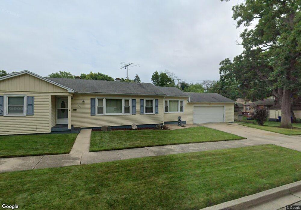
1621 N Linden Ave Waukegan, IL 60085
Marquette Highlands NeighborhoodEstimated Value: $226,000 - $249,000
3
Beds
2
Baths
1,308
Sq Ft
$180/Sq Ft
Est. Value
About This Home
This home is located at 1621 N Linden Ave, Waukegan, IL 60085 and is currently estimated at $234,810, approximately $179 per square foot. 1621 N Linden Ave is a home located in Lake County with nearby schools including Glen Flora Elementary School, Edith M Smith Middle School, and Waukegan High School.
Ownership History
Date
Name
Owned For
Owner Type
Purchase Details
Closed on
Sep 23, 1999
Sold by
Zielinski Ruby E
Bought by
Smith Dwayne
Current Estimated Value
Home Financials for this Owner
Home Financials are based on the most recent Mortgage that was taken out on this home.
Original Mortgage
$116,820
Outstanding Balance
$34,660
Interest Rate
7.83%
Mortgage Type
FHA
Estimated Equity
$200,150
Create a Home Valuation Report for This Property
The Home Valuation Report is an in-depth analysis detailing your home's value as well as a comparison with similar homes in the area
Home Values in the Area
Average Home Value in this Area
Purchase History
| Date | Buyer | Sale Price | Title Company |
|---|---|---|---|
| Smith Dwayne | $117,000 | Collar Counties Title Plant |
Source: Public Records
Mortgage History
| Date | Status | Borrower | Loan Amount |
|---|---|---|---|
| Open | Smith Dwayne | $116,820 |
Source: Public Records
Tax History Compared to Growth
Tax History
| Year | Tax Paid | Tax Assessment Tax Assessment Total Assessment is a certain percentage of the fair market value that is determined by local assessors to be the total taxable value of land and additions on the property. | Land | Improvement |
|---|---|---|---|---|
| 2024 | $4,158 | $57,767 | $9,260 | $48,507 |
| 2023 | $4,314 | $52,097 | $8,351 | $43,746 |
| 2022 | $4,314 | $50,124 | $6,951 | $43,173 |
| 2021 | $3,679 | $41,292 | $6,199 | $35,093 |
| 2020 | $3,680 | $38,468 | $5,775 | $32,693 |
| 2019 | $3,651 | $35,250 | $5,292 | $29,958 |
| 2018 | $3,522 | $33,624 | $7,490 | $26,134 |
| 2017 | $3,378 | $29,748 | $6,627 | $23,121 |
| 2016 | $3,067 | $25,850 | $5,759 | $20,091 |
| 2015 | $2,895 | $23,136 | $5,154 | $17,982 |
| 2014 | $2,907 | $22,721 | $5,705 | $17,016 |
| 2012 | $3,823 | $24,617 | $6,181 | $18,436 |
Source: Public Records
Map
Nearby Homes
- 1018 W Atlantic Ave
- 1905 Linden Ave
- 616 W Keith Ave
- 1312 N Linden Ave
- 1335 Chestnut St
- 1336 N Ash St
- 1504 W Glen Flora Ave
- 1105 Woodlawn Cir
- 1110 N Ash St
- 1117 Judge Ave
- 1000 Pine St
- 917 N Linden Ave
- 1038 Indiana Ave
- 2008 Harding Ave
- 918 N Ash St
- 2009 Harding Ave
- 1109 Massena Ave
- 1023 N Elmwood Ave
- 2232 Walnut St
- 824 N Butrick St
- 1017 W Keith Ave
- 1013 W Keith Ave
- 1620 N Linden Ave
- 1022 W Atlantic Ave
- 1009 W Keith Ave
- 1010 W Atlantic Ave
- 1105 W Keith Ave
- 1102 W Atlantic Ave
- 1005 W Keith Ave
- 1705 N Linden Ave
- 1018 W Keith Ave
- 1106 W Atlantic Ave
- 1000 W Atlantic Ave
- 1014 W Keith Ave
- 1700 N Linden Ave
- 1620 Walnut St
- 1113 W Keith Ave
- 1110 W Atlantic Ave
- 1006 W Keith Ave
- 1600 Walnut St