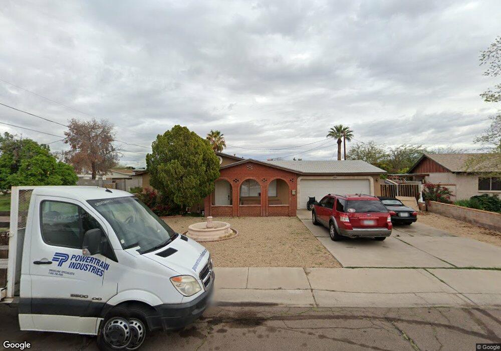
1621 S Roberts Rd Tempe, AZ 85281
Marilyn Ann NeighborhoodEstimated Value: $415,000 - $501,000
Studio
2
Baths
1,480
Sq Ft
$307/Sq Ft
Est. Value
About This Home
This home is located at 1621 S Roberts Rd, Tempe, AZ 85281 and is currently estimated at $454,150, approximately $306 per square foot. 1621 S Roberts Rd is a home located in Maricopa County with nearby schools including Geneva Epps Mosley Middle School, Tempe High School, and Noor Academy of Arizona.
Ownership History
Date
Name
Owned For
Owner Type
Purchase Details
Closed on
Nov 29, 2011
Sold by
Bukalo Muamer
Bought by
Bukalo Sabit and Bukalo Ramiza
Current Estimated Value
Purchase Details
Closed on
Feb 9, 1999
Sold by
Cherington Ronald C and Cherington Sheryl A
Bought by
Bukalo Sabit and Bukalo Ramiza
Home Financials for this Owner
Home Financials are based on the most recent Mortgage that was taken out on this home.
Original Mortgage
$90,320
Outstanding Balance
$21,433
Interest Rate
6.77%
Mortgage Type
New Conventional
Estimated Equity
$432,717
Create a Home Valuation Report for This Property
The Home Valuation Report is an in-depth analysis detailing your home's value as well as a comparison with similar homes in the area
Home Values in the Area
Average Home Value in this Area
Purchase History
We collect this data history from publicly available records. To have your information removed, we recommend requesting removal directly through your county’s website.
| Date | Buyer | Sale Price | Title Company |
|---|---|---|---|
| Bukalo Sabit | -- | None Available | |
| Bukalo Sabit | $112,900 | Security Title Agency |
Source: Public Records
Mortgage History
We collect this data history from publicly available records. To have your information removed, we recommend requesting removal directly through your county’s website.
| Date | Status | Borrower | Loan Amount |
|---|---|---|---|
| Open | Bukalo Sabit | $90,320 |
Source: Public Records
Tax History
| Year | Tax Paid | Tax Assessment Tax Assessment Total Assessment is a certain percentage of the fair market value that is determined by local assessors to be the total taxable value of land and additions on the property. | Land | Improvement |
|---|---|---|---|---|
| 2025 | $2,632 | $21,960 | -- | -- |
| 2024 | $2,430 | $20,914 | -- | -- |
| 2023 | $2,430 | $38,320 | $7,660 | $30,660 |
| 2022 | $2,331 | $29,510 | $5,900 | $23,610 |
| 2021 | $2,347 | $27,420 | $5,480 | $21,940 |
| 2020 | $2,276 | $24,580 | $4,910 | $19,670 |
| 2019 | $1,724 | $20,680 | $4,130 | $16,550 |
| 2018 | $1,681 | $18,280 | $3,650 | $14,630 |
| 2017 | $1,631 | $16,750 | $3,350 | $13,400 |
| 2016 | $1,619 | $15,920 | $3,180 | $12,740 |
| 2015 | $1,555 | $14,280 | $2,850 | $11,430 |
Source: Public Records
Map
Nearby Homes
- 1711 S Hardy Dr
- 1621 S Marilyn Ann Dr
- 1721 S Shafer Dr
- 812 W Parkway Blvd
- 1022 W 13th St
- 726 W 19th St
- 624 W 17th Place
- 1321 W 14th St
- 607 W 15th St
- 833 W Broadway Rd
- 826 W 12th St
- 617 W 13th St
- 800 W 12th St
- 720 W 12th St
- 543 W 18th St
- 1215 S Judd St
- 1365 W 12th Place
- 512 W 17th St
- 518 W 19th St
- 1101 W 10th St
- 1627 S Roberts Rd
- 951 W 16th St
- 1624 S Parkside Dr
- 945 W 16th St
- 1622 S Roberts Rd
- 939 W 16th St
- 1618 S Parkside Dr
- 1616 S Parkside Dr
- 1003 W 16th St
- 1701 S Roberts Rd
- 1630 S Parkside Dr
- 1002 W 17th St
- 933 W 16th St
- 1009 W 16th St
- 1703 S Roberts Rd
- 1004 W 17th St Unit 3
- 948 W 16th St
- 954 W 16th St
- 942 W 16th St Unit 2
- 1000 W 16th St
Your Personal Tour Guide
Ask me questions while you tour the home.