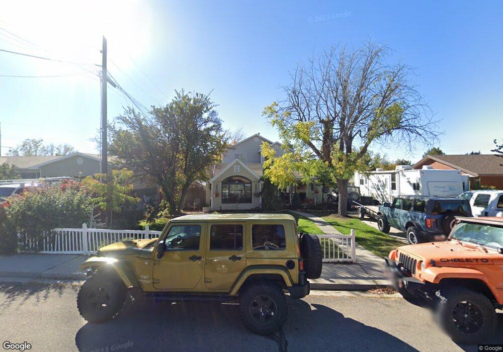
1621 W 1320 N Provo, UT 84604
Grandview South NeighborhoodEstimated Value: $530,000 - $576,000
3
Beds
1
Bath
1,366
Sq Ft
$404/Sq Ft
Est. Value
About This Home
This home is located at 1621 W 1320 N, Provo, UT 84604 and is currently estimated at $552,211, approximately $404 per square foot. 1621 W 1320 N is a home located in Utah County with nearby schools including Westridge Elementary School, Dixon Middle School, and Provo High School.
Ownership History
Date
Name
Owned For
Owner Type
Purchase Details
Closed on
Aug 22, 2002
Sold by
Powell Shane and Powell Juliet
Bought by
Powell Shane and Powell Juliet P
Current Estimated Value
Home Financials for this Owner
Home Financials are based on the most recent Mortgage that was taken out on this home.
Original Mortgage
$168,480
Outstanding Balance
$71,139
Interest Rate
6.52%
Estimated Equity
$481,072
Purchase Details
Closed on
Apr 27, 1999
Sold by
Childs Barry B and Childs Alice S
Bought by
Powell Shane and Powell Juilet
Home Financials for this Owner
Home Financials are based on the most recent Mortgage that was taken out on this home.
Original Mortgage
$94,400
Interest Rate
11.75%
Create a Home Valuation Report for This Property
The Home Valuation Report is an in-depth analysis detailing your home's value as well as a comparison with similar homes in the area
Home Values in the Area
Average Home Value in this Area
Purchase History
| Date | Buyer | Sale Price | Title Company |
|---|---|---|---|
| Powell Shane | -- | Empire Land Title Company | |
| Powell Shane | -- | First American Title Ins Co |
Source: Public Records
Mortgage History
| Date | Status | Borrower | Loan Amount |
|---|---|---|---|
| Open | Powell Shane | $168,480 | |
| Closed | Powell Shane | $94,400 | |
| Closed | Powell Shane | $5,900 |
Source: Public Records
Tax History Compared to Growth
Tax History
| Year | Tax Paid | Tax Assessment Tax Assessment Total Assessment is a certain percentage of the fair market value that is determined by local assessors to be the total taxable value of land and additions on the property. | Land | Improvement |
|---|---|---|---|---|
| 2025 | $2,345 | $245,960 | $170,400 | $276,800 |
| 2024 | $2,345 | $230,835 | $0 | $0 |
| 2023 | $2,392 | $232,100 | $0 | $0 |
| 2022 | $2,210 | $216,260 | $0 | $0 |
| 2021 | $1,674 | $285,700 | $108,100 | $177,600 |
| 2020 | $1,615 | $258,300 | $98,300 | $160,000 |
| 2019 | $1,542 | $256,500 | $98,300 | $158,200 |
| 2018 | $1,402 | $236,600 | $91,200 | $145,400 |
| 2017 | $1,208 | $111,980 | $0 | $0 |
| 2016 | $1,259 | $108,845 | $0 | $0 |
| 2015 | $1,246 | $108,845 | $0 | $0 |
| 2014 | $1,178 | $107,305 | $0 | $0 |
Source: Public Records
Map
Nearby Homes