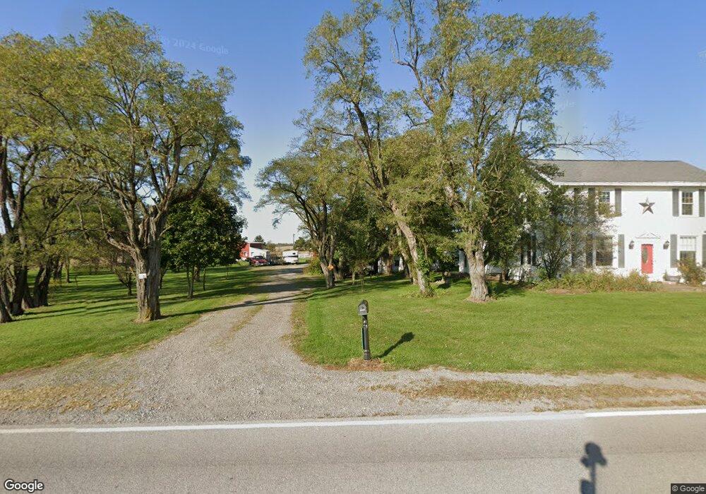
16215 Waynesfield Rd Waynesfield, OH 45896
Estimated Value: $358,000 - $429,347
5
Beds
2
Baths
2,696
Sq Ft
$147/Sq Ft
Est. Value
About This Home
This home is located at 16215 Waynesfield Rd, Waynesfield, OH 45896 and is currently estimated at $396,587, approximately $147 per square foot. 16215 Waynesfield Rd is a home located in Auglaize County with nearby schools including Waynesfield-Goshen Local Elementary School and Waynesfield-Goshen Local High School.
Ownership History
Date
Name
Owned For
Owner Type
Purchase Details
Closed on
Nov 13, 2014
Sold by
Lowe Samuel E
Bought by
Lowe Jennifer L
Current Estimated Value
Purchase Details
Closed on
Oct 26, 2007
Sold by
Gossard Randy D and Gossard Beth A
Bought by
Lowe Samuel E and Lowe Jennifer L
Home Financials for this Owner
Home Financials are based on the most recent Mortgage that was taken out on this home.
Original Mortgage
$171,000
Outstanding Balance
$108,193
Interest Rate
6.38%
Mortgage Type
Purchase Money Mortgage
Estimated Equity
$288,394
Purchase Details
Closed on
Sep 30, 2002
Sold by
Block Floyd A and Block Edith N
Bought by
Gossard Randy D
Purchase Details
Closed on
Mar 29, 1995
Sold by
Block Floyd A
Bought by
Block Kenneth W
Create a Home Valuation Report for This Property
The Home Valuation Report is an in-depth analysis detailing your home's value as well as a comparison with similar homes in the area
Home Values in the Area
Average Home Value in this Area
Purchase History
| Date | Buyer | Sale Price | Title Company |
|---|---|---|---|
| Lowe Jennifer L | -- | Attorney | |
| Lowe Samuel E | $171,000 | Buckeye Title Agency Inc | |
| Gossard Randy D | $155,000 | -- | |
| Block Kenneth W | -- | -- |
Source: Public Records
Mortgage History
| Date | Status | Borrower | Loan Amount |
|---|---|---|---|
| Open | Lowe Samuel E | $171,000 |
Source: Public Records
Tax History Compared to Growth
Tax History
| Year | Tax Paid | Tax Assessment Tax Assessment Total Assessment is a certain percentage of the fair market value that is determined by local assessors to be the total taxable value of land and additions on the property. | Land | Improvement |
|---|---|---|---|---|
| 2024 | $6,716 | $106,770 | $16,940 | $89,830 |
| 2023 | $3,728 | $106,770 | $16,940 | $89,830 |
| 2022 | $3,442 | $83,720 | $16,580 | $67,140 |
| 2021 | $3,434 | $83,720 | $16,580 | $67,140 |
| 2020 | $3,382 | $83,720 | $16,576 | $67,144 |
| 2019 | $2,749 | $69,769 | $13,811 | $55,958 |
| 2018 | $2,673 | $69,769 | $13,811 | $55,958 |
| 2017 | $2,664 | $69,769 | $13,811 | $55,958 |
| 2016 | $1,816 | $48,896 | $13,157 | $35,739 |
| 2015 | $1,817 | $48,896 | $13,157 | $35,739 |
| 2014 | $1,827 | $49,113 | $13,157 | $35,956 |
| 2013 | $2,030 | $49,113 | $13,157 | $35,956 |
Source: Public Records
Map
Nearby Homes
- 25836 Ohio 67
- 202 W Mulberry St
- 105 Guthrie St
- 18544 Santa Fe Line Rd
- 22275 Buckland Holden Rd
- 20630 State Route 67
- 8150 Amherst Rd
- 5065 Amherst Rd
- 17 E Walnut St
- 37 N Main St
- 0 Ohio 67
- 11352 N Township Road 88
- 12102 Shannon Dr Unit 89
- 12015 Holly Dr
- 11579 Cooper Ave
- 11161 Macalpine Way
- 11385 Horseshoe Channel Dr
- 11546 Horseshoe Channel Dr
- 11526 Horseshoe Channel Dr
- 11638 Channel View Dr
- 16330 Waynesfield Rd
- 16375 State Route 196
- 16357 Waynesfield Rd
- 16108 Waynesfield Rd
- 16390 Waynesfield Rd
- 16120 Waynesfield Rd
- 16379 State Route 196
- 16381 Waynesfield Rd
- 16431 Waynesfield Rd
- 16379 Waynesfield Rd
- 16449 Waynesfield Rd
- 16450 Waynesfield Rd
- 15986 Waynesfield Rd
- 16477 Waynesfield Rd
- 16470 Waynesfield Rd
- 16538 Waynesfield Rd
- 15796 Waynesfield Rd
- 27251 Waynesfield Rd
- 29965 Waynesfield Rd