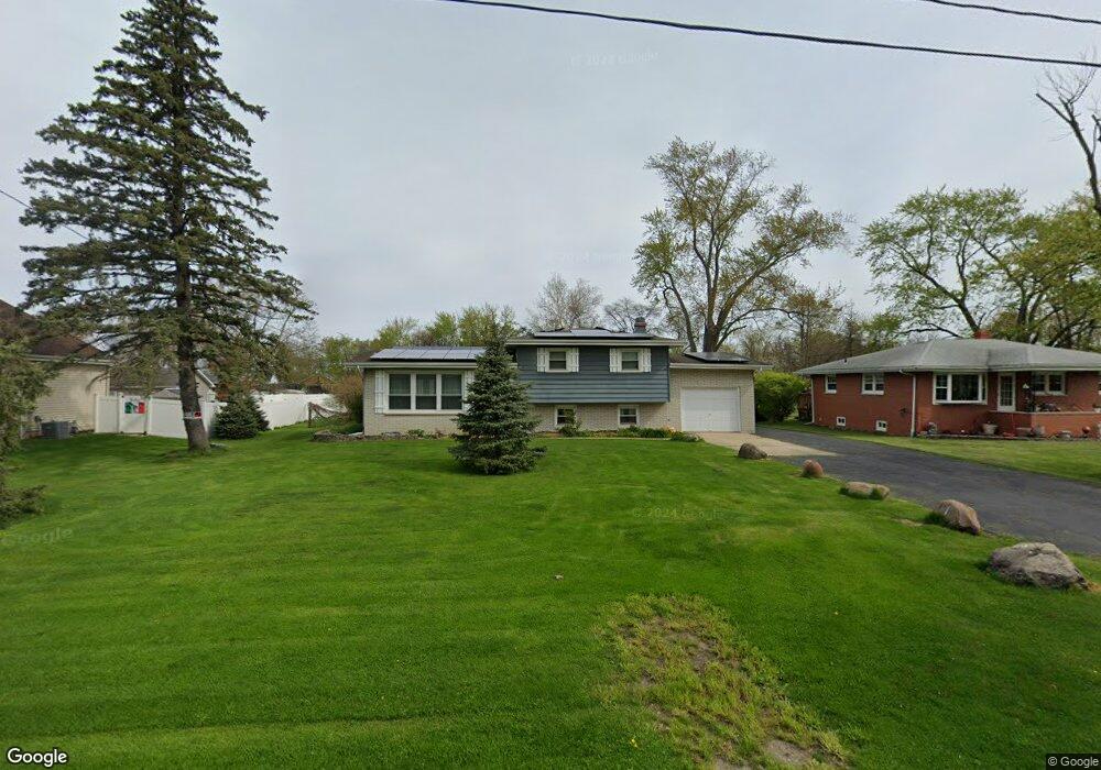
1622 E Rand St Hobart, IN 46342
Estimated Value: $244,000 - $275,000
3
Beds
3
Baths
1,814
Sq Ft
$142/Sq Ft
Est. Value
About This Home
This home is located at 1622 E Rand St, Hobart, IN 46342 and is currently estimated at $258,204, approximately $142 per square foot. 1622 E Rand St is a home located in Lake County with nearby schools including Hobart High School, Trinity Lutheran School, and Hobart Baptist School.
Ownership History
Date
Name
Owned For
Owner Type
Purchase Details
Closed on
Aug 10, 2006
Sold by
Nunn Donald J
Bought by
Nunn Donald J and Nunn Penney R
Current Estimated Value
Purchase Details
Closed on
Apr 14, 2006
Sold by
Hamady John and Hamady Joyce
Bought by
Nunn Donald J
Home Financials for this Owner
Home Financials are based on the most recent Mortgage that was taken out on this home.
Original Mortgage
$155,066
Outstanding Balance
$88,238
Interest Rate
6.48%
Mortgage Type
FHA
Estimated Equity
$169,966
Create a Home Valuation Report for This Property
The Home Valuation Report is an in-depth analysis detailing your home's value as well as a comparison with similar homes in the area
Home Values in the Area
Average Home Value in this Area
Purchase History
| Date | Buyer | Sale Price | Title Company |
|---|---|---|---|
| Nunn Donald J | -- | None Available | |
| Nunn Donald J | -- | Chicago Title Insurance Co |
Source: Public Records
Mortgage History
| Date | Status | Borrower | Loan Amount |
|---|---|---|---|
| Open | Nunn Donald J | $155,066 |
Source: Public Records
Tax History
| Year | Tax Paid | Tax Assessment Tax Assessment Total Assessment is a certain percentage of the fair market value that is determined by local assessors to be the total taxable value of land and additions on the property. | Land | Improvement |
|---|---|---|---|---|
| 2025 | $2,970 | $253,600 | $20,100 | $233,500 |
| 2024 | $8,001 | $193,400 | $20,100 | $173,300 |
| 2023 | $2,693 | $196,000 | $20,100 | $175,900 |
| 2022 | $2,693 | $193,200 | $20,100 | $173,100 |
| 2021 | $2,454 | $175,000 | $15,500 | $159,500 |
| 2020 | $2,292 | $165,900 | $15,500 | $150,400 |
| 2019 | $2,425 | $160,200 | $15,500 | $144,700 |
| 2018 | $2,512 | $151,900 | $15,500 | $136,400 |
| 2017 | $2,625 | $153,100 | $15,500 | $137,600 |
| 2016 | $2,462 | $151,700 | $15,500 | $136,200 |
| 2014 | $2,330 | $151,000 | $15,400 | $135,600 |
| 2013 | $2,295 | $149,700 | $15,400 | $134,300 |
Source: Public Records
Map
Nearby Homes
- 1891 Cooke St
- 2080 E Rand St
- 1409 E North St
- 401 N Joliet St
- 315 N Hobart Rd
- 444 N Ohio St
- 240 Rush Ct
- 241 Brandt Place
- 2545 Tulip Ln
- 1321 Jackson St
- 140 N Linda St
- 8 Indiana 130
- 1020 E Cleveland Ave
- 1212 Devonshire St
- 349 Fox Trail Ct
- 2901 Arbor Ln
- 36 N Linda St
- 54 N Michigan Ave
- 190 Camelot Estates Unit 190
- 1618 E 33rd Ave
- 1702 E Rand St
- 1616 E Rand St
- 1710 E Rand St
- 1608 E Rand St
- 1707 E Rand St
- 1657 E Rand St
- 641 N Hobart Rd
- 1653 E Rand St
- 1716 E Rand St
- 1709 E Rand St
- 545 N Hobart Rd
- 657 N Hobart Rd
- North N Hobart Rd
- 538 Pershing St
- 533 Pershing St
- 1711 E 38th Place
- 537 N Hobart Rd
- 1736 E Rand St
- 665 N Hobart Rd
- 1510 E Rand St
Your Personal Tour Guide
Ask me questions while you tour the home.